Property Record
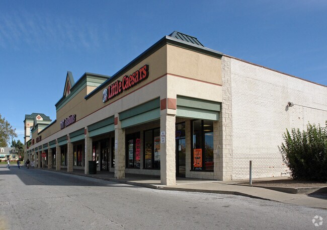
16800 Harvard Ave, Cleveland, OH 44128


NEARBY LISTINGS FOR SALE OR LEASE
Property Detail
16800 Harvard Ave
Cleveland-Elyria, OH
S/R Add
141-10-011
PCL AA OL 73 AC 8.836 2004 S/R ADDITIONAL PARCELS 141-10-042 THRU 141-10-045 141-10-052 , 141-10-58 141-11-002 141-11-003 , 14110049 TO 050, 14111064, 14110046, 1411059 2004S/R MB141 PG10 MB325 PG09
Regionalshoppingcenterormallwithanchorstore
Cuyahoga
X
Ohio
39035C0208E
73
2024
8.84 AC
2024
South
122100
Cleveland
74,579 SF
DEMOGRAPHICS near 16800 Harvard Ave
1 Mile
3 Mile
5 Mile
2024 Total Population
17,705
118,816
281,603
2029 Population
17,217
116,005
275,135
Pop Growth 2024-2029
(2.76%)
(2.37%)
(2.30%)
Average Age
43
42
40
2024 Total Households
7,600
51,851
122,397
HH Growth 2024-2029
(2.95%)
(2.59%)
(2.42%)
Median Household Inc
$46,888
$45,916
$47,665
Avg Household Size
2.20
2.20
2.20
2024 Avg HH Vehicles
2.00
1.00
1.00
Median Home Value
$74,184
$89,638
$120,780
Median Year Built
1950
1949
1951
Nearby Places
Map Layers
Map Styles
 Street
 Aerial
- Restaurants
- Banks
- Shops
- Fitness
- Groceries
PUBLIC TRANSPORTATION
AIRPORT
Cleveland-Hopkins International
DRIVE
WALK
Distance
Cleveland-Hopkins International
28 min
19.9 mi
Freight Ports
Port of Baltimore
DRIVE
WALK
Distance
Port of Baltimore
1 min
301.8 mi
SALE & LEASE HISTORY
LISTING DATE
SALE/LEASE

Sep 25, 2016
For Lease
Nearby Properties
Address
Land Use
TOTAL SIZE
Lot Size
Zoning
Address
Land Use
TOTAL SIZE
Lot Size
Zoning
475,904 SF
8.04 AC
U-7A
Address
Land Use
TOTAL SIZE
Lot Size
Zoning
68.97 AC
C-1
Address
Land Use
TOTAL SIZE
Lot Size
Zoning
682,144 SF
99.58 AC
C-2
Address
Land Use
TOTAL SIZE
Lot Size
Zoning
233,767 SF
36.30 AC
U-1A1
Address
Land Use
TOTAL SIZE
Lot Size
Zoning
186,275 SF
17.80 AC
U-8
Address
Land Use
TOTAL SIZE
Lot Size
Zoning
333,582 SF
3.67 AC
U-1A1
Address
Land Use
TOTAL SIZE
Lot Size
Zoning
129,112 SF
24.11 AC
U-8
Address
Land Use
TOTAL SIZE
Lot Size
Zoning
289,009 SF
25.27 AC
I/O
Address
Land Use
TOTAL SIZE
Lot Size
Zoning
143,512 SF
16 AC
Address
Land Use
TOTAL SIZE
Lot Size
Zoning
204,701 SF
10.12 AC
Address
Land Use
TOTAL SIZE
Lot Size
Zoning
4,414 SF
112.92 AC
U-10
Address
Land Use
TOTAL SIZE
Lot Size
Zoning
18,898 SF
3.57 AC
U-3
Address
Land Use
TOTAL SIZE
Lot Size
Zoning
221,406 SF
12.05 AC
2F
Address
Land Use
TOTAL SIZE
Lot Size
Zoning
120,722 SF
20.55 AC
I/O
Address
Land Use
TOTAL SIZE
Lot Size
Zoning
249,712 SF
22.69 AC
I
Address
Land Use
TOTAL SIZE
Lot Size
Zoning
105,215 SF
5.42 AC
PF
Address
Land Use
TOTAL SIZE
Lot Size
Zoning
110,000 SF
0.85 AC
Address
Land Use
TOTAL SIZE
Lot Size
Zoning
178,654 SF
2.69 AC
Address
Land Use
TOTAL SIZE
Lot Size
Zoning
153,560 SF
32.47 AC
I
Address
Land Use
TOTAL SIZE
Lot Size
Zoning
155,896 SF
16.38 AC
Address
Land Use
TOTAL SIZE
Lot Size
Zoning
24,400 SF
3.87 AC
CM
Address
Land Use
TOTAL SIZE
Lot Size
Zoning
164,109 SF
8.89 AC
U-1A1
Address
Land Use
TOTAL SIZE
Lot Size
Zoning
191,322 SF
23.60 AC
1F
Address
Land Use
TOTAL SIZE
Lot Size
Zoning
15,154 SF
9.24 AC
SI
Address
Land Use
TOTAL SIZE
Lot Size
Zoning
17,124 SF
147.11 AC
R-1
Address
Land Use
TOTAL SIZE
Lot Size
Zoning
176,175 SF
21 AC
AA
Address
Land Use
TOTAL SIZE
Lot Size
Zoning
187,774 SF
15.57 AC
MPUD
Address
Land Use
TOTAL SIZE
Lot Size
Zoning
15.46 AC
Address
Land Use
TOTAL SIZE
Lot Size
Zoning
87,344 SF
6.39 AC
U-4A
Address
Land Use
TOTAL SIZE
Lot Size
Zoning
4,160 SF
1.84 AC
U-6
The World's #1 Commercial Real Estate Marketplace
Connect with us
© 2026 CoStar Group
The information above has been obtained from sources believed reliable. While we do not doubt its accuracy we have not verified it and make no guarantee, warranty or representation about it. It is your responsibility to independently confirm its accuracy and completeness. Any projections, opinions, assumptions, or estimates used are for example only and do not represent the current or future performance of the property. The value of this transaction to you depends on tax and other factors which should be evaluated by your tax, financial, and legal advisors. You and your advisors should conduct a careful, independent investigation of the property to determine to your satisfaction the suitability of the property for your needs.