Property Record
16825 State Highway 49, Plymouth, CA 95669


NEARBY LISTINGS FOR SALE OR LEASE
Property Detail
16825 State Highway 49
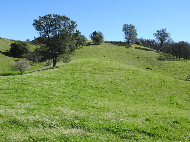
Agriculturalland
43M58 PAR 1 SEC15 T7N R10E
X
Amador
06005C0330F
California
2024
145 AC
2025
Merced/Central
000200
Other Market Areas
4,296 SF
008-100-030-000
DEMOGRAPHICS near 16825 State Highway 49
1 Mile
3 Mile
5 Mile
2024 Total Population
212
1,701
4,666
2029 Population
218
1,769
4,844
Pop Growth 2024-2029
+ 2.83%
+ 4.00%
+ 3.81%
Average Age
46
46
48
2024 Total Households
84
617
1,103
HH Growth 2024-2029
+ 3.57%
+ 4.21%
+ 3.90%
Median Household Inc
$90,624
$74,549
$81,060
Avg Household Size
2.50
2.50
2.40
2024 Avg HH Vehicles
3.00
2.00
2.00
Median Home Value
$553,030
$609,127
$586,956
Median Year Built
1981
1983
1982
Nearby Places
Map Layers
Map Styles
 Street
 Aerial
- Restaurants
- Banks
- Shops
- Fitness
- Groceries
SALE & LEASE HISTORY
LISTING DATE
SALE/LEASE

Jun 04, 2024
For Sale
Nearby Properties
Address
Land Use
TOTAL SIZE
Lot Size
Zoning
Address
Land Use
TOTAL SIZE
Lot Size
Zoning
22.07 AC
NC
Address
Land Use
TOTAL SIZE
Lot Size
Zoning
6,413 SF
40 AC
AG
Address
Land Use
TOTAL SIZE
Lot Size
Zoning
2,144 SF
207.94 AC
AG
Address
Land Use
TOTAL SIZE
Lot Size
Zoning
18,978 SF
2 AC
C1
Address
Land Use
TOTAL SIZE
Lot Size
Zoning
2,639 SF
105.88 AC
A
Address
Land Use
TOTAL SIZE
Lot Size
Zoning
22,526 SF
2.68 AC
NC
Address
Land Use
TOTAL SIZE
Lot Size
Zoning
17.60 AC
NC
Address
Land Use
TOTAL SIZE
Lot Size
Zoning
465.98 AC
R1A
Address
Land Use
TOTAL SIZE
Lot Size
Zoning
1,060 SF
161.27 AC
Address
Land Use
TOTAL SIZE
Lot Size
Zoning
Address
Land Use
TOTAL SIZE
Lot Size
Zoning
1,632 SF
9.69 AC
C2
Address
Land Use
TOTAL SIZE
Lot Size
Zoning
2,448 SF
0.64 AC
NC
Address
Land Use
TOTAL SIZE
Lot Size
Zoning
4,161 SF
30.51 AC
AG
Address
Land Use
TOTAL SIZE
Lot Size
Zoning
1,059 SF
44.23 AC
Address
Land Use
TOTAL SIZE
Lot Size
Zoning
6,650 SF
0.63 AC
NC
Address
Land Use
TOTAL SIZE
Lot Size
Zoning
1,120 SF
3.66 AC
Address
Land Use
TOTAL SIZE
Lot Size
Zoning
3,421 SF
64.20 AC
R1A
Address
Land Use
TOTAL SIZE
Lot Size
Zoning
1,280 SF
0.64 AC
NC
Address
Land Use
TOTAL SIZE
Lot Size
Zoning
3,528 SF
88.83 AC
X
Address
Land Use
TOTAL SIZE
Lot Size
Zoning
4,000 SF
1.35 AC
Address
Land Use
TOTAL SIZE
Lot Size
Zoning
40.51 AC
Address
Land Use
TOTAL SIZE
Lot Size
Zoning
7,730 SF
0.72 AC
NC
Address
Land Use
TOTAL SIZE
Lot Size
Zoning
42.47 AC
R1A
Address
Land Use
TOTAL SIZE
Lot Size
Zoning
1,842 SF
0.09 AC
NC
Address
Land Use
TOTAL SIZE
Lot Size
Zoning
4,116 SF
0.09 AC
NC
Address
Land Use
TOTAL SIZE
Lot Size
Zoning
784 SF
52.50 AC
AG
The World's #1 Commercial Real Estate Marketplace
Connect with us
© 2026 CoStar Group
The information above has been obtained from sources believed reliable. While we do not doubt its accuracy we have not verified it and make no guarantee, warranty or representation about it. It is your responsibility to independently confirm its accuracy and completeness. Any projections, opinions, assumptions, or estimates used are for example only and do not represent the current or future performance of the property. The value of this transaction to you depends on tax and other factors which should be evaluated by your tax, financial, and legal advisors. You and your advisors should conduct a careful, independent investigation of the property to determine to your satisfaction the suitability of the property for your needs.