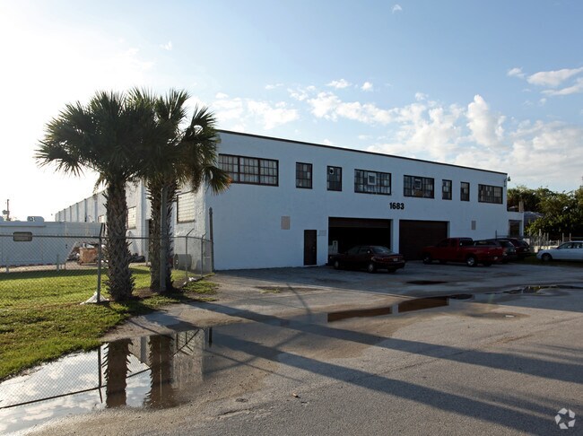
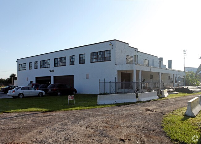
Property Record
1683 N Beardall Ave, Sanford, FL 32771


NEARBY LISTINGS FOR SALE OR LEASE
Property Detail
1683 N Beardall Ave
33-19-31-300-0140-0000
Acreage & Unrec
Warehouse
SEC 33 TWP 19S RGE 31E N 150 FT OF S 385 FT OF W 1/2 OF NW 1/4 OF NE 1/4 + S 235 FT OF NW 1/4 OF NE 1/4
X
Seminole
12127C0765H
Florida
2025
9.10 AC
2025
Seminole County
021100
Orlando
29,656 SF
Orlando-Kissimmee-Sanford, FL
DEMOGRAPHICS near 1683 N Beardall Ave
1 Mile
3 Mile
5 Mile
2024 Total Population
3,405
17,064
60,452
2029 Population
3,560
17,849
63,965
Pop Growth 2024-2029
+ 4.55%
+ 4.60%
+ 5.81%
Average Age
37
41
39
2024 Total Households
1,124
6,246
22,493
HH Growth 2024-2029
+ 4.72%
+ 4.64%
+ 5.87%
Median Household Inc
$65,266
$56,732
$53,954
Avg Household Size
3.00
2.60
2.60
2024 Avg HH Vehicles
2.00
2.00
2.00
Median Home Value
$298,294
$256,942
$233,362
Median Year Built
2005
1975
1987
Nearby Places
Map Layers
Map Styles
 Street
 Aerial
- Restaurants
- Banks
- Shops
- Fitness
- Groceries
PUBLIC TRANSPORTATION
COMMUTER RAIL
Sanford Amtrak Auto Train Station (Auto Train - Amtrak)
DRIVE
WALK
Distance
Sanford Amtrak Auto Train Station (Auto Train - Amtrak)
10 min
4.8 mi
Sanford (SunRail - Florida Department of Transportation)
DRIVE
WALK
Distance
Sanford (SunRail - Florida Department of Transportation)
12 min
5.6 mi
AIRPORT
Orlando Sanford International
DRIVE
WALK
Distance
Orlando Sanford International
12 min
6.3 mi
Daytona Beach International
DRIVE
WALK
Distance
Daytona Beach International
51 min
31.9 mi
Orlando International
DRIVE
WALK
Distance
Orlando International
46 min
35.3 mi
Freight Ports
Port Canaveral
DRIVE
WALK
Distance
Port Canaveral
83 min
68.3 mi
Nearby Properties
Address
Land Use
TOTAL SIZE
Lot Size
Zoning
Address
Land Use
TOTAL SIZE
Lot Size
Zoning
413,982 SF
0.05 AC
RI1
Address
Land Use
TOTAL SIZE
Lot Size
Zoning
615.80 AC
RI1
Address
Land Use
TOTAL SIZE
Lot Size
Zoning
376.01 AC
C2
Address
Land Use
TOTAL SIZE
Lot Size
Zoning
10,900 SF
38.31 AC
RI1
Address
Land Use
TOTAL SIZE
Lot Size
Zoning
115,946 SF
47.65 AC
PD
Address
Land Use
TOTAL SIZE
Lot Size
Zoning
19.06 AC
A1
Address
Land Use
TOTAL SIZE
Lot Size
Zoning
115,431 SF
61 AC
PLI
Address
Land Use
TOTAL SIZE
Lot Size
Zoning
5,150 SF
17.30 AC
SC3
Address
Land Use
TOTAL SIZE
Lot Size
Zoning
177.86 AC
A1
Address
Land Use
TOTAL SIZE
Lot Size
Zoning
Address
Land Use
TOTAL SIZE
Lot Size
Zoning
4,648 SF
161.90 AC
A1
Address
Land Use
TOTAL SIZE
Lot Size
Zoning
89,119 SF
2.67 AC
SC3
Address
Land Use
TOTAL SIZE
Lot Size
Zoning
Address
Land Use
TOTAL SIZE
Lot Size
Zoning
97.58 AC
AG
Address
Land Use
TOTAL SIZE
Lot Size
Zoning
1,664 SF
40.25 AC
A1
Address
Land Use
TOTAL SIZE
Lot Size
Zoning
28,155 SF
8 AC
A1
Address
Land Use
TOTAL SIZE
Lot Size
Zoning
12,864 SF
14.70 AC
RI1
Address
Land Use
TOTAL SIZE
Lot Size
Zoning
45,173 SF
11.22 AC
PD
Address
Land Use
TOTAL SIZE
Lot Size
Zoning
93,684 SF
5.86 AC
RMOI
Address
Land Use
TOTAL SIZE
Lot Size
Zoning
4,749 SF
1.77 AC
RMOI
Address
Land Use
TOTAL SIZE
Lot Size
Zoning
102,431 SF
13.20 AC
MR2
Address
Land Use
TOTAL SIZE
Lot Size
Zoning
8,046 SF
269.35 AC
A1
Address
Land Use
TOTAL SIZE
Lot Size
Zoning
1,152 SF
9.30 AC
A1
Address
Land Use
TOTAL SIZE
Lot Size
Zoning
59,899 SF
1.79 AC
PD
Address
Land Use
TOTAL SIZE
Lot Size
Zoning
48,195 SF
39.20 AC
A1
Address
Land Use
TOTAL SIZE
Lot Size
Zoning
61,429 SF
10.21 AC
Address
Land Use
TOTAL SIZE
Lot Size
Zoning
2,432 SF
9.22 AC
PCD
Address
Land Use
TOTAL SIZE
Lot Size
Zoning
7.97 AC
PUD
Address
Land Use
TOTAL SIZE
Lot Size
Zoning
8,406 SF
19.20 AC
A1
Address
Land Use
TOTAL SIZE
Lot Size
Zoning
1,316 SF
1.83 AC
The World's #1 Commercial Real Estate Marketplace
Connect with us
© 2026 CoStar Group
The information above has been obtained from sources believed reliable. While we do not doubt its accuracy we have not verified it and make no guarantee, warranty or representation about it. It is your responsibility to independently confirm its accuracy and completeness. Any projections, opinions, assumptions, or estimates used are for example only and do not represent the current or future performance of the property. The value of this transaction to you depends on tax and other factors which should be evaluated by your tax, financial, and legal advisors. You and your advisors should conduct a careful, independent investigation of the property to determine to your satisfaction the suitability of the property for your needs.