Property Record
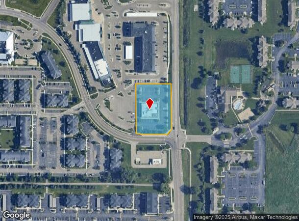
16830 Chandler Rd, East Lansing, MI 48823


NEARBY LISTINGS FOR SALE OR LEASE
Property Detail
16830 Chandler Rd
010-135-000-001-00
Chandler Crossings Condominium
Restaurantbuilding
CLINTON COUNTY CONDO SUB PLAN #50
X
Clinton
26065C0040D
Michigan
2024
1.38 AC
2025
East Lansing
011200
West Michigan
7,566 SF
Lansing-East Lansing, MI
DEMOGRAPHICS near 16830 Chandler Rd
1 Mile
3 Mile
5 Mile
2024 Total Population
8,358
60,360
126,223
2029 Population
8,446
60,635
126,970
Pop Growth 2024-2029
+ 1.05%
+ 0.46%
+ 0.59%
Average Age
34
35
36
2024 Total Households
3,950
25,725
54,790
HH Growth 2024-2029
+ 0.94%
+ 0.50%
+ 0.56%
Median Household Inc
$36,003
$48,146
$49,009
Avg Household Size
2.00
2.10
2.10
2024 Avg HH Vehicles
2.00
2.00
2.00
Median Home Value
$240,043
$201,232
$177,829
Median Year Built
1995
1977
1972
Nearby Places
Map Layers
Map Styles
 Street
 Aerial
- Restaurants
- Banks
- Shops
- Fitness
- Groceries
PUBLIC TRANSPORTATION
COMMUTER RAIL
East Lansing Amtrak Station (Blue Water - Amtrak)
DRIVE
WALK
Distance
East Lansing Amtrak Station (Blue Water - Amtrak)
11 min
4.3 mi
AIRPORT
Capital Region International
DRIVE
WALK
Distance
Capital Region International
17 min
8.3 mi
Freight Ports
Port of Toledo
DRIVE
WALK
Distance
Port of Toledo
151 min
116.8 mi
Nearby Properties
Address
Land Use
TOTAL SIZE
Lot Size
Zoning
Address
Land Use
TOTAL SIZE
Lot Size
Zoning
42,875 SF
35 AC
PD
Address
Land Use
TOTAL SIZE
Lot Size
Zoning
66,818 SF
0.99 AC
EV
Address
Land Use
TOTAL SIZE
Lot Size
Zoning
7,579 SF
83.53 AC
PD
Address
Land Use
TOTAL SIZE
Lot Size
Zoning
42,875 SF
28.77 AC
Address
Land Use
TOTAL SIZE
Lot Size
Zoning
14,304 SF
3.37 AC
MIXED Z
Address
Land Use
TOTAL SIZE
Lot Size
Zoning
222,869 SF
0.10 AC
B3
Address
Land Use
TOTAL SIZE
Lot Size
Zoning
274,720 SF
10.55 AC
Address
Land Use
TOTAL SIZE
Lot Size
Zoning
73,179 SF
58.17 AC
RM14
Address
Land Use
TOTAL SIZE
Lot Size
Zoning
12,435 SF
0.52 AC
B3
Address
Land Use
TOTAL SIZE
Lot Size
Zoning
63,461 SF
32 AC
F COMM
Address
Land Use
TOTAL SIZE
Lot Size
Zoning
13.13 AC
Address
Land Use
TOTAL SIZE
Lot Size
Zoning
66.43 AC
Address
Land Use
TOTAL SIZE
Lot Size
Zoning
16,466 SF
14.82 AC
DEVELOPMEN
Address
Land Use
TOTAL SIZE
Lot Size
Zoning
195,094 SF
1.89 AC
Address
Land Use
TOTAL SIZE
Lot Size
Zoning
19,035 SF
12.32 AC
RM08
Address
Land Use
TOTAL SIZE
Lot Size
Zoning
20,438 SF
17.81 AC
DEVELOPMEN
Address
Land Use
TOTAL SIZE
Lot Size
Zoning
215,335 SF
38.10 AC
RM08
Address
Land Use
TOTAL SIZE
Lot Size
Zoning
300,760 SF
27.22 AC
RM08
Address
Land Use
TOTAL SIZE
Lot Size
Zoning
183,047 SF
24.36 AC
B4
Address
Land Use
TOTAL SIZE
Lot Size
Zoning
131,234 SF
2.49 AC
Address
Land Use
TOTAL SIZE
Lot Size
Zoning
9,628 SF
1.86 AC
B2
Address
Land Use
TOTAL SIZE
Lot Size
Zoning
142,152 SF
47.56 AC
B4
Address
Land Use
TOTAL SIZE
Lot Size
Zoning
9,280 SF
24.38 AC
RC
Address
Land Use
TOTAL SIZE
Lot Size
Zoning
3,504 SF
30.61 AC
DEVELOPMEN
Address
Land Use
TOTAL SIZE
Lot Size
Zoning
141,026 SF
0.45 AC
B3
Address
Land Use
TOTAL SIZE
Lot Size
Zoning
118,415 SF
4.74 AC
RM22
Address
Land Use
TOTAL SIZE
Lot Size
Zoning
63.94 AC
Address
Land Use
TOTAL SIZE
Lot Size
Zoning
8,834 SF
17.46 AC
DEVELOPMEN
Address
Land Use
TOTAL SIZE
Lot Size
Zoning
19,035 SF
11.98 AC
RM08
Address
Land Use
TOTAL SIZE
Lot Size
Zoning
112,248 SF
3.70 AC
B2
The World's #1 Commercial Real Estate Marketplace
Connect with us
© 2025 CoStar Group
The information above has been obtained from sources believed reliable. While we do not doubt its accuracy we have not verified it and make no guarantee, warranty or representation about it. It is your responsibility to independently confirm its accuracy and completeness. Any projections, opinions, assumptions, or estimates used are for example only and do not represent the current or future performance of the property. The value of this transaction to you depends on tax and other factors which should be evaluated by your tax, financial, and legal advisors. You and your advisors should conduct a careful, independent investigation of the property to determine to your satisfaction the suitability of the property for your needs.