Property Record
16839 N Outer 40 Rd, Chesterfield, MO 63005

NEARBY LISTINGS FOR SALE OR LEASE
-
-
Long Road Crossing Dr & N Trade Center
Chesterfield, MO 63005
$464,286 - $12,869,337
0.82 - 10.86 AC Lot
Land
-
-
View all Chesterfield listings for sale on LoopNet.com
Property Detail
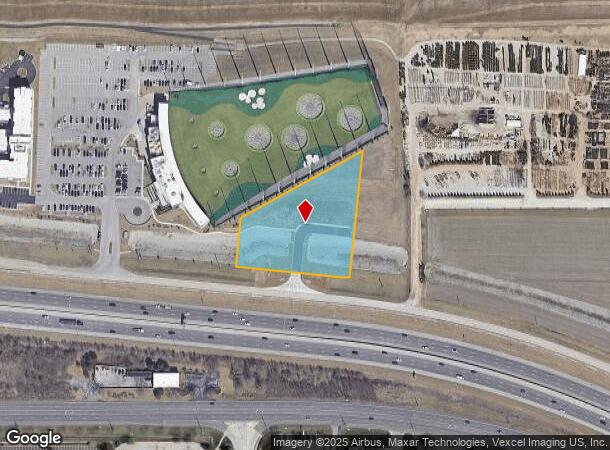
16839 N Outer 40 Rd
St. Louis, MO-IL
Summit-Topgolf Lot C Lot Split
17T-52-0138
SUMMIT-TOPGOLF LOT C LOT SPLIT LOT C-1
Vacantlandnec
St. Louis
AE
Missouri
29183C0465G
c-1
2024
2.16 AC
2025
Chesterfield/Hwy-40
221630
St. Louis
DEMOGRAPHICS near 16839 N Outer 40 Rd
1 Mile
3 Mile
5 Mile
2024 Total Population
2,312
26,048
97,948
2029 Population
2,309
25,692
97,986
Pop Growth 2024-2029
(0.13%)
(1.37%)
+ 0.04%
Average Age
41
45
44
2024 Total Households
836
10,579
37,598
HH Growth 2024-2029
(0.36%)
(1.30%)
(0.02%)
Median Household Inc
$141,027
$132,974
$125,951
Avg Household Size
2.70
2.40
2.50
2024 Avg HH Vehicles
2.00
2.00
2.00
Median Home Value
$487,344
$434,181
$385,210
Median Year Built
1997
1985
1983
Nearby Places
- Restaurants
- Banks
- Shops
- Fitness
- Groceries
PUBLIC TRANSPORTATION
AIRPORT
St Louis Lambert International
DRIVE
WALK
Distance
St Louis Lambert International
36 min
25.9 mi
SALE & LEASE HISTORY
LISTING DATE
SALE/LEASE

Nov 12, 2020
For Sale
May 17, 2021
For Sale
Nearby Properties
Address
Land Use
TOTAL SIZE
Lot Size
Zoning
Address
Land Use
TOTAL SIZE
Lot Size
Zoning
200,372 SF
121.45 AC
105FPNU
Address
Land Use
TOTAL SIZE
Lot Size
Zoning
8.21 AC
105C8
Address
Land Use
TOTAL SIZE
Lot Size
Zoning
1,298,224 SF
194.08 AC
C-8
Address
Land Use
TOTAL SIZE
Lot Size
Zoning
420,140 SF
16.49 AC
105C8
Address
Land Use
TOTAL SIZE
Lot Size
Zoning
462,876 SF
12.89 AC
105R8
Address
Land Use
TOTAL SIZE
Lot Size
Zoning
157,315 SF
41.71 AC
105C8
Address
Land Use
TOTAL SIZE
Lot Size
Zoning
587,809 SF
36.69 AC
105NU
Address
Land Use
TOTAL SIZE
Lot Size
Zoning
352,152 SF
31.79 AC
105C8
Address
Land Use
TOTAL SIZE
Lot Size
Zoning
Address
Land Use
TOTAL SIZE
Lot Size
Zoning
269,687 SF
38.30 AC
105C8
Address
Land Use
TOTAL SIZE
Lot Size
Zoning
218,130 SF
7.31 AC
105PC&R
Address
Land Use
TOTAL SIZE
Lot Size
Zoning
363,584 SF
48.15 AC
FPNU
Address
Land Use
TOTAL SIZE
Lot Size
Zoning
344,386 SF
41.26 AC
R2
Address
Land Use
TOTAL SIZE
Lot Size
Zoning
359,937 SF
26.91 AC
R4
Address
Land Use
TOTAL SIZE
Lot Size
Zoning
42,037 SF
193.91 AC
NU
Address
Land Use
TOTAL SIZE
Lot Size
Zoning
242,380 SF
12.60 AC
105PC&R
Address
Land Use
TOTAL SIZE
Lot Size
Zoning
288,733 SF
36.80 AC
R5
Address
Land Use
TOTAL SIZE
Lot Size
Zoning
182,939 SF
3.80 AC
105PC
Address
Land Use
TOTAL SIZE
Lot Size
Zoning
285,752 SF
23.98 AC
105PC
Address
Land Use
TOTAL SIZE
Lot Size
Zoning
197,927 SF
16.61 AC
105C8
Address
Land Use
TOTAL SIZE
Lot Size
Zoning
204,940 SF
16.35 AC
FPNU
Address
Land Use
TOTAL SIZE
Lot Size
Zoning
2,164 SF
22.98 AC
105PS
Address
Land Use
TOTAL SIZE
Lot Size
Zoning
108,384 SF
6.05 AC
105PC
Address
Land Use
TOTAL SIZE
Lot Size
Zoning
89,348 SF
2.61 AC
105C8
Address
Land Use
TOTAL SIZE
Lot Size
Zoning
58,710 SF
14.75 AC
105PC
Address
Land Use
TOTAL SIZE
Lot Size
Zoning
117,704 SF
9.27 AC
105PI
Address
Land Use
TOTAL SIZE
Lot Size
Zoning
153,316 SF
6.44 AC
105PC
Address
Land Use
TOTAL SIZE
Lot Size
Zoning
150,788 SF
4.91 AC
105C8
Address
Land Use
TOTAL SIZE
Lot Size
Zoning
7,860 SF
223.24 AC
105M3
Address
Land Use
TOTAL SIZE
Lot Size
Zoning
185.56 AC
105FPNU
The World's #1 Commercial Real Estate Marketplace
Connect with us
© 2025 CoStar Group
The information above has been obtained from sources believed reliable. While we do not doubt its accuracy we have not verified it and make no guarantee, warranty or representation about it. It is your responsibility to independently confirm its accuracy and completeness. Any projections, opinions, assumptions, or estimates used are for example only and do not represent the current or future performance of the property. The value of this transaction to you depends on tax and other factors which should be evaluated by your tax, financial, and legal advisors. You and your advisors should conduct a careful, independent investigation of the property to determine to your satisfaction the suitability of the property for your needs.