Property Record
30 Talmadge Hill Rd, Prospect, CT 06712


Property Detail
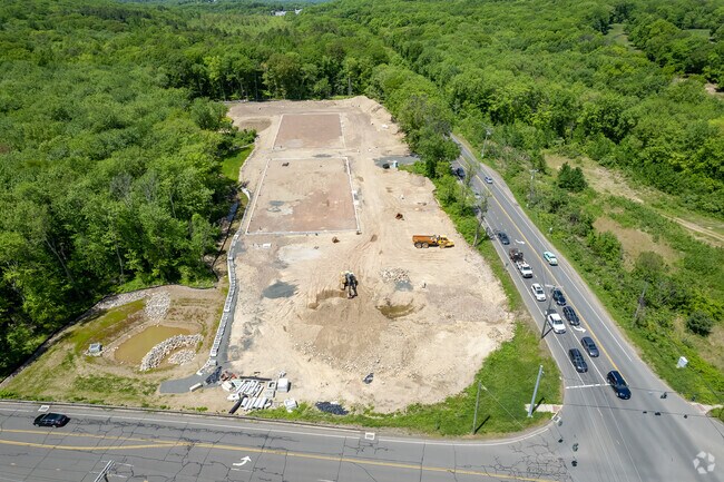
30 Talmadge Hill Rd
MIDD-000410-000000-000042
New Haven
Commercialacreage
Connecticut
CA40
42
C and X Area of minimal flood hazard, usually depicted on FIRMs as above the 500-year flood level.
12.34 AC
2025
Middlebury
2025
Westchester/So Connecticut
344100
New Haven, CT
NEARBY LISTINGS FOR SALE OR LEASE
DEMOGRAPHICS near 30 Talmadge Hill Rd
1 mile
3 mile
5 mile
2025 Total Population
2,993
63,815
147,762
2030 Population
3,071
65,576
151,348
Pop Growth 2025-2030
+ 2.61%
+ 2.76%
+ 2.43%
Average Age
44
40
40
2025 Total Households
1,178
25,040
57,803
HH Growth 2025-2030
+ 2.55%
+ 2.85%
+ 2.47%
Median Household Inc
$93,424
$61,441
$61,787
Avg Household Size
2.50
2.40
2.50
2025 Avg HH Vehicles
2.00
2.00
2.00
Median Home Value
$327,149
$255,400
$252,442
Median Year Built
1971
1960
1959
Nearby Places
Map Layers
Map Styles
 Street
 Aerial
Transit
 Traffic
 Biking
Places
Listings with unknown addresses are not visible on the map
- Restaurants
- Banks
- Shops
- Fitness
- Groceries
SALE & LEASE HISTORY
LISTING DATE
SALE/LEASE

Dec 11, 2020
For Lease
Nearby Properties
Address
Land Use
TOTAL SIZE
Lot Size
Zoning
Address
Land Use
TOTAL SIZE
Lot Size
Zoning
72,415 SF
48.10 AC
R-20
Address
Land Use
TOTAL SIZE
Lot Size
Zoning
87,221 SF
46.28 AC
RA-1
Address
Land Use
TOTAL SIZE
Lot Size
Zoning
168,763 SF
107.36 AC
R-40
Address
Land Use
TOTAL SIZE
Lot Size
Zoning
95,030 SF
14.30 AC
RA-1
Address
Land Use
TOTAL SIZE
Lot Size
Zoning
69,492 SF
25 AC
R-40
Address
Land Use
TOTAL SIZE
Lot Size
Zoning
35,200 SF
8.55 AC
B
Address
Land Use
TOTAL SIZE
Lot Size
Zoning
41,031 SF
17.07 AC
R-20
Address
Land Use
TOTAL SIZE
Lot Size
Zoning
4,368 SF
13.97 AC
RM
Address
Land Use
TOTAL SIZE
Lot Size
Zoning
12.71 AC
RM
Address
Land Use
TOTAL SIZE
Lot Size
Zoning
45,193 SF
12.92 AC
B
Address
Land Use
TOTAL SIZE
Lot Size
Zoning
35,463 SF
2.03 AC
R-20
Address
Land Use
TOTAL SIZE
Lot Size
Zoning
52,250 SF
14.32 AC
RA1
Address
Land Use
TOTAL SIZE
Lot Size
Zoning
28.89 AC
IP
Address
Land Use
TOTAL SIZE
Lot Size
Zoning
209,186 SF
20.50 AC
IP
Address
Land Use
TOTAL SIZE
Lot Size
Zoning
18.41 AC
CA
Address
Land Use
TOTAL SIZE
Lot Size
Zoning
7.96 AC
RA-1
Address
Land Use
TOTAL SIZE
Lot Size
Zoning
6.47 AC
R15
Address
Land Use
TOTAL SIZE
Lot Size
Zoning
149,109 SF
15.36 AC
IP
Address
Land Use
TOTAL SIZE
Lot Size
Zoning
13,371 SF
2.90 AC
B
Address
Land Use
TOTAL SIZE
Lot Size
Zoning
30,675 SF
3.26 AC
RA-1
Address
Land Use
TOTAL SIZE
Lot Size
Zoning
69,700 SF
8.88 AC
IP
Address
Land Use
TOTAL SIZE
Lot Size
Zoning
26 AC
R15
Address
Land Use
TOTAL SIZE
Lot Size
Zoning
1,118 SF
9 AC
R-20
Address
Land Use
TOTAL SIZE
Lot Size
Zoning
14,281 SF
5.22 AC
R-20
Address
Land Use
TOTAL SIZE
Lot Size
Zoning
2,112 SF
1.29 AC
R-20A
Address
Land Use
TOTAL SIZE
Lot Size
Zoning
57,746 SF
7.53 AC
IP
Address
Land Use
TOTAL SIZE
Lot Size
Zoning
22,845 SF
5 AC
RA-1
Address
Land Use
TOTAL SIZE
Lot Size
Zoning
90,760 SF
16.32 AC
IND-1
Address
Land Use
TOTAL SIZE
Lot Size
Zoning
86,976 SF
10.45 AC
IP
Address
Land Use
TOTAL SIZE
Lot Size
Zoning
39.25 AC
B
The World's #1 Commercial Real Estate Marketplace
Connect with us
© 2026 CoStar Group
The information above has been obtained from sources believed reliable. While we do not doubt its accuracy we have not verified it and make no guarantee, warranty or representation about it. It is your responsibility to independently confirm its accuracy and completeness. Any projections, opinions, assumptions, or estimates used are for example only and do not represent the current or future performance of the property. The value of this transaction to you depends on tax and other factors which should be evaluated by your tax, financial, and legal advisors. You and your advisors should conduct a careful, independent investigation of the property to determine to your satisfaction the suitability of the property for your needs.