Property Record
16855 N Ogden St, Omaha, NE 68116
NEARBY LISTINGS FOR SALE OR LEASE
Property Detail
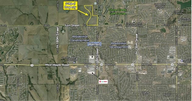
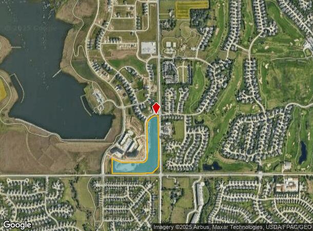
16855 N Ogden St
Omaha-Council Bluffs, NE-IA
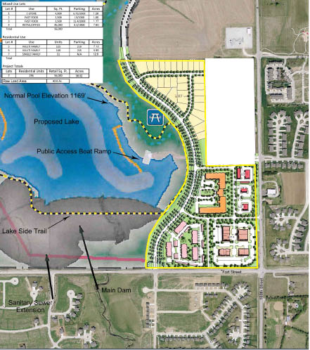
Lake Livin
0285-0102-16
LAKE LIVIN LOT 2 BLOCK 0 LOT 2 530,871 SQ FT
Commercialnec
Douglas
X
Nebraska
31055C0191J
2
2024
12.19 AC
2025
Northwest Omaha
007469
Omaha/Council Bluffs
DEMOGRAPHICS near 16855 N Ogden St
1 Mile
3 Mile
5 Mile
2024 Total Population
9,713
72,578
143,097
2029 Population
9,969
74,463
145,650
Pop Growth 2024-2029
+ 2.64%
+ 2.60%
+ 1.78%
Average Age
38
37
38
2024 Total Households
3,613
26,377
53,465
HH Growth 2024-2029
+ 2.74%
+ 2.47%
+ 1.70%
Median Household Inc
$116,079
$112,517
$108,705
Avg Household Size
2.70
2.70
2.60
2024 Avg HH Vehicles
2.00
2.00
2.00
Median Home Value
$297,763
$300,856
$294,154
Median Year Built
2008
2005
1999
Nearby Places
Map Layers
Map Styles
 Street
 Aerial
- Restaurants
- Banks
- Shops
- Fitness
- Groceries
PUBLIC TRANSPORTATION
AIRPORT
Eppley Airfield
DRIVE
WALK
Distance
Eppley Airfield
33 min
17.2 mi
Freight Ports
Tulsa Port Of Catoosa
DRIVE
WALK
Distance
Tulsa Port Of Catoosa
485 min
433.9 mi
SALE & LEASE HISTORY
LISTING DATE
SALE/LEASE

Apr 12, 2017
For Sale
Nearby Properties
Address
Land Use
TOTAL SIZE
Lot Size
Zoning
Address
Land Use
TOTAL SIZE
Lot Size
Zoning
443,045 SF
22.82 AC
Address
Land Use
TOTAL SIZE
Lot Size
Zoning
486,568 SF
51.70 AC
ELKHORN
Address
Land Use
TOTAL SIZE
Lot Size
Zoning
396,428 SF
14.45 AC
R6
Address
Land Use
TOTAL SIZE
Lot Size
Zoning
420,483 SF
18.51 AC
R6
Address
Land Use
TOTAL SIZE
Lot Size
Zoning
311,856 SF
19.22 AC
Address
Land Use
TOTAL SIZE
Lot Size
Zoning
339,557 SF
12.89 AC
R7
Address
Land Use
TOTAL SIZE
Lot Size
Zoning
350,925 SF
12.71 AC
Address
Land Use
TOTAL SIZE
Lot Size
Zoning
320,111 SF
19.17 AC
R4
Address
Land Use
TOTAL SIZE
Lot Size
Zoning
255,483 SF
14.25 AC
Address
Land Use
TOTAL SIZE
Lot Size
Zoning
301,689 SF
8.82 AC
Address
Land Use
TOTAL SIZE
Lot Size
Zoning
261,247 SF
13.20 AC
Address
Land Use
TOTAL SIZE
Lot Size
Zoning
355,421 SF
18.66 AC
Address
Land Use
TOTAL SIZE
Lot Size
Zoning
168,896 SF
8.79 AC
MU
Address
Land Use
TOTAL SIZE
Lot Size
Zoning
228,963 SF
7.36 AC
Address
Land Use
TOTAL SIZE
Lot Size
Zoning
149,113 SF
7.64 AC
R6
Address
Land Use
TOTAL SIZE
Lot Size
Zoning
125,313 SF
5.52 AC
R6
Address
Land Use
TOTAL SIZE
Lot Size
Zoning
136,279 SF
5.65 AC
Address
Land Use
TOTAL SIZE
Lot Size
Zoning
69,358 SF
10.22 AC
Address
Land Use
TOTAL SIZE
Lot Size
Zoning
190,673 SF
10.74 AC
Address
Land Use
TOTAL SIZE
Lot Size
Zoning
189,099 SF
7.13 AC
Address
Land Use
TOTAL SIZE
Lot Size
Zoning
108,552 SF
6.87 AC
R5
Address
Land Use
TOTAL SIZE
Lot Size
Zoning
166,080 SF
6.25 AC
R6
Address
Land Use
TOTAL SIZE
Lot Size
Zoning
207,693 SF
21.62 AC
MU
Address
Land Use
TOTAL SIZE
Lot Size
Zoning
173,593 SF
5.70 AC
R6PUD
Address
Land Use
TOTAL SIZE
Lot Size
Zoning
171,808 SF
17.77 AC
Address
Land Use
TOTAL SIZE
Lot Size
Zoning
169,654 SF
8.02 AC
Address
Land Use
TOTAL SIZE
Lot Size
Zoning
175,127 SF
14.12 AC
MU
Address
Land Use
TOTAL SIZE
Lot Size
Zoning
144,450 SF
3.97 AC
Address
Land Use
TOTAL SIZE
Lot Size
Zoning
99,983 SF
9.37 AC
Address
Land Use
TOTAL SIZE
Lot Size
Zoning
155,202 SF
4.87 AC
The World's #1 Commercial Real Estate Marketplace
Connect with us
© 2025 CoStar Group
The information above has been obtained from sources believed reliable. While we do not doubt its accuracy we have not verified it and make no guarantee, warranty or representation about it. It is your responsibility to independently confirm its accuracy and completeness. Any projections, opinions, assumptions, or estimates used are for example only and do not represent the current or future performance of the property. The value of this transaction to you depends on tax and other factors which should be evaluated by your tax, financial, and legal advisors. You and your advisors should conduct a careful, independent investigation of the property to determine to your satisfaction the suitability of the property for your needs.