Property Record
16866 Telegraph Rd, Detroit, MI 48219


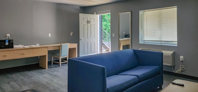
This Property Is For Sale
NEARBY LISTINGS FOR SALE OR LEASE
-
-
View all Detroit listings for sale on LoopNet.com
Property Detail
16866 Telegraph Rd
22-122524
Riverdale Park
Multifamilydwelling
E TELEGRAPH N 70 FT OF 11 & W 90 FT OF S 1/2 9 & W 90 FT OF N 40 FT 10 RIVERDALE PARK SUB L33 P77 PLATS, W C R 22/472 30900 SQ FT
X
Wayne
26163C0067E
Michigan
2025
0.71 AC
2025
Detroit/Dearborn
544300
Detroit
12,333 SF
Detroit-Warren-Dearborn, MI
DEMOGRAPHICS near 16866 Telegraph Rd
1 Mile
3 Mile
5 Mile
2024 Total Population
11,911
108,478
297,077
2029 Population
11,622
105,385
290,050
Pop Growth 2024-2029
(2.43%)
(2.85%)
(2.37%)
Average Age
38
39
40
2024 Total Households
4,976
44,029
119,873
HH Growth 2024-2029
(2.59%)
(2.95%)
(2.43%)
Median Household Inc
$39,569
$48,308
$50,789
Avg Household Size
2.30
2.40
2.40
2024 Avg HH Vehicles
1.00
2.00
2.00
Median Home Value
$74,105
$113,866
$130,285
Median Year Built
1952
1953
1955
Nearby Places
Map Layers
Map Styles
 Street
 Aerial
- Restaurants
- Banks
- Shops
- Fitness
- Groceries
PUBLIC TRANSPORTATION
AIRPORT
Detroit Metro Wayne County
DRIVE
WALK
Distance
Detroit Metro Wayne County
34 min
18.8 mi
Windsor International
DRIVE
WALK
Distance
Windsor International
43 min
26.5 mi
Freight Ports
Port of Toledo
DRIVE
WALK
Distance
Port of Toledo
86 min
70.6 mi
Nearby Properties
Address
Land Use
TOTAL SIZE
Lot Size
Zoning
Address
Land Use
TOTAL SIZE
Lot Size
Zoning
383,602 SF
36.60 AC
I-1
Address
Land Use
TOTAL SIZE
Lot Size
Zoning
85.45 AC
Address
Land Use
TOTAL SIZE
Lot Size
Zoning
397,200 SF
14.07 AC
RMU
Address
Land Use
TOTAL SIZE
Lot Size
Zoning
204 SF
11.31 AC
RM
Address
Land Use
TOTAL SIZE
Lot Size
Zoning
202,736 SF
20 AC
PD
Address
Land Use
TOTAL SIZE
Lot Size
Zoning
143,700 SF
3.27 AC
PD
Address
Land Use
TOTAL SIZE
Lot Size
Zoning
835,383 SF
36.85 AC
Address
Land Use
TOTAL SIZE
Lot Size
Zoning
300,936 SF
18.40 AC
M4
Address
Land Use
TOTAL SIZE
Lot Size
Zoning
158,092 SF
11.75 AC
B-3
Address
Land Use
TOTAL SIZE
Lot Size
Zoning
158,354 SF
43.70 AC
M4
Address
Land Use
TOTAL SIZE
Lot Size
Zoning
164,964 SF
14.96 AC
R-7
Address
Land Use
TOTAL SIZE
Lot Size
Zoning
152 SF
7.32 AC
RM
Address
Land Use
TOTAL SIZE
Lot Size
Zoning
143,941 SF
11.66 AC
PD
Address
Land Use
TOTAL SIZE
Lot Size
Zoning
167,562 SF
9.25 AC
R5
Address
Land Use
TOTAL SIZE
Lot Size
Zoning
286,524 SF
16.58 AC
Address
Land Use
TOTAL SIZE
Lot Size
Zoning
16.05 AC
I-1
Address
Land Use
TOTAL SIZE
Lot Size
Zoning
129,975 SF
6.89 AC
R5
Address
Land Use
TOTAL SIZE
Lot Size
Zoning
57,739 SF
1.71 AC
Address
Land Use
TOTAL SIZE
Lot Size
Zoning
104,567 SF
2.14 AC
PD
Address
Land Use
TOTAL SIZE
Lot Size
Zoning
104 SF
8.93 AC
RM
Address
Land Use
TOTAL SIZE
Lot Size
Zoning
18.17 AC
I-L
Address
Land Use
TOTAL SIZE
Lot Size
Zoning
186.50 AC
IND
Address
Land Use
TOTAL SIZE
Lot Size
Zoning
9.07 AC
R-7
Address
Land Use
TOTAL SIZE
Lot Size
Zoning
133,729 SF
5.95 AC
I-1
Address
Land Use
TOTAL SIZE
Lot Size
Zoning
160,300 SF
11.15 AC
M-2
Address
Land Use
TOTAL SIZE
Lot Size
Zoning
137,658 SF
18.37 AC
I-L
Address
Land Use
TOTAL SIZE
Lot Size
Zoning
97,114 SF
2.10 AC
R1
Address
Land Use
TOTAL SIZE
Lot Size
Zoning
207,088 SF
14.25 AC
R-1
Address
Land Use
TOTAL SIZE
Lot Size
Zoning
79,340 SF
3.20 AC
PD
Address
Land Use
TOTAL SIZE
Lot Size
Zoning
76,117 SF
5.57 AC
R-9
The World's #1 Commercial Real Estate Marketplace
Connect with us
© 2025 CoStar Group
The information above has been obtained from sources believed reliable. While we do not doubt its accuracy we have not verified it and make no guarantee, warranty or representation about it. It is your responsibility to independently confirm its accuracy and completeness. Any projections, opinions, assumptions, or estimates used are for example only and do not represent the current or future performance of the property. The value of this transaction to you depends on tax and other factors which should be evaluated by your tax, financial, and legal advisors. You and your advisors should conduct a careful, independent investigation of the property to determine to your satisfaction the suitability of the property for your needs.