Property Record
1689 579 Hwy, Wimauma, FL 33598

NEARBY LISTINGS FOR SALE OR LEASE
Property Detail
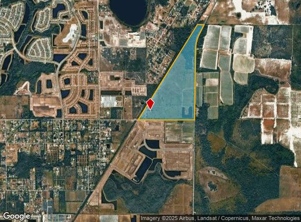
1689 579 Hwy
Tampa-St. Petersburg-Clearwater, FL
Unplatted
U-16-32-20-ZZZ-000003-22580.0
THAT PART E OF RR TOGETHER WITH THAT PART OF W 1/2 OF NW 1/4 W OF RD
Pasture
Hillsborough
AE
Florida
12081C0075E
22580
2024
195.74 AC
2024
Eastern Outlying
013914
Tampa/St Petersburg
DEMOGRAPHICS near 1689 579 Hwy
1 Mile
3 Mile
5 Mile
2024 Total Population
780
20,713
56,279
2029 Population
896
23,246
63,222
Pop Growth 2024-2029
+ 14.87%
+ 12.23%
+ 12.34%
Average Age
35
44
53
2024 Total Households
233
7,446
24,496
HH Growth 2024-2029
+ 15.02%
+ 12.03%
+ 12.42%
Median Household Inc
$49,614
$67,969
$61,668
Avg Household Size
3.20
2.60
2.20
2024 Avg HH Vehicles
3.00
2.00
2.00
Median Home Value
$295,407
$293,997
$259,654
Median Year Built
2011
2010
2001
Nearby Places
Map Layers
Map Styles
 Street
 Aerial
- Restaurants
- Banks
- Shops
- Fitness
- Groceries
PUBLIC TRANSPORTATION
AIRPORT
Tampa International
DRIVE
WALK
Distance
Tampa International
55 min
34.8 mi
Sarasota/Bradenton International
DRIVE
WALK
Distance
Sarasota/Bradenton International
55 min
34.8 mi
St Pete-Clearwater International
DRIVE
WALK
Distance
St Pete-Clearwater International
72 min
44.0 mi
Freight Ports
Port Manatee
DRIVE
WALK
Distance
Port Manatee
34 min
19.4 mi
SALE & LEASE HISTORY
LISTING DATE
SALE/LEASE

Jul 18, 2018
For Sale
Jul 13, 2018
For Sale
Nearby Properties
Address
Land Use
TOTAL SIZE
Lot Size
Zoning
Address
Land Use
TOTAL SIZE
Lot Size
Zoning
2,050.45 AC
AR
Address
Land Use
TOTAL SIZE
Lot Size
Zoning
211,729 SF
33.11 AC
PD
Address
Land Use
TOTAL SIZE
Lot Size
Zoning
92,585 SF
15.11 AC
PD
Address
Land Use
TOTAL SIZE
Lot Size
Zoning
857.12 AC
AM
Address
Land Use
TOTAL SIZE
Lot Size
Zoning
75,710 SF
10.24 AC
PD
Address
Land Use
TOTAL SIZE
Lot Size
Zoning
172.60 AC
PD
Address
Land Use
TOTAL SIZE
Lot Size
Zoning
8,897 SF
431.90 AC
AR
Address
Land Use
TOTAL SIZE
Lot Size
Zoning
62,648 SF
19.54 AC
AR
Address
Land Use
TOTAL SIZE
Lot Size
Zoning
165.08 AC
PD
Address
Land Use
TOTAL SIZE
Lot Size
Zoning
25,340 SF
2.97 AC
CG
Address
Land Use
TOTAL SIZE
Lot Size
Zoning
49,600 SF
4.54 AC
PD
Address
Land Use
TOTAL SIZE
Lot Size
Zoning
624 SF
359.68 AC
AR
Address
Land Use
TOTAL SIZE
Lot Size
Zoning
52,776 SF
213.10 AC
PD-MU
Address
Land Use
TOTAL SIZE
Lot Size
Zoning
4,564 SF
15.53 AC
PD
Address
Land Use
TOTAL SIZE
Lot Size
Zoning
370.62 AC
AR
Address
Land Use
TOTAL SIZE
Lot Size
Zoning
17,616 SF
2.20 AC
CG
Address
Land Use
TOTAL SIZE
Lot Size
Zoning
1,620 SF
224.25 AC
PD
Address
Land Use
TOTAL SIZE
Lot Size
Zoning
2,686 SF
83.76 AC
AM
Address
Land Use
TOTAL SIZE
Lot Size
Zoning
17.42 AC
PD
Address
Land Use
TOTAL SIZE
Lot Size
Zoning
88,007 SF
11.63 AC
RSC-2
Address
Land Use
TOTAL SIZE
Lot Size
Zoning
27,124 SF
2.99 AC
PD-MU
Address
Land Use
TOTAL SIZE
Lot Size
Zoning
26,274 SF
1.42 AC
PD-MU
Address
Land Use
TOTAL SIZE
Lot Size
Zoning
21,860 SF
9.96 AC
PD-MU
Address
Land Use
TOTAL SIZE
Lot Size
Zoning
236.20 AC
AR
Address
Land Use
TOTAL SIZE
Lot Size
Zoning
178.64 AC
PD
Address
Land Use
TOTAL SIZE
Lot Size
Zoning
56.47 AC
PD
Address
Land Use
TOTAL SIZE
Lot Size
Zoning
12,148 SF
1.71 AC
PD
Address
Land Use
TOTAL SIZE
Lot Size
Zoning
20,022 SF
2.29 AC
CG
Address
Land Use
TOTAL SIZE
Lot Size
Zoning
6,179 SF
1.76 AC
PD
Address
Land Use
TOTAL SIZE
Lot Size
Zoning
196.30 AC
AR
The World's #1 Commercial Real Estate Marketplace
Connect with us
© 2025 CoStar Group
The information above has been obtained from sources believed reliable. While we do not doubt its accuracy we have not verified it and make no guarantee, warranty or representation about it. It is your responsibility to independently confirm its accuracy and completeness. Any projections, opinions, assumptions, or estimates used are for example only and do not represent the current or future performance of the property. The value of this transaction to you depends on tax and other factors which should be evaluated by your tax, financial, and legal advisors. You and your advisors should conduct a careful, independent investigation of the property to determine to your satisfaction the suitability of the property for your needs.