Property Record
169 Railroad Ave, Rutherfordton, NC 28139


NEARBY LISTINGS FOR SALE OR LEASE
-
-
View all Rutherfordton listings for lease on LoopNet.com
Property Detail
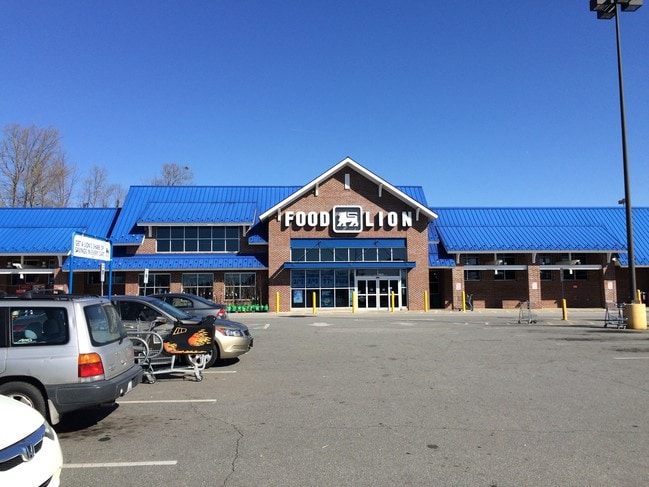
169 Railroad Ave
1634949
Intersection S R W Of 1St St & W R W Of
Supermarket
Rutherford
X
North Carolina
3710162000J
4.38 AC
2025
North Carolina West/Cherokee Area
2025
Other Market Areas
960502
Forest City, NC
34,861 SF
DEMOGRAPHICS near 169 Railroad Ave
1 Mile
3 Mile
5 Mile
2024 Total Population
3,034
13,333
23,116
2029 Population
3,128
13,663
23,570
Pop Growth 2024-2029
+ 3.10%
+ 2.48%
+ 1.96%
Average Age
42
43
43
2024 Total Households
1,286
5,449
9,494
HH Growth 2024-2029
+ 3.03%
+ 2.37%
+ 1.84%
Median Household Inc
$31,250
$37,758
$38,597
Avg Household Size
2.20
2.30
2.30
2024 Avg HH Vehicles
2.00
2.00
2.00
Median Home Value
$91,922
$155,114
$154,218
Median Year Built
1969
1974
1974
Nearby Places
Map Layers
Map Styles
 Street
 Aerial
- Restaurants
- Banks
- Shops
- Fitness
- Groceries
PUBLIC TRANSPORTATION
AIRPORT
Asheville Regional
DRIVE
WALK
Distance
Asheville Regional
61 min
49.3 mi
SALE & LEASE HISTORY
LISTING DATE
SALE/LEASE

Dec 05, 2017
For Lease
Nearby Properties
Address
Land Use
TOTAL SIZE
Lot Size
Zoning
Address
Land Use
TOTAL SIZE
Lot Size
Zoning
334,081 SF
94.10 AC
Address
Land Use
TOTAL SIZE
Lot Size
Zoning
168,615 SF
27.34 AC
CIV
Address
Land Use
TOTAL SIZE
Lot Size
Zoning
141,217 SF
27.03 AC
Address
Land Use
TOTAL SIZE
Lot Size
Zoning
87,123 SF
1.98 AC
Address
Land Use
TOTAL SIZE
Lot Size
Zoning
87,108 SF
26.73 AC
GC
Address
Land Use
TOTAL SIZE
Lot Size
Zoning
421,200 SF
41.90 AC
Address
Land Use
TOTAL SIZE
Lot Size
Zoning
61,023 SF
7.64 AC
R6
Address
Land Use
TOTAL SIZE
Lot Size
Zoning
1,408 SF
6.95 AC
R20
Address
Land Use
TOTAL SIZE
Lot Size
Zoning
63,006 SF
14.29 AC
Address
Land Use
TOTAL SIZE
Lot Size
Zoning
328,907 SF
52.37 AC
Address
Land Use
TOTAL SIZE
Lot Size
Zoning
4,982 SF
27.13 AC
Address
Land Use
TOTAL SIZE
Lot Size
Zoning
2,026 SF
8.71 AC
R6
Address
Land Use
TOTAL SIZE
Lot Size
Zoning
12,480 SF
43 AC
Address
Land Use
TOTAL SIZE
Lot Size
Zoning
95,267 SF
8.40 AC
GC
Address
Land Use
TOTAL SIZE
Lot Size
Zoning
16,074 SF
101.60 AC
Address
Land Use
TOTAL SIZE
Lot Size
Zoning
7,424 SF
6.39 AC
IND
Address
Land Use
TOTAL SIZE
Lot Size
Zoning
53,790 SF
6.37 AC
R6
Address
Land Use
TOTAL SIZE
Lot Size
Zoning
23,990 SF
3 AC
Address
Land Use
TOTAL SIZE
Lot Size
Zoning
6,448 SF
3.30 AC
GC
Address
Land Use
TOTAL SIZE
Lot Size
Zoning
6,000 SF
15.30 AC
Address
Land Use
TOTAL SIZE
Lot Size
Zoning
6,988 SF
1.51 AC
R6
Address
Land Use
TOTAL SIZE
Lot Size
Zoning
10,366 SF
1.22 AC
CIV
Address
Land Use
TOTAL SIZE
Lot Size
Zoning
19,530 SF
1.50 AC
CIV
Address
Land Use
TOTAL SIZE
Lot Size
Zoning
93,600 SF
45.11 AC
HCI
Address
Land Use
TOTAL SIZE
Lot Size
Zoning
17,622 SF
5.14 AC
MS
Address
Land Use
TOTAL SIZE
Lot Size
Zoning
53,860 SF
15.88 AC
CIV
Address
Land Use
TOTAL SIZE
Lot Size
Zoning
7,367 SF
0.64 AC
CIV
Address
Land Use
TOTAL SIZE
Lot Size
Zoning
42,360 SF
CIV
Address
Land Use
TOTAL SIZE
Lot Size
Zoning
1,200 SF
6.13 AC
SFR-3
The World's #1 Commercial Real Estate Marketplace
Connect with us
© 2025 CoStar Group
The information above has been obtained from sources believed reliable. While we do not doubt its accuracy we have not verified it and make no guarantee, warranty or representation about it. It is your responsibility to independently confirm its accuracy and completeness. Any projections, opinions, assumptions, or estimates used are for example only and do not represent the current or future performance of the property. The value of this transaction to you depends on tax and other factors which should be evaluated by your tax, financial, and legal advisors. You and your advisors should conduct a careful, independent investigation of the property to determine to your satisfaction the suitability of the property for your needs.