Property Record
169 Sickles Ave, Nyack, NY 10960


This Property Is For Sale
NEARBY LISTINGS FOR SALE OR LEASE
-
-
View all Nyack listings for sale on LoopNet.com
Property Detail
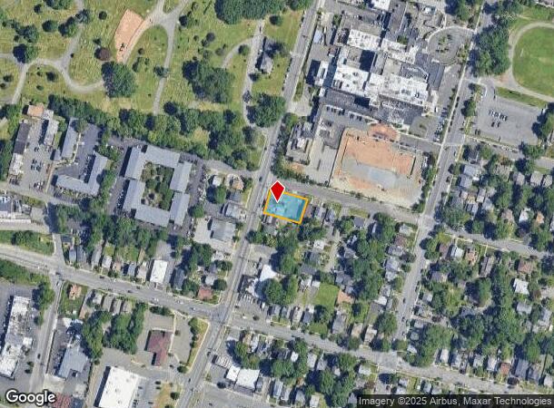
169 Sickles Ave
New York-Jersey City-White Plains, NY-NJ
Rockland
392403-065-036-0002-001-000-0000
New York
Townhouserowhouse
0.22 AC
X
Rockland County
36087C0181G
Northern New Jersey
2,552 SF
DEMOGRAPHICS near 169 Sickles Ave
1 Mile
3 Mile
5 Mile
2024 Total Population
13,685
32,935
123,986
2029 Population
14,019
33,878
127,118
Pop Growth 2024-2029
+ 2.44%
+ 2.86%
+ 2.53%
Average Age
43
43
43
2024 Total Households
6,074
12,654
44,988
HH Growth 2024-2029
+ 2.50%
+ 2.86%
+ 2.48%
Median Household Inc
$121,597
$127,058
$126,349
Avg Household Size
2.20
2.50
2.60
2024 Avg HH Vehicles
2.00
2.00
2.00
Median Home Value
$636,156
$686,073
$697,157
Median Year Built
1962
1963
1964
Nearby Places
Map Layers
Map Styles
 Street
 Aerial
- Restaurants
- Banks
- Shops
- Fitness
- Groceries
PUBLIC TRANSPORTATION
COMMUTER RAIL
Nanuet (Pascack Valley Line - NJ Transit Commuter Rail (NJ Transit))
DRIVE
WALK
Distance
Nanuet (Pascack Valley Line - NJ Transit Commuter Rail (NJ Transit))
11 min
5.6 mi
Tarrytown Station (Hudson Line - Metro-North Commuter Railroad Company (Metro-North))
DRIVE
WALK
Distance
Tarrytown Station (Hudson Line - Metro-North Commuter Railroad Company (Metro-North))
14 min
7.8 mi
AIRPORT
Westchester County
DRIVE
WALK
Distance
Westchester County
29 min
19.4 mi
LaGuardia
DRIVE
WALK
Distance
LaGuardia
51 min
32.3 mi
New York Stewart International
DRIVE
WALK
Distance
New York Stewart International
58 min
39.4 mi
Freight Ports
NY - Red Hook Container Terminal
DRIVE
WALK
Distance
NY - Red Hook Container Terminal
62 min
33.9 mi
Nearby Properties
Address
Land Use
TOTAL SIZE
Lot Size
Zoning
Address
Land Use
TOTAL SIZE
Lot Size
Zoning
415,374 SF
8.43 AC
H
Address
Land Use
TOTAL SIZE
Lot Size
Zoning
4,540,462 SF
30.89 AC
Address
Land Use
TOTAL SIZE
Lot Size
Zoning
298,975 SF
63.32 AC
03 - MULTI
Address
Land Use
TOTAL SIZE
Lot Size
Zoning
25.52 AC
Address
Land Use
TOTAL SIZE
Lot Size
Zoning
108,264 SF
14.90 AC
R-18
Address
Land Use
TOTAL SIZE
Lot Size
Zoning
302.70 AC
R-40
Address
Land Use
TOTAL SIZE
Lot Size
Zoning
1.10 AC
R-3
Address
Land Use
TOTAL SIZE
Lot Size
Zoning
984 SF
3.10 AC
LI
Address
Land Use
TOTAL SIZE
Lot Size
Zoning
1,887 SF
245.60 AC
02 - SINGL
Address
Land Use
TOTAL SIZE
Lot Size
Zoning
Address
Land Use
TOTAL SIZE
Lot Size
Zoning
441.47 AC
R-40
Address
Land Use
TOTAL SIZE
Lot Size
Zoning
500,448 SF
29.92 AC
Address
Land Use
TOTAL SIZE
Lot Size
Zoning
142,608 SF
5.60 AC
HRA
Address
Land Use
TOTAL SIZE
Lot Size
Zoning
Address
Land Use
TOTAL SIZE
Lot Size
Zoning
184.50 AC
R-40
Address
Land Use
TOTAL SIZE
Lot Size
Zoning
215,345 SF
18.60 AC
LO
Address
Land Use
TOTAL SIZE
Lot Size
Zoning
34.45 AC
Address
Land Use
TOTAL SIZE
Lot Size
Zoning
8.80 AC
R-1
Address
Land Use
TOTAL SIZE
Lot Size
Zoning
176,522 SF
11.83 AC
LO
Address
Land Use
TOTAL SIZE
Lot Size
Zoning
108,115 SF
2.21 AC
M
Address
Land Use
TOTAL SIZE
Lot Size
Zoning
142,143 SF
14 AC
R-18
Address
Land Use
TOTAL SIZE
Lot Size
Zoning
208,143 SF
13.15 AC
LO
Address
Land Use
TOTAL SIZE
Lot Size
Zoning
Address
Land Use
TOTAL SIZE
Lot Size
Zoning
141,480 SF
25.60 AC
LI
Address
Land Use
TOTAL SIZE
Lot Size
Zoning
188,101 SF
3.85 AC
M
Address
Land Use
TOTAL SIZE
Lot Size
Zoning
2.30 AC
R-3
Address
Land Use
TOTAL SIZE
Lot Size
Zoning
230,136 SF
14.90 AC
LIO
Address
Land Use
TOTAL SIZE
Lot Size
Zoning
59,148 SF
14.50 AC
R-18
Address
Land Use
TOTAL SIZE
Lot Size
Zoning
42,418 SF
4.80 AC
R-15
Address
Land Use
TOTAL SIZE
Lot Size
Zoning
18,065 SF
19.43 AC
The World's #1 Commercial Real Estate Marketplace
Connect with us
© 2025 CoStar Group
The information above has been obtained from sources believed reliable. While we do not doubt its accuracy we have not verified it and make no guarantee, warranty or representation about it. It is your responsibility to independently confirm its accuracy and completeness. Any projections, opinions, assumptions, or estimates used are for example only and do not represent the current or future performance of the property. The value of this transaction to you depends on tax and other factors which should be evaluated by your tax, financial, and legal advisors. You and your advisors should conduct a careful, independent investigation of the property to determine to your satisfaction the suitability of the property for your needs.