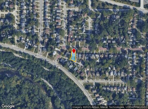
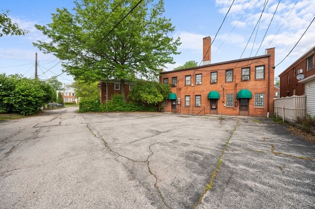
Property Record
16903 Fischer Rd, Lakewood, OH 44107
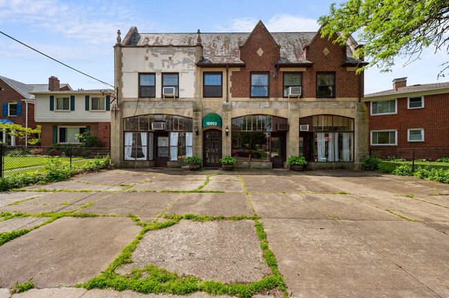
This Property Is For Sale
NEARBY LISTINGS FOR SALE OR LEASE
Property Detail
16903 Fischer Rd
Cleveland-Elyria, OH
Exeter Square
024-04-002
18 EXETER SQ 0015 ALL
Storesoffices
Cuyahoga
X
Ohio
39035C0154E
15
2024
0.14 AC
2024
West
123100
Cleveland
7,150 SF
DEMOGRAPHICS near 16903 Fischer Rd
1 Mile
3 Mile
5 Mile
2024 Total Population
16,446
135,559
232,012
2029 Population
15,972
131,668
225,132
Pop Growth 2024-2029
(2.88%)
(2.87%)
(2.97%)
Average Age
40
41
41
2024 Total Households
7,769
63,802
105,922
HH Growth 2024-2029
(3.10%)
(2.99%)
(3.10%)
Median Household Inc
$72,574
$57,958
$55,978
Avg Household Size
2.10
2.00
2.10
2024 Avg HH Vehicles
2.00
1.00
2.00
Median Home Value
$205,886
$180,233
$170,626
Median Year Built
1946
1948
1950
Nearby Places
- Restaurants
- Banks
- Shops
- Fitness
- Groceries
PUBLIC TRANSPORTATION
COMMUTER RAIL
Cleveland Lakefront Station (Blue Line - Greater Cleveland Regional Transit Authority Rapid Transit (The Rapid), Green Line - Greater Cleveland Regional Transit Authority Rapid Transit (The Rapid))
DRIVE
WALK
Distance
Cleveland Lakefront Station (Blue Line - Greater Cleveland Regional Transit Authority Rapid Transit (The Rapid), Green Line - Greater Cleveland Regional Transit Authority Rapid Transit (The Rapid))
19 min
9.6 mi
AIRPORT
Cleveland-Hopkins International
DRIVE
WALK
Distance
Cleveland-Hopkins International
14 min
5.3 mi
Nearby Properties
Address
Land Use
TOTAL SIZE
Lot Size
Zoning
Address
Land Use
TOTAL SIZE
Lot Size
Zoning
263,090 SF
33.53 AC
GB-A
Address
Land Use
TOTAL SIZE
Lot Size
Zoning
780,869 SF
14.77 AC
LR
Address
Land Use
TOTAL SIZE
Lot Size
Zoning
187 SF
20.90 AC
PG
Address
Land Use
TOTAL SIZE
Lot Size
Zoning
518,244 SF
21.80 AC
Address
Land Use
TOTAL SIZE
Lot Size
Zoning
208,209 SF
12.10 AC
1F
Address
Land Use
TOTAL SIZE
Lot Size
Zoning
53,718 SF
2.19 AC
PF
Address
Land Use
TOTAL SIZE
Lot Size
Zoning
63,139 SF
1.52 AC
PF
Address
Land Use
TOTAL SIZE
Lot Size
Zoning
243,118 SF
15.01 AC
PF
Address
Land Use
TOTAL SIZE
Lot Size
Zoning
217,747 SF
29.07 AC
GB-A
Address
Land Use
TOTAL SIZE
Lot Size
Zoning
326,357 SF
6.40 AC
GB
Address
Land Use
TOTAL SIZE
Lot Size
Zoning
168,750 SF
18.55 AC
GI
Address
Land Use
TOTAL SIZE
Lot Size
Zoning
355,242 SF
13.28 AC
RMF-HR
Address
Land Use
TOTAL SIZE
Lot Size
Zoning
162,449 SF
23.90 AC
PF
Address
Land Use
TOTAL SIZE
Lot Size
Zoning
25,814 SF
64.97 AC
2F
Address
Land Use
TOTAL SIZE
Lot Size
Zoning
235,984 SF
18.10 AC
GB
Address
Land Use
TOTAL SIZE
Lot Size
Zoning
107,866 SF
11.22 AC
PF
Address
Land Use
TOTAL SIZE
Lot Size
Zoning
244,602 SF
10.31 AC
CR
Address
Land Use
TOTAL SIZE
Lot Size
Zoning
128,902 SF
7.12 AC
PD
Address
Land Use
TOTAL SIZE
Lot Size
Zoning
142,740 SF
1.83 AC
MF-2
Address
Land Use
TOTAL SIZE
Lot Size
Zoning
20.99 AC
2F
Address
Land Use
TOTAL SIZE
Lot Size
Zoning
211,719 SF
18.82 AC
PF
Address
Land Use
TOTAL SIZE
Lot Size
Zoning
126,661 SF
7.07 AC
PD
Address
Land Use
TOTAL SIZE
Lot Size
Zoning
56,212 SF
2.69 AC
Address
Land Use
TOTAL SIZE
Lot Size
Zoning
278,256 SF
0.81 AC
C1
Address
Land Use
TOTAL SIZE
Lot Size
Zoning
228,712 SF
10.10 AC
C3
Address
Land Use
TOTAL SIZE
Lot Size
Zoning
154,906 SF
5.99 AC
GB
Address
Land Use
TOTAL SIZE
Lot Size
Zoning
64,000 SF
4.05 AC
Address
Land Use
TOTAL SIZE
Lot Size
Zoning
181,049 SF
7.76 AC
GI
Address
Land Use
TOTAL SIZE
Lot Size
Zoning
169,865 SF
28.66 AC
1F
Address
Land Use
TOTAL SIZE
Lot Size
Zoning
111,956 SF
210.37 AC
PP
The World's #1 Commercial Real Estate Marketplace
Connect with us
© 2025 CoStar Group
The information above has been obtained from sources believed reliable. While we do not doubt its accuracy we have not verified it and make no guarantee, warranty or representation about it. It is your responsibility to independently confirm its accuracy and completeness. Any projections, opinions, assumptions, or estimates used are for example only and do not represent the current or future performance of the property. The value of this transaction to you depends on tax and other factors which should be evaluated by your tax, financial, and legal advisors. You and your advisors should conduct a careful, independent investigation of the property to determine to your satisfaction the suitability of the property for your needs.