Property Record
16910 Fm 2920 Rd, Tomball, TX 77377


NEARBY LISTINGS FOR SALE OR LEASE
Property Detail
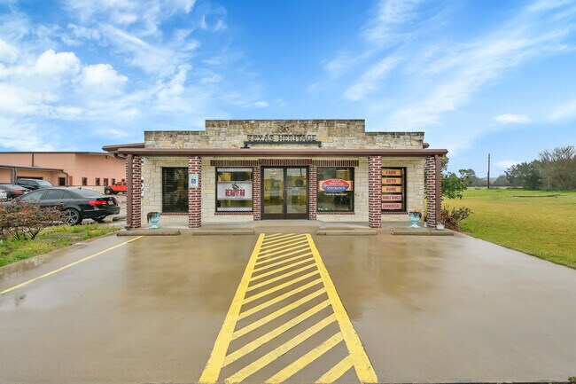
16910 Fm 2920 Rd
1299180010002
Smokey Estates
Storebuilding
RES B BLK 1 SMOKEY ESTATES
X
Harris
48339C0675G
Texas
2024
1.65 AC
2025
Northwest Outlier
555501
Houston
9,268 SF
Houston-The Woodlands-Sugar Land, TX
DEMOGRAPHICS near 16910 Fm 2920 Rd
1 Mile
3 Mile
5 Mile
2024 Total Population
712
10,631
54,590
2029 Population
742
11,295
59,025
Pop Growth 2024-2029
+ 4.21%
+ 6.25%
+ 8.12%
Average Age
40
40
38
2024 Total Households
246
3,631
18,761
HH Growth 2024-2029
+ 4.07%
+ 6.14%
+ 8.04%
Median Household Inc
$85,065
$93,621
$89,953
Avg Household Size
2.90
2.90
2.80
2024 Avg HH Vehicles
3.00
2.00
2.00
Median Home Value
$461,999
$412,047
$322,868
Median Year Built
1993
1999
2003
Nearby Places
Map Layers
Map Styles
 Street
 Aerial
- Restaurants
- Banks
- Shops
- Fitness
- Groceries
PUBLIC TRANSPORTATION
AIRPORT
George Bush Intcntl/Houston
DRIVE
WALK
Distance
George Bush Intcntl/Houston
39 min
30.2 mi
SALE & LEASE HISTORY
LISTING DATE
SALE/LEASE

Mar 03, 2017
For Sale
Mar 03, 2017
For Lease
Feb 25, 2020
For Lease
Dec 10, 2020
For Lease
Aug 09, 2019
For Lease
Aug 09, 2017
For Lease
Nearby Properties
Address
Land Use
TOTAL SIZE
Lot Size
Zoning
Address
Land Use
TOTAL SIZE
Lot Size
Zoning
326,902 SF
15.45 AC
Address
Land Use
TOTAL SIZE
Lot Size
Zoning
148,105 SF
19.73 AC
Address
Land Use
TOTAL SIZE
Lot Size
Zoning
110,553 SF
10.34 AC
Address
Land Use
TOTAL SIZE
Lot Size
Zoning
112,854 SF
5.80 AC
Address
Land Use
TOTAL SIZE
Lot Size
Zoning
103,000 SF
8.36 AC
Address
Land Use
TOTAL SIZE
Lot Size
Zoning
135,804 SF
15.33 AC
Address
Land Use
TOTAL SIZE
Lot Size
Zoning
123,400 SF
15.08 AC
Address
Land Use
TOTAL SIZE
Lot Size
Zoning
70,192 SF
2.20 AC
Address
Land Use
TOTAL SIZE
Lot Size
Zoning
65,475 SF
7.84 AC
Address
Land Use
TOTAL SIZE
Lot Size
Zoning
122,970 SF
11.79 AC
Address
Land Use
TOTAL SIZE
Lot Size
Zoning
56,700 SF
10 AC
Address
Land Use
TOTAL SIZE
Lot Size
Zoning
66,960 SF
17.39 AC
Address
Land Use
TOTAL SIZE
Lot Size
Zoning
86,551 SF
6.97 AC
Address
Land Use
TOTAL SIZE
Lot Size
Zoning
115,910 SF
21.27 AC
Address
Land Use
TOTAL SIZE
Lot Size
Zoning
50,061 SF
1.73 AC
Address
Land Use
TOTAL SIZE
Lot Size
Zoning
62,322 SF
15.82 AC
Address
Land Use
TOTAL SIZE
Lot Size
Zoning
42,900 SF
2.11 AC
Address
Land Use
TOTAL SIZE
Lot Size
Zoning
64,986 SF
4.75 AC
Address
Land Use
TOTAL SIZE
Lot Size
Zoning
83,930 SF
4.74 AC
Address
Land Use
TOTAL SIZE
Lot Size
Zoning
18,590 SF
15.24 AC
Address
Land Use
TOTAL SIZE
Lot Size
Zoning
76.78 AC
Address
Land Use
TOTAL SIZE
Lot Size
Zoning
81,175 SF
3.31 AC
Address
Land Use
TOTAL SIZE
Lot Size
Zoning
73,040 SF
5.22 AC
Address
Land Use
TOTAL SIZE
Lot Size
Zoning
113,545 SF
8.24 AC
Address
Land Use
TOTAL SIZE
Lot Size
Zoning
1,184 SF
27.54 AC
Address
Land Use
TOTAL SIZE
Lot Size
Zoning
Address
Land Use
TOTAL SIZE
Lot Size
Zoning
25,063 SF
5 AC
Address
Land Use
TOTAL SIZE
Lot Size
Zoning
85,700 SF
6 AC
Address
Land Use
TOTAL SIZE
Lot Size
Zoning
6,729 SF
98.17 AC
Address
Land Use
TOTAL SIZE
Lot Size
Zoning
106,900 SF
14.27 AC
The World's #1 Commercial Real Estate Marketplace
Connect with us
© 2026 CoStar Group
The information above has been obtained from sources believed reliable. While we do not doubt its accuracy we have not verified it and make no guarantee, warranty or representation about it. It is your responsibility to independently confirm its accuracy and completeness. Any projections, opinions, assumptions, or estimates used are for example only and do not represent the current or future performance of the property. The value of this transaction to you depends on tax and other factors which should be evaluated by your tax, financial, and legal advisors. You and your advisors should conduct a careful, independent investigation of the property to determine to your satisfaction the suitability of the property for your needs.