Property Record
16917 W Indian School Rd, Goodyear, AZ 85395
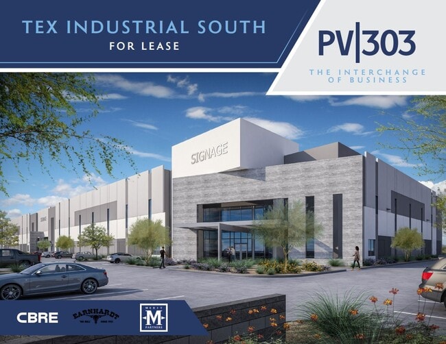
Current Lease Availabilities
NEARBY LISTINGS FOR SALE OR LEASE
Property Detail
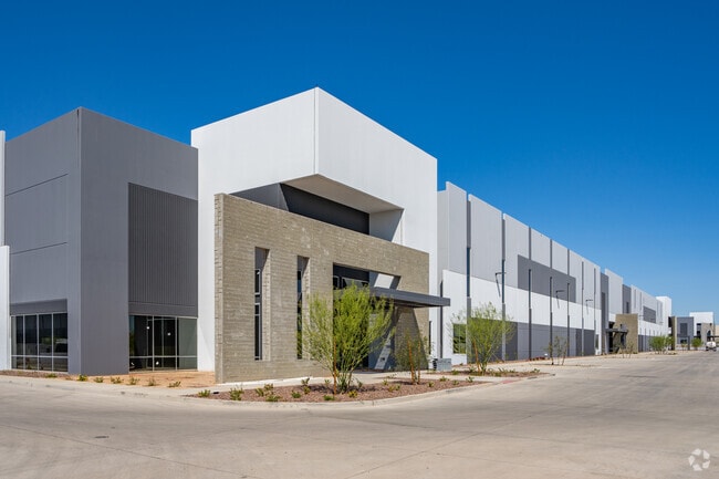
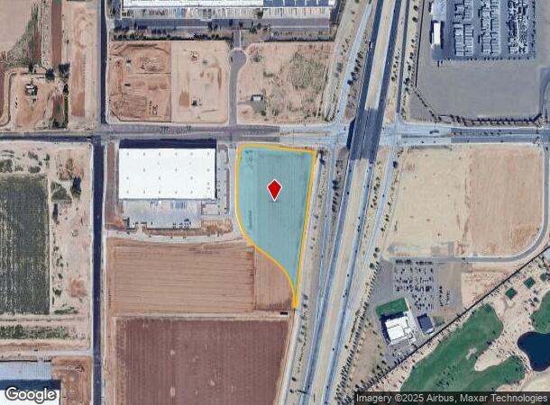
16917 W Indian School Rd
Phoenix
Pv303 West 2 Phase 2
Phoenix-Mesa-Scottsdale, AZ
PV303 WEST 2 PHASE 2 MCR 1612-45
501-02-942
Maricopa
Commercialacreage
Arizona
2025
2
2025
9.29 AC
061056
Glendale
DEMOGRAPHICS near 16917 W Indian School Rd
1 Mile
3 Mile
5 Mile
2024 Total Population
1,663
44,545
140,587
2029 Population
1,875
49,446
156,128
Pop Growth 2024-2029
+ 12.75%
+ 11.00%
+ 11.05%
Average Age
68
45
40
2024 Total Households
840
16,630
47,478
HH Growth 2024-2029
+ 13.33%
+ 11.20%
+ 11.22%
Median Household Inc
$103,800
$101,963
$100,816
Avg Household Size
1.90
2.60
2.90
2024 Avg HH Vehicles
2.00
2.00
2.00
Median Home Value
$472,499
$461,173
$418,440
Median Year Built
2009
2009
2007
Nearby Places
- Restaurants
- Banks
- Shops
- Fitness
- Groceries
PUBLIC TRANSPORTATION
AIRPORT
Phoenix Sky Harbor International
DRIVE
WALK
Distance
Phoenix Sky Harbor International
38 min
29.1 mi
Freight Ports
Port of San Diego
DRIVE
WALK
Distance
Port of San Diego
374 min
336.4 mi
Nearby Properties
Address
Land Use
TOTAL SIZE
Lot Size
Zoning
Address
Land Use
TOTAL SIZE
Lot Size
Zoning
75.54 AC
Address
Land Use
TOTAL SIZE
Lot Size
Zoning
35.05 AC
Address
Land Use
TOTAL SIZE
Lot Size
Zoning
76,301 SF
15.91 AC
Address
Land Use
TOTAL SIZE
Lot Size
Zoning
Address
Land Use
TOTAL SIZE
Lot Size
Zoning
551,831 SF
609.49 AC
AG
Address
Land Use
TOTAL SIZE
Lot Size
Zoning
1,192,719 SF
70.75 AC
Address
Land Use
TOTAL SIZE
Lot Size
Zoning
915,160 SF
53.89 AC
Address
Land Use
TOTAL SIZE
Lot Size
Zoning
1,155,404 SF
75.47 AC
Address
Land Use
TOTAL SIZE
Lot Size
Zoning
2.51 AC
Address
Land Use
TOTAL SIZE
Lot Size
Zoning
1,253,382 SF
74.13 AC
Address
Land Use
TOTAL SIZE
Lot Size
Zoning
438,256 SF
48.59 AC
Address
Land Use
TOTAL SIZE
Lot Size
Zoning
802,439 SF
56.30 AC
PAD
Address
Land Use
TOTAL SIZE
Lot Size
Zoning
25.69 AC
Address
Land Use
TOTAL SIZE
Lot Size
Zoning
640,330 SF
91.15 AC
Address
Land Use
TOTAL SIZE
Lot Size
Zoning
244,676 SF
131.34 AC
Address
Land Use
TOTAL SIZE
Lot Size
Zoning
721,156 SF
44.90 AC
PAD
Address
Land Use
TOTAL SIZE
Lot Size
Zoning
663,367 SF
38.83 AC
Address
Land Use
TOTAL SIZE
Lot Size
Zoning
320,888 SF
31.41 AC
C-G
Address
Land Use
TOTAL SIZE
Lot Size
Zoning
398,872 SF
9.39 AC
PAD
Address
Land Use
TOTAL SIZE
Lot Size
Zoning
601,124 SF
39.88 AC
PAD
Address
Land Use
TOTAL SIZE
Lot Size
Zoning
599,070 SF
38.33 AC
Address
Land Use
TOTAL SIZE
Lot Size
Zoning
563,781 SF
34.84 AC
PAD
Address
Land Use
TOTAL SIZE
Lot Size
Zoning
643,798 SF
42.24 AC
PAD
Address
Land Use
TOTAL SIZE
Lot Size
Zoning
643,756 SF
39.25 AC
PAD
Address
Land Use
TOTAL SIZE
Lot Size
Zoning
295,014 SF
37.63 AC
PAD
Address
Land Use
TOTAL SIZE
Lot Size
Zoning
643,798 SF
39.40 AC
PAD
Address
Land Use
TOTAL SIZE
Lot Size
Zoning
278,670 SF
40.72 AC
Address
Land Use
TOTAL SIZE
Lot Size
Zoning
337,781 SF
9.11 AC
PF
Address
Land Use
TOTAL SIZE
Lot Size
Zoning
198,109 SF
79 AC
R-43
Address
Land Use
TOTAL SIZE
Lot Size
Zoning
295,635 SF
16.57 AC
PAD
The World's #1 Commercial Real Estate Marketplace
Connect with us
© 2025 CoStar Group
The information above has been obtained from sources believed reliable. While we do not doubt its accuracy we have not verified it and make no guarantee, warranty or representation about it. It is your responsibility to independently confirm its accuracy and completeness. Any projections, opinions, assumptions, or estimates used are for example only and do not represent the current or future performance of the property. The value of this transaction to you depends on tax and other factors which should be evaluated by your tax, financial, and legal advisors. You and your advisors should conduct a careful, independent investigation of the property to determine to your satisfaction the suitability of the property for your needs.