Property Record
16920 W Commerce Dr, Goodyear, AZ 85338
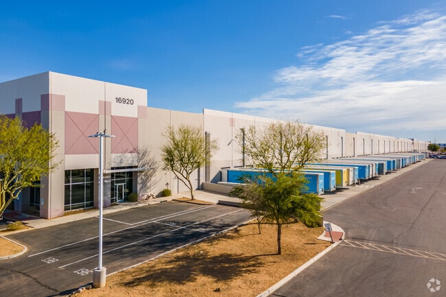

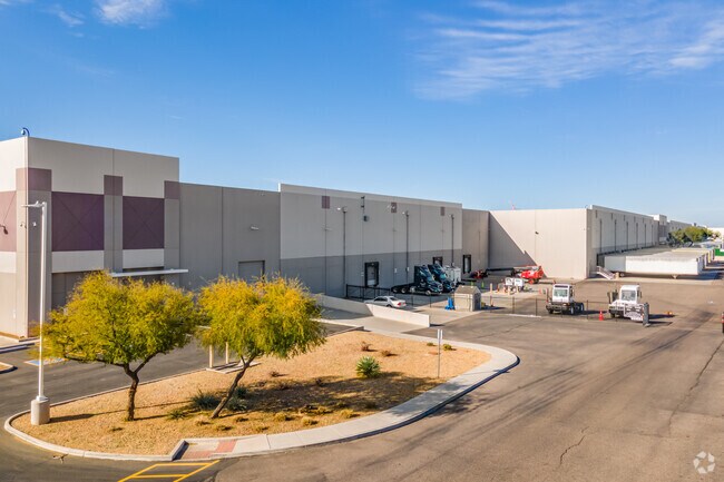
Property Detail
16920 W Commerce Dr
500-94-438
GOODYEAR CROSSING INDUSTRIAL PARK LOT 1B MLD MCR 1038-30
Warehouse
Maricopa
I-2
Arizona
C and X Area of minimal flood hazard, usually depicted on FIRMs as above the 500-year flood level.
1b
2025
45 AC
2025
Goodyear
061024
Phoenix
821,580 SF
Phoenix-Mesa-Chandler, AZ
NEARBY LISTINGS FOR SALE OR LEASE
-
-
View all Goodyear listings for lease on LoopNet.com
DEMOGRAPHICS near 16920 W Commerce Dr
1 mile
3 mile
5 mile
2025 Total Population
3,439
40,168
93,006
2030 Population
3,728
42,876
98,916
Pop Growth 2025-2030
+ 8.40%
+ 6.74%
+ 6.35%
Average Age
35
35
38
2025 Total Households
1,030
12,356
30,294
HH Growth 2025-2030
+ 8.54%
+ 6.72%
+ 6.42%
Median Household Inc
$105,416
$101,543
$96,656
Avg Household Size
3.30
3.20
3.00
2025 Avg HH Vehicles
2.00
2.00
2.00
Median Home Value
$448,666
$437,310
$451,161
Median Year Built
2008
2007
2008
Nearby Places
Map Layers
Map Styles
 Street
 Aerial
Layers
 Traffic
 Biking
Places
Listings with unknown addresses are not visible on the map
- Restaurants
- Banks
- Shops
- Fitness
- Groceries
PUBLIC TRANSPORTATION
AIRPORT
Phoenix Sky Harbor International
Drive
Walk
Distance
Phoenix Sky Harbor International
42 min
30.5 mi
Freight Ports
Port of San Diego
Drive
Walk
Distance
Port of San Diego
375 min
331.6 mi
SALE & LEASE HISTORY
LISTING DATE
SALE/LEASE

Mar 06, 2025
For Lease
Nearby Properties
Address
Land Use
TOTAL SIZE
Lot Size
Zoning
Address
Land Use
TOTAL SIZE
Lot Size
Zoning
15.76 AC
Address
Land Use
TOTAL SIZE
Lot Size
Zoning
15.76 AC
Address
Land Use
TOTAL SIZE
Lot Size
Zoning
1,310,258 SF
79.03 AC
PAD
Address
Land Use
TOTAL SIZE
Lot Size
Zoning
963,302 SF
48.33 AC
I-2
Address
Land Use
TOTAL SIZE
Lot Size
Zoning
220,494 SF
50.53 AC
AG
Address
Land Use
TOTAL SIZE
Lot Size
Zoning
730,339 SF
47.89 AC
Address
Land Use
TOTAL SIZE
Lot Size
Zoning
591,362 SF
44.62 AC
PAD
Address
Land Use
TOTAL SIZE
Lot Size
Zoning
16.70 AC
Address
Land Use
TOTAL SIZE
Lot Size
Zoning
16.70 AC
Address
Land Use
TOTAL SIZE
Lot Size
Zoning
540,349 SF
27.47 AC
PAD
Address
Land Use
TOTAL SIZE
Lot Size
Zoning
663,150 SF
34.49 AC
Address
Land Use
TOTAL SIZE
Lot Size
Zoning
54,562 SF
7.65 AC
PAD
Address
Land Use
TOTAL SIZE
Lot Size
Zoning
Address
Land Use
TOTAL SIZE
Lot Size
Zoning
57,976 SF
155.09 AC
PFD
Address
Land Use
TOTAL SIZE
Lot Size
Zoning
239,259 SF
22.68 AC
PAD
Address
Land Use
TOTAL SIZE
Lot Size
Zoning
4,472 SF
1.27 AC
PAD
Address
Land Use
TOTAL SIZE
Lot Size
Zoning
Address
Land Use
TOTAL SIZE
Lot Size
Zoning
19.76 AC
R-43
Address
Land Use
TOTAL SIZE
Lot Size
Zoning
200,448 SF
30.39 AC
PAD
Address
Land Use
TOTAL SIZE
Lot Size
Zoning
226,139 SF
19.46 AC
PAD
Address
Land Use
TOTAL SIZE
Lot Size
Zoning
89,088 SF
9.87 AC
PAD
Address
Land Use
TOTAL SIZE
Lot Size
Zoning
223,890 SF
12.64 AC
PAD
Address
Land Use
TOTAL SIZE
Lot Size
Zoning
2,212 SF
1.01 AC
PAD
Address
Land Use
TOTAL SIZE
Lot Size
Zoning
178,193 SF
17 AC
I-1
Address
Land Use
TOTAL SIZE
Lot Size
Zoning
84,649 SF
10.10 AC
PAD
Address
Land Use
TOTAL SIZE
Lot Size
Zoning
555,304 SF
68.12 AC
PAD
Address
Land Use
TOTAL SIZE
Lot Size
Zoning
542,968 SF
16.92 AC
PAD
Address
Land Use
TOTAL SIZE
Lot Size
Zoning
186,968 SF
16.09 AC
PAD
Address
Land Use
TOTAL SIZE
Lot Size
Zoning
259,703 SF
14.25 AC
PAD
The World's #1 Commercial Real Estate Marketplace
Connect with us
© 2026 CoStar Group
The information above has been obtained from sources believed reliable. While we do not doubt its accuracy we have not verified it and make no guarantee, warranty or representation about it. It is your responsibility to independently confirm its accuracy and completeness. Any projections, opinions, assumptions, or estimates used are for example only and do not represent the current or future performance of the property. The value of this transaction to you depends on tax and other factors which should be evaluated by your tax, financial, and legal advisors. You and your advisors should conduct a careful, independent investigation of the property to determine to your satisfaction the suitability of the property for your needs.