Property Record
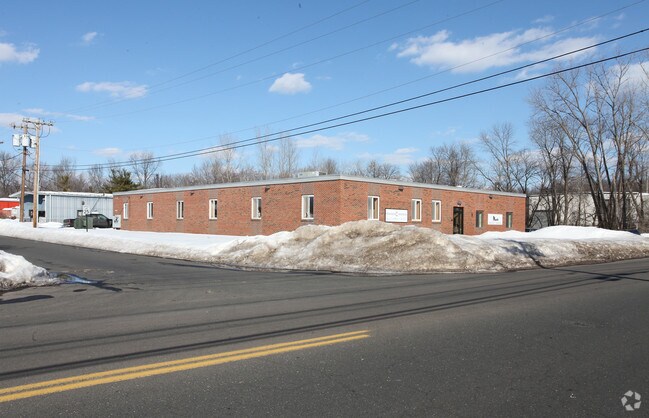
1695 Berlin Tpke, Berlin, CT 06037


NEARBY LISTINGS FOR SALE OR LEASE
Property Detail
1695 Berlin Tpke
BERL-000221-000141-000015-007918
Hartford
Commercialbuilding
Connecticut
X
15
09009C0160H
3.03 AC
2025
Berlin
2025
Hartford
400200
Hartford-West Hartford-East Hartford, CT
448 SF
DEMOGRAPHICS near 1695 Berlin Tpke
1 Mile
3 Mile
5 Mile
2024 Total Population
2,524
59,967
153,285
2029 Population
2,500
59,138
151,981
Pop Growth 2024-2029
(0.95%)
(1.38%)
(0.85%)
Average Age
45
41
40
2024 Total Households
1,088
24,165
61,831
HH Growth 2024-2029
(0.92%)
(1.38%)
(0.87%)
Median Household Inc
$73,915
$67,939
$75,855
Avg Household Size
2.30
2.40
2.40
2024 Avg HH Vehicles
2.00
2.00
2.00
Median Home Value
$255,128
$267,654
$254,683
Median Year Built
1969
1962
1966
Nearby Places
Map Layers
Map Styles
 Street
 Aerial
- Restaurants
- Banks
- Shops
- Fitness
- Groceries
PUBLIC TRANSPORTATION
COMMUTER RAIL
DRIVE
WALK
Distance
6 min
2.8 mi
DRIVE
WALK
Distance
6 min
2.8 mi
AIRPORT
Tweed/New Haven
DRIVE
WALK
Distance
Tweed/New Haven
40 min
28.1 mi
Bradley International
DRIVE
WALK
Distance
Bradley International
48 min
29.8 mi
Freight Ports
Port of New Haven
DRIVE
WALK
Distance
Port of New Haven
35 min
25.8 mi
Nearby Properties
Address
Land Use
TOTAL SIZE
Lot Size
Zoning
Address
Land Use
TOTAL SIZE
Lot Size
Zoning
17.38 AC
PRD
Address
Land Use
TOTAL SIZE
Lot Size
Zoning
29.45 AC
R-15
Address
Land Use
TOTAL SIZE
Lot Size
Zoning
241,225 SF
25.64 AC
R-11
Address
Land Use
TOTAL SIZE
Lot Size
Zoning
15.10 AC
PRD
Address
Land Use
TOTAL SIZE
Lot Size
Zoning
19.49 AC
PRD
Address
Land Use
TOTAL SIZE
Lot Size
Zoning
11.81 AC
PRD
Address
Land Use
TOTAL SIZE
Lot Size
Zoning
129,626 SF
22.36 AC
IT
Address
Land Use
TOTAL SIZE
Lot Size
Zoning
13.28 AC
PRD
Address
Land Use
TOTAL SIZE
Lot Size
Zoning
38,860 SF
38.47 AC
PS-B
Address
Land Use
TOTAL SIZE
Lot Size
Zoning
185,902 SF
101.89 AC
GI-2
Address
Land Use
TOTAL SIZE
Lot Size
Zoning
41.78 AC
IT
Address
Land Use
TOTAL SIZE
Lot Size
Zoning
15.50 AC
PRD
Address
Land Use
TOTAL SIZE
Lot Size
Zoning
18.53 AC
BTD
Address
Land Use
TOTAL SIZE
Lot Size
Zoning
91,663 SF
22.20 AC
R-21
Address
Land Use
TOTAL SIZE
Lot Size
Zoning
197,680 SF
26.91 AC
IT
Address
Land Use
TOTAL SIZE
Lot Size
Zoning
25.10 AC
R-15
Address
Land Use
TOTAL SIZE
Lot Size
Zoning
5.65 AC
HB
Address
Land Use
TOTAL SIZE
Lot Size
Zoning
13.02 AC
HB
Address
Land Use
TOTAL SIZE
Lot Size
Zoning
67,050 SF
20.36 AC
R-15
Address
Land Use
TOTAL SIZE
Lot Size
Zoning
61,435 SF
25.96 AC
R-15
Address
Land Use
TOTAL SIZE
Lot Size
Zoning
6.09 AC
PRD
Address
Land Use
TOTAL SIZE
Lot Size
Zoning
122,735 SF
16.85 AC
HB
Address
Land Use
TOTAL SIZE
Lot Size
Zoning
228,928 SF
16.24 AC
IT
Address
Land Use
TOTAL SIZE
Lot Size
Zoning
156,397 SF
28 AC
HB
Address
Land Use
TOTAL SIZE
Lot Size
Zoning
38,096 SF
8.26 AC
PS-A
Address
Land Use
TOTAL SIZE
Lot Size
Zoning
96,874 SF
6.40 AC
IOP
Address
Land Use
TOTAL SIZE
Lot Size
Zoning
61,047 SF
9.12 AC
CCD-2
Address
Land Use
TOTAL SIZE
Lot Size
Zoning
236,666 SF
32.60 AC
R-21
Address
Land Use
TOTAL SIZE
Lot Size
Zoning
48,668 SF
6.96 AC
R-11
Address
Land Use
TOTAL SIZE
Lot Size
Zoning
66 AC
GI-2
The World's #1 Commercial Real Estate Marketplace
Connect with us
© 2026 CoStar Group
The information above has been obtained from sources believed reliable. While we do not doubt its accuracy we have not verified it and make no guarantee, warranty or representation about it. It is your responsibility to independently confirm its accuracy and completeness. Any projections, opinions, assumptions, or estimates used are for example only and do not represent the current or future performance of the property. The value of this transaction to you depends on tax and other factors which should be evaluated by your tax, financial, and legal advisors. You and your advisors should conduct a careful, independent investigation of the property to determine to your satisfaction the suitability of the property for your needs.