Property Record
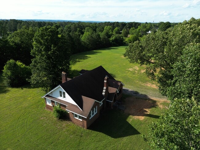
1695 Mack Smith Rd, Rossville, GA 30741


Property Detail
1695 Mack Smith Rd
0010A-352
PT LL 17 9/4
Specialpurpose
Catoosa
C-1
Georgia
B and X Area of moderate flood hazard, usually the area between the limits of the 100-year and 500-year floods.
17
2025
2.07 AC
2025
Catoosa County
030502
Chattanooga
2,378 SF
Chattanooga, TN-GA
NEARBY LISTINGS FOR SALE OR LEASE
DEMOGRAPHICS near 1695 Mack Smith Rd
1 mile
3 mile
5 mile
2025 Total Population
5,951
48,272
128,144
2030 Population
6,067
49,488
132,757
Pop Growth 2025-2030
+ 1.95%
+ 2.52%
+ 3.60%
Average Age
41
41
40
2025 Total Households
2,538
20,529
52,128
HH Growth 2025-2030
+ 2.09%
+ 2.63%
+ 3.67%
Median Household Inc
$43,490
$55,483
$58,901
Avg Household Size
2.30
2.30
2.40
2025 Avg HH Vehicles
2.00
2.00
2.00
Median Home Value
$185,883
$219,436
$240,161
Median Year Built
1986
1973
1971
Nearby Places
Map Layers
Map Styles
 Street
 Aerial
Layers
 Traffic
 Biking
Places
Listings with unknown addresses are not visible on the map
- Restaurants
- Banks
- Shops
- Fitness
- Groceries
PUBLIC TRANSPORTATION
AIRPORT
Lovell Field
Drive
Walk
Distance
Lovell Field
13 min
4.9 mi
Freight Ports
Georgia Ports - Savannah
Drive
Walk
Distance
Georgia Ports - Savannah
399 min
357.4 mi
SALE & LEASE HISTORY
LISTING DATE
SALE/LEASE

May 30, 2024
For Sale
Nearby Properties
Address
Land Use
TOTAL SIZE
Lot Size
Zoning
Address
Land Use
TOTAL SIZE
Lot Size
Zoning
72,340 SF
105.70 AC
FOR R-1
Address
Land Use
TOTAL SIZE
Lot Size
Zoning
20,964 SF
17.72 AC
R1
Address
Land Use
TOTAL SIZE
Lot Size
Zoning
790,207 SF
53.84 AC
C2
Address
Land Use
TOTAL SIZE
Lot Size
Zoning
176.54 AC
R1
Address
Land Use
TOTAL SIZE
Lot Size
Zoning
233,109 SF
18.99 AC
FOR C-1
Address
Land Use
TOTAL SIZE
Lot Size
Zoning
17,742 SF
8 AC
FOR PM
Address
Land Use
TOTAL SIZE
Lot Size
Zoning
85,068 SF
9.57 AC
Address
Land Use
TOTAL SIZE
Lot Size
Zoning
19,600 SF
14.10 AC
UR
Address
Land Use
TOTAL SIZE
Lot Size
Zoning
88,285 SF
7 AC
R3
Address
Land Use
TOTAL SIZE
Lot Size
Zoning
209,168 SF
23.28 AC
C2
Address
Land Use
TOTAL SIZE
Lot Size
Zoning
90,565 SF
18.50 AC
FOR R-2
Address
Land Use
TOTAL SIZE
Lot Size
Zoning
135,954 SF
11.83 AC
R3
Address
Land Use
TOTAL SIZE
Lot Size
Zoning
133,447 SF
17.65 AC
FOR C-2
Address
Land Use
TOTAL SIZE
Lot Size
Zoning
15,968 SF
9.50 AC
Address
Land Use
TOTAL SIZE
Lot Size
Zoning
66,027 SF
2.84 AC
C2
Address
Land Use
TOTAL SIZE
Lot Size
Zoning
151,314 SF
6.60 AC
Address
Land Use
TOTAL SIZE
Lot Size
Zoning
35,740 SF
5.20 AC
R2
Address
Land Use
TOTAL SIZE
Lot Size
Zoning
2,210 SF
11.33 AC
FOR R-5
Address
Land Use
TOTAL SIZE
Lot Size
Zoning
139,638 SF
16.69 AC
FOR C-2
Address
Land Use
TOTAL SIZE
Lot Size
Zoning
58,911 SF
12.37 AC
FOR C-2
Address
Land Use
TOTAL SIZE
Lot Size
Zoning
109,933 SF
5 AC
Address
Land Use
TOTAL SIZE
Lot Size
Zoning
20,400 SF
13.90 AC
R4
Address
Land Use
TOTAL SIZE
Lot Size
Zoning
130,515 SF
18.78 AC
FOR C-1
Address
Land Use
TOTAL SIZE
Lot Size
Zoning
103,668 SF
5.37 AC
C2
Address
Land Use
TOTAL SIZE
Lot Size
Zoning
83,082 SF
6.25 AC
C2
Address
Land Use
TOTAL SIZE
Lot Size
Zoning
7,678 SF
13.79 AC
R2
Address
Land Use
TOTAL SIZE
Lot Size
Zoning
31,548 SF
7.58 AC
R3
Address
Land Use
TOTAL SIZE
Lot Size
Zoning
41,872 SF
7.09 AC
C2
Address
Land Use
TOTAL SIZE
Lot Size
Zoning
101,298 SF
14 AC
FOR C-2
Address
Land Use
TOTAL SIZE
Lot Size
Zoning
102,900 SF
3.36 AC
R2
The World's #1 Commercial Real Estate Marketplace
Connect with us
© 2026 CoStar Group
The information above has been obtained from sources believed reliable. While we do not doubt its accuracy we have not verified it and make no guarantee, warranty or representation about it. It is your responsibility to independently confirm its accuracy and completeness. Any projections, opinions, assumptions, or estimates used are for example only and do not represent the current or future performance of the property. The value of this transaction to you depends on tax and other factors which should be evaluated by your tax, financial, and legal advisors. You and your advisors should conduct a careful, independent investigation of the property to determine to your satisfaction the suitability of the property for your needs.