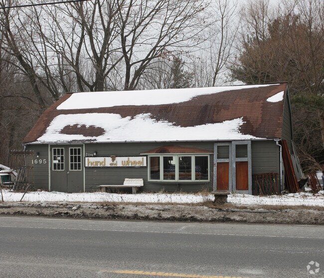
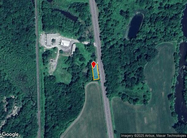
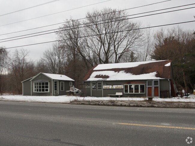
Property Record
1695 N Main St, Sheffield, MA 01257
NEARBY LISTINGS FOR SALE OR LEASE
Property Detail
1695 N Main St
Pittsfield, MA
Berkshire
SHEF-000330-000002-000020
Massachusetts
Storebuilding
2.0
2025
0.20 AC
2025
Massachusetts North/West Area
926100
Other Market Areas
1,244 SF
DEMOGRAPHICS near 1695 N Main St
1 Mile
3 Mile
5 Mile
2024 Total Population
170
2,921
8,580
2029 Population
164
2,889
8,459
Pop Growth 2024-2029
(3.53%)
(1.10%)
(1.41%)
Average Age
47
49
48
2024 Total Households
73
1,359
3,760
HH Growth 2024-2029
(4.11%)
(1.03%)
(1.52%)
Median Household Inc
$65,000
$54,077
$64,518
Avg Household Size
2.30
2.00
2.10
2024 Avg HH Vehicles
2.00
2.00
2.00
Median Home Value
$377,777
$434,131
$422,358
Median Year Built
1948
1956
1957
Nearby Places
Map Layers
Map Styles
 Street
 Aerial
- Restaurants
- Banks
- Shops
- Fitness
- Groceries
Nearby Properties
Address
Land Use
TOTAL SIZE
Lot Size
Zoning
Address
Land Use
TOTAL SIZE
Lot Size
Zoning
106,461 SF
12 AC
B2
Address
Land Use
TOTAL SIZE
Lot Size
Zoning
1,236 SF
1,157.77 AC
R1
Address
Land Use
TOTAL SIZE
Lot Size
Zoning
96,198 SF
4.87 AC
R2
Address
Land Use
TOTAL SIZE
Lot Size
Zoning
118 AC
R2
Address
Land Use
TOTAL SIZE
Lot Size
Zoning
5,672 SF
4.53 AC
B2
Address
Land Use
TOTAL SIZE
Lot Size
Zoning
25,770 SF
B
Address
Land Use
TOTAL SIZE
Lot Size
Zoning
29.27 AC
R1
Address
Land Use
TOTAL SIZE
Lot Size
Zoning
4,141 SF
3.48 AC
B2
Address
Land Use
TOTAL SIZE
Lot Size
Zoning
32,838 SF
2.07 AC
B2
Address
Land Use
TOTAL SIZE
Lot Size
Zoning
11,262 SF
0.23 AC
VC
Address
Land Use
TOTAL SIZE
Lot Size
Zoning
23.91 AC
R1
Address
Land Use
TOTAL SIZE
Lot Size
Zoning
15,694 SF
0.75 AC
B2
Address
Land Use
TOTAL SIZE
Lot Size
Zoning
45,771 SF
0.50 AC
B
Address
Land Use
TOTAL SIZE
Lot Size
Zoning
37,828 SF
60.03 AC
B2
Address
Land Use
TOTAL SIZE
Lot Size
Zoning
0.75 AC
B3
Address
Land Use
TOTAL SIZE
Lot Size
Zoning
48,813 SF
1.66 AC
B2
Address
Land Use
TOTAL SIZE
Lot Size
Zoning
11,347 SF
41.14 AC
R1
Address
Land Use
TOTAL SIZE
Lot Size
Zoning
4,984 SF
1.80 AC
B
Address
Land Use
TOTAL SIZE
Lot Size
Zoning
7,590 SF
6.06 AC
R1
Address
Land Use
TOTAL SIZE
Lot Size
Zoning
5,648 SF
19.30 AC
R1
Address
Land Use
TOTAL SIZE
Lot Size
Zoning
574.40 AC
R2
Address
Land Use
TOTAL SIZE
Lot Size
Zoning
17,076 SF
1.89 AC
B
Address
Land Use
TOTAL SIZE
Lot Size
Zoning
27,136 SF
0.35 AC
B
Address
Land Use
TOTAL SIZE
Lot Size
Zoning
19,518 SF
3.01 AC
B2
Address
Land Use
TOTAL SIZE
Lot Size
Zoning
2,139 SF
62 AC
R1
Address
Land Use
TOTAL SIZE
Lot Size
Zoning
23,436 SF
0.70 AC
B
Address
Land Use
TOTAL SIZE
Lot Size
Zoning
23,490 SF
0.27 AC
B
Address
Land Use
TOTAL SIZE
Lot Size
Zoning
20,046 SF
0.24 AC
B
Address
Land Use
TOTAL SIZE
Lot Size
Zoning
16.23 AC
R1
Address
Land Use
TOTAL SIZE
Lot Size
Zoning
12,520 SF
3.88 AC
GB
The World's #1 Commercial Real Estate Marketplace
Connect with us
© 2025 CoStar Group
The information above has been obtained from sources believed reliable. While we do not doubt its accuracy we have not verified it and make no guarantee, warranty or representation about it. It is your responsibility to independently confirm its accuracy and completeness. Any projections, opinions, assumptions, or estimates used are for example only and do not represent the current or future performance of the property. The value of this transaction to you depends on tax and other factors which should be evaluated by your tax, financial, and legal advisors. You and your advisors should conduct a careful, independent investigation of the property to determine to your satisfaction the suitability of the property for your needs.