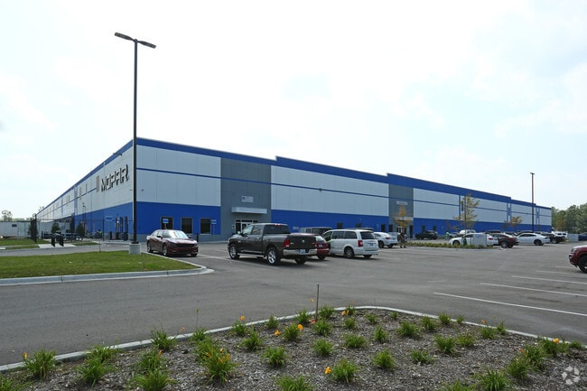
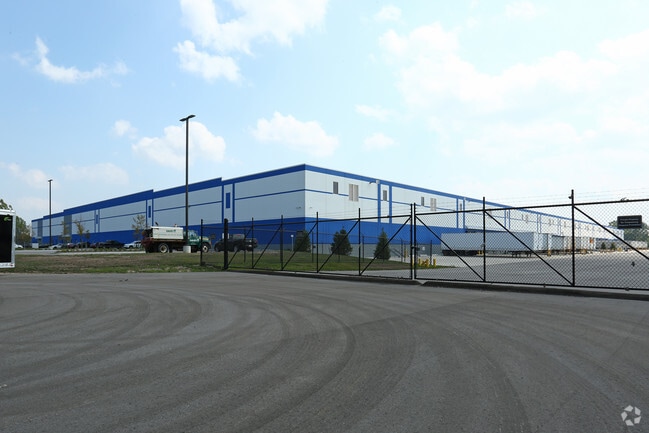
Property Record
16950 Pine, Romulus, MI 48174

Property Detail
16950 Pine
80-127-99-0023-703
32T2 U2 V1 W1A COMMENCING AT THE S 1/4 COR OF SEC 32 T3S R9E TH ALONG THE S LINE OF SAID SEC 32 S88D 41M 11S W 29 FT TO THE
Distributionwarehouseregional
WAYNE
M2-GEN
Michigan
B and X Area of moderate flood hazard, usually the area between the limits of the 100-year and 500-year floods.
0023
2025
55.95 AC
2025
Airport District
586300
Detroit
500,240 SF
Detroit-Warren-Dearborn, MI
NEARBY LISTINGS FOR SALE OR LEASE
DEMOGRAPHICS near 16950 Pine
1 mile
3 mile
5 mile
2025 Total Population
525
10,204
46,736
2030 Population
525
10,099
46,086
Pop Growth 2025-2030
0.00%
(1.03%)
(1.39%)
Average Age
45
42
40
2025 Total Households
209
3,996
18,319
HH Growth 2025-2030
0.00%
(1.00%)
(1.45%)
Median Household Inc
$87,500
$73,261
$74,327
Avg Household Size
2.40
2.50
2.50
2025 Avg HH Vehicles
2.00
2.00
2.00
Median Home Value
$248,550
$240,444
$243,728
Median Year Built
1978
1969
1976
Nearby Places
Map Layers
Map Styles
 Street
 Aerial
Layers
 Traffic
 Biking
Places
Listings with unknown addresses are not visible on the map
- Restaurants
- Banks
- Shops
- Fitness
- Groceries
PUBLIC TRANSPORTATION
AIRPORT
Detroit Metro Wayne County
Drive
Walk
Distance
Detroit Metro Wayne County
7 min
4.0 mi
Windsor International
Drive
Walk
Distance
Windsor International
54 min
32.4 mi
Freight Ports
Port of Toledo
Drive
Walk
Distance
Port of Toledo
58 min
44.8 mi
Nearby Properties
Address
Land Use
TOTAL SIZE
Lot Size
Zoning
Address
Land Use
TOTAL SIZE
Lot Size
Zoning
752,400 SF
72.97 AC
PDA
Address
Land Use
TOTAL SIZE
Lot Size
Zoning
516,762 SF
51.63 AC
PDA
Address
Land Use
TOTAL SIZE
Lot Size
Zoning
500,240 SF
M1-LIG
Address
Land Use
TOTAL SIZE
Lot Size
Zoning
146,562 SF
M2-GEN
Address
Land Use
TOTAL SIZE
Lot Size
Zoning
1,141,765 SF
154.21 AC
M2-GEN
Address
Land Use
TOTAL SIZE
Lot Size
Zoning
600,000 SF
M1-LIG
Address
Land Use
TOTAL SIZE
Lot Size
Zoning
199,922 SF
30.86 AC
M2-GEN
Address
Land Use
TOTAL SIZE
Lot Size
Zoning
462,840 SF
45.66 AC
PDA
Address
Land Use
TOTAL SIZE
Lot Size
Zoning
87,000 SF
18.02 AC
Address
Land Use
TOTAL SIZE
Lot Size
Zoning
129,260 SF
5.25 AC
AP-AIRPORT
Address
Land Use
TOTAL SIZE
Lot Size
Zoning
88,790 SF
M2-GEN
Address
Land Use
TOTAL SIZE
Lot Size
Zoning
M1-LIG
Address
Land Use
TOTAL SIZE
Lot Size
Zoning
201,184 SF
10.22 AC
M-2/PDA
Address
Land Use
TOTAL SIZE
Lot Size
Zoning
338,896 SF
14.35 AC
M2-GEN
Address
Land Use
TOTAL SIZE
Lot Size
Zoning
101,200 SF
5.54 AC
AP-AIRPORT
Address
Land Use
TOTAL SIZE
Lot Size
Zoning
105,000 SF
15.26 AC
M2-GEN
Address
Land Use
TOTAL SIZE
Lot Size
Zoning
87,000 SF
17.20 AC
B1 LOCA
Address
Land Use
TOTAL SIZE
Lot Size
Zoning
88,790 SF
10.48 AC
M2-GEN
Address
Land Use
TOTAL SIZE
Lot Size
Zoning
79,895 SF
12.56 AC
M2-GEN
Address
Land Use
TOTAL SIZE
Lot Size
Zoning
117,695 SF
21.72 AC
M2-GEN
Address
Land Use
TOTAL SIZE
Lot Size
Zoning
88.62 AC
M1-LIG
Address
Land Use
TOTAL SIZE
Lot Size
Zoning
47.09 AC
I2 HEAV
Address
Land Use
TOTAL SIZE
Lot Size
Zoning
61,100 SF
6.88 AC
M2-GEN
Address
Land Use
TOTAL SIZE
Lot Size
Zoning
70.99 AC
M1-LIG
Address
Land Use
TOTAL SIZE
Lot Size
Zoning
Address
Land Use
TOTAL SIZE
Lot Size
Zoning
76.32 AC
PDA
Address
Land Use
TOTAL SIZE
Lot Size
Zoning
50,688 SF
2.56 AC
CBD-1
Address
Land Use
TOTAL SIZE
Lot Size
Zoning
105,728 SF
18.41 AC
M2-GEN
Address
Land Use
TOTAL SIZE
Lot Size
Zoning
62,760 SF
4.25 AC
M-2/PDA
The World's #1 Commercial Real Estate Marketplace
Connect with us
© 2026 CoStar Group
The information above has been obtained from sources believed reliable. While we do not doubt its accuracy we have not verified it and make no guarantee, warranty or representation about it. It is your responsibility to independently confirm its accuracy and completeness. Any projections, opinions, assumptions, or estimates used are for example only and do not represent the current or future performance of the property. The value of this transaction to you depends on tax and other factors which should be evaluated by your tax, financial, and legal advisors. You and your advisors should conduct a careful, independent investigation of the property to determine to your satisfaction the suitability of the property for your needs.