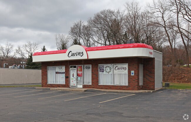
Property Record
1698 Penfield Rd, Rochester, NY 14625
NEARBY LISTINGS FOR SALE OR LEASE
Property Detail
1698 Penfield Rd
264200-139-050-0001-052-000
0050-13-04
Storesoffices
Monroe
X
New York
36055C0238G
52.000
2025
0.69 AC
2024
Northeast
011605
Rochester
5,400 SF
Rochester, NY
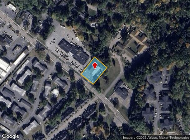
DEMOGRAPHICS near 1698 Penfield Rd
1 Mile
3 Mile
5 Mile
2024 Total Population
6,058
54,506
158,746
2029 Population
5,986
53,766
156,495
Pop Growth 2024-2029
(1.19%)
(1.36%)
(1.42%)
Average Age
45
44
43
2024 Total Households
2,853
22,924
68,766
HH Growth 2024-2029
(1.26%)
(1.47%)
(1.51%)
Median Household Inc
$71,181
$78,560
$84,416
Avg Household Size
2.10
2.20
2.20
2024 Avg HH Vehicles
2.00
2.00
2.00
Median Home Value
$194,194
$234,134
$230,827
Median Year Built
1968
1967
1964
Nearby Places
- Restaurants
- Banks
- Shops
- Fitness
- Groceries
PUBLIC TRANSPORTATION
COMMUTER RAIL
Rochester (Empire Service - VIA Rail, Lake Shore Limited - VIA Rail, Maple Leaf - VIA Rail, Toronto - New York - VIA Rail)
DRIVE
WALK
Distance
Rochester (Empire Service - VIA Rail, Lake Shore Limited - VIA Rail, Maple Leaf - VIA Rail, Toronto - New York - VIA Rail)
13 min
7.5 mi
AIRPORT
Frederick Douglass/Greater Rochester International
DRIVE
WALK
Distance
Frederick Douglass/Greater Rochester International
19 min
10.6 mi
Freight Ports
Albany, NY Port
DRIVE
WALK
Distance
Albany, NY Port
264 min
224.0 mi
SALE & LEASE HISTORY
LISTING DATE
SALE/LEASE

Aug 14, 2021
For Sale
Nearby Properties
Address
Land Use
TOTAL SIZE
Lot Size
Zoning
Address
Land Use
TOTAL SIZE
Lot Size
Zoning
65,745 SF
154.98 AC
Address
Land Use
TOTAL SIZE
Lot Size
Zoning
70,683 SF
53.22 AC
Address
Land Use
TOTAL SIZE
Lot Size
Zoning
640 SF
84.10 AC
RA-2
Address
Land Use
TOTAL SIZE
Lot Size
Zoning
408,790 SF
31.90 AC
02 - SINGL
Address
Land Use
TOTAL SIZE
Lot Size
Zoning
198,655 SF
31.05 AC
02 - SINGL
Address
Land Use
TOTAL SIZE
Lot Size
Zoning
3,752 SF
36.50 AC
MR
Address
Land Use
TOTAL SIZE
Lot Size
Zoning
155,517 SF
45.77 AC
Address
Land Use
TOTAL SIZE
Lot Size
Zoning
251,359 SF
46.83 AC
GB
Address
Land Use
TOTAL SIZE
Lot Size
Zoning
2,902 SF
127.70 AC
CEMETERY
Address
Land Use
TOTAL SIZE
Lot Size
Zoning
364,800 SF
28.40 AC
R-1-15
Address
Land Use
TOTAL SIZE
Lot Size
Zoning
65,750 SF
42.60 AC
APT
Address
Land Use
TOTAL SIZE
Lot Size
Zoning
193,120 SF
10.83 AC
INDUSTRIAL
Address
Land Use
TOTAL SIZE
Lot Size
Zoning
283,456 SF
40.76 AC
R-1-20
Address
Land Use
TOTAL SIZE
Lot Size
Zoning
62,200 SF
17.92 AC
Address
Land Use
TOTAL SIZE
Lot Size
Zoning
1,878 SF
56.60 AC
MHP
Address
Land Use
TOTAL SIZE
Lot Size
Zoning
74,490 SF
16.20 AC
MIXED USE
Address
Land Use
TOTAL SIZE
Lot Size
Zoning
90,684 SF
20.51 AC
LI
Address
Land Use
TOTAL SIZE
Lot Size
Zoning
52,080 SF
21.10 AC
Address
Land Use
TOTAL SIZE
Lot Size
Zoning
38,776 SF
10.33 AC
MR
Address
Land Use
TOTAL SIZE
Lot Size
Zoning
4,210 SF
14.85 AC
PDD
Address
Land Use
TOTAL SIZE
Lot Size
Zoning
247,668 SF
36.68 AC
GB
Address
Land Use
TOTAL SIZE
Lot Size
Zoning
293,504 SF
3.86 AC
03 - MULTI
Address
Land Use
TOTAL SIZE
Lot Size
Zoning
50,387 SF
4.10 AC
02 - SINGL
Address
Land Use
TOTAL SIZE
Lot Size
Zoning
105,674 SF
9.02 AC
MUD
Address
Land Use
TOTAL SIZE
Lot Size
Zoning
70,468 SF
318.95 AC
Address
Land Use
TOTAL SIZE
Lot Size
Zoning
12,024 SF
17 AC
MR
Address
Land Use
TOTAL SIZE
Lot Size
Zoning
121,828 SF
2.74 AC
05 - COMME
Address
Land Use
TOTAL SIZE
Lot Size
Zoning
182,943 SF
15.83 AC
LI
Address
Land Use
TOTAL SIZE
Lot Size
Zoning
49,500 SF
8.60 AC
LI
Address
Land Use
TOTAL SIZE
Lot Size
Zoning
123,630 SF
11.72 AC
GB
The World's #1 Commercial Real Estate Marketplace
Connect with us
© 2025 CoStar Group
The information above has been obtained from sources believed reliable. While we do not doubt its accuracy we have not verified it and make no guarantee, warranty or representation about it. It is your responsibility to independently confirm its accuracy and completeness. Any projections, opinions, assumptions, or estimates used are for example only and do not represent the current or future performance of the property. The value of this transaction to you depends on tax and other factors which should be evaluated by your tax, financial, and legal advisors. You and your advisors should conduct a careful, independent investigation of the property to determine to your satisfaction the suitability of the property for your needs.