Property Record
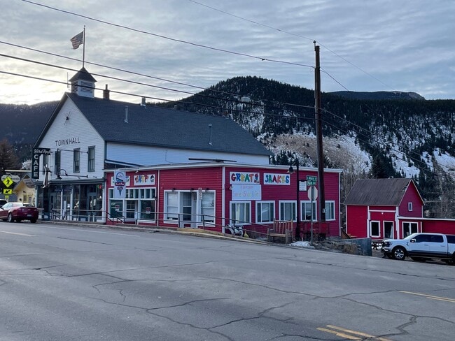
16A S Main St, Empire, CO 80438


Property Detail
16A S Main St
Denver-Aurora-Centennial, CO
SUBDIVISION: EMPIRE BLOCK: 19 LOT: 7 W 42FT & IMPS 434/950
1837-282-16-201
CLEAR CREEK
Commercialbuilding
Colorado
B and X Area of moderate flood hazard, usually the area between the limits of the 100-year and 500-year floods.
7
2025
0.23 AC
2025
Southwest Outlying
014900
Denver
6,396 SF
NEARBY LISTINGS FOR SALE OR LEASE
-
-
View all Empire listings for lease on LoopNet.com
DEMOGRAPHICS near 16A S Main St
1 mile
3 mile
5 mile
2025 Total Population
365
1,107
2,475
2030 Population
348
1,040
2,352
Pop Growth 2025-2030
(4.66%)
(6.05%)
(4.97%)
Average Age
45
45
45
2025 Total Households
168
512
1,176
HH Growth 2025-2030
(4.76%)
(6.45%)
(5.19%)
Median Household Inc
$63,214
$70,367
$70,777
Avg Household Size
2.10
2.10
2.00
2025 Avg HH Vehicles
3.00
2.00
2.00
Median Home Value
$353,333
$418,644
$429,348
Median Year Built
1973
1970
1971
Nearby Places
Map Layers
Map Styles
 Street
 Aerial
Layers
 Traffic
 Biking
Places
Listings with unknown addresses are not visible on the map
- Restaurants
- Banks
- Shops
- Fitness
- Groceries
SALE & LEASE HISTORY
LISTING DATE
SALE/LEASE

Jan 11, 2024
For Lease
Nearby Properties
Address
Land Use
TOTAL SIZE
Lot Size
Zoning
Address
Land Use
TOTAL SIZE
Lot Size
Zoning
Address
Land Use
TOTAL SIZE
Lot Size
Zoning
27,898 SF
284.85 AC
Address
Land Use
TOTAL SIZE
Lot Size
Zoning
Address
Land Use
TOTAL SIZE
Lot Size
Zoning
Address
Land Use
TOTAL SIZE
Lot Size
Zoning
3,232 SF
7.96 AC
Address
Land Use
TOTAL SIZE
Lot Size
Zoning
18,672 SF
1.32 AC
Address
Land Use
TOTAL SIZE
Lot Size
Zoning
0.93 AC
Address
Land Use
TOTAL SIZE
Lot Size
Zoning
4,593 SF
0.13 AC
Address
Land Use
TOTAL SIZE
Lot Size
Zoning
3,720 SF
5.63 AC
Address
Land Use
TOTAL SIZE
Lot Size
Zoning
2.38 AC
Address
Land Use
TOTAL SIZE
Lot Size
Zoning
1,760 SF
0.66 AC
Address
Land Use
TOTAL SIZE
Lot Size
Zoning
12,720 SF
22.38 AC
AG
Address
Land Use
TOTAL SIZE
Lot Size
Zoning
4,800 SF
2.01 AC
Address
Land Use
TOTAL SIZE
Lot Size
Zoning
7,980 SF
0.94 AC
M-1
Address
Land Use
TOTAL SIZE
Lot Size
Zoning
4,680 SF
3.73 AC
C-WM
Address
Land Use
TOTAL SIZE
Lot Size
Zoning
Address
Land Use
TOTAL SIZE
Lot Size
Zoning
3,537 SF
18.47 AC
MR-1
Address
Land Use
TOTAL SIZE
Lot Size
Zoning
1,152 SF
0.17 AC
Address
Land Use
TOTAL SIZE
Lot Size
Zoning
3,680 SF
0.22 AC
Address
Land Use
TOTAL SIZE
Lot Size
Zoning
3,773 SF
3.28 AC
Address
Land Use
TOTAL SIZE
Lot Size
Zoning
609 SF
3.60 AC
PD
Address
Land Use
TOTAL SIZE
Lot Size
Zoning
2,274 SF
0.23 AC
Address
Land Use
TOTAL SIZE
Lot Size
Zoning
4,336 SF
6.20 AC
Address
Land Use
TOTAL SIZE
Lot Size
Zoning
6,160 SF
0.33 AC
Address
Land Use
TOTAL SIZE
Lot Size
Zoning
816 SF
0.10 AC
Address
Land Use
TOTAL SIZE
Lot Size
Zoning
1,196 SF
0.88 AC
Address
Land Use
TOTAL SIZE
Lot Size
Zoning
7.99 AC
MR-1
Address
Land Use
TOTAL SIZE
Lot Size
Zoning
4,914 SF
0.38 AC
Address
Land Use
TOTAL SIZE
Lot Size
Zoning
6.03 AC
MR-1
The World's #1 Commercial Real Estate Marketplace
Connect with us
© 2026 CoStar Group
The information above has been obtained from sources believed reliable. While we do not doubt its accuracy we have not verified it and make no guarantee, warranty or representation about it. It is your responsibility to independently confirm its accuracy and completeness. Any projections, opinions, assumptions, or estimates used are for example only and do not represent the current or future performance of the property. The value of this transaction to you depends on tax and other factors which should be evaluated by your tax, financial, and legal advisors. You and your advisors should conduct a careful, independent investigation of the property to determine to your satisfaction the suitability of the property for your needs.