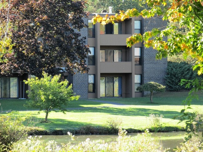
Property Record
16G Brandywine, Amherst, MA 01002

Property Detail
16G Brandywine
AMHE-000005C-000000-000055
HAMPSHIRE
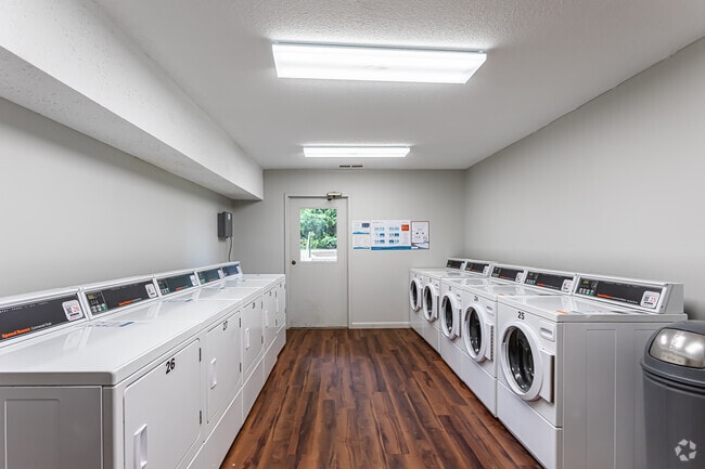
Apartment
Massachusetts
AE The base floodplain where base flood elevations are provided. AE Zones are now used on new format FIRMs instead of A1-A30 Zones.
55
2025
13.98 AC
2025
North Amherst
820300
Hartford
23,690 SF
Amherst Town-Northampton, MA
NEARBY LISTINGS FOR SALE OR LEASE
DEMOGRAPHICS near 16G Brandywine
1 mile
3 mile
5 mile
2025 Total Population
7,271
35,019
52,487
2030 Population
7,310
35,230
52,665
Pop Growth 2025-2030
+ 0.54%
+ 0.60%
+ 0.34%
Average Age
30
30
34
2025 Total Households
1,831
7,273
14,671
HH Growth 2025-2030
+ 0.66%
+ 0.85%
+ 0.33%
Median Household Inc
$62,259
$63,325
$70,327
Avg Household Size
2.30
2.20
2.20
2025 Avg HH Vehicles
2.00
2.00
2.00
Median Home Value
$559,966
$496,935
$461,415
Median Year Built
1978
1972
1973
Nearby Places
Map Layers
Map Styles
 Street
 Aerial
Layers
 Traffic
 Biking
Places
Listings with unknown addresses are not visible on the map
- Restaurants
- Banks
- Shops
- Fitness
- Groceries
PUBLIC TRANSPORTATION
COMMUTER RAIL
Northampton (Valley Flyer - Amtrak, Vermonter - Amtrak)
Drive
Walk
Distance
Northampton (Valley Flyer - Amtrak, Vermonter - Amtrak)
21 min
9.6 mi
Freight Ports
Albany, NY Port
Drive
Walk
Distance
Albany, NY Port
130 min
101.0 mi
Nearby Properties
Address
Land Use
TOTAL SIZE
Lot Size
Zoning
Address
Land Use
TOTAL SIZE
Lot Size
Zoning
258,531 SF
17.10 AC
Address
Land Use
TOTAL SIZE
Lot Size
Zoning
197,000 SF
22.53 AC
Address
Land Use
TOTAL SIZE
Lot Size
Zoning
1,344 SF
284.31 AC
Address
Land Use
TOTAL SIZE
Lot Size
Zoning
168,500 SF
18.25 AC
C+I
Address
Land Use
TOTAL SIZE
Lot Size
Zoning
108,000 SF
30.85 AC
Address
Land Use
TOTAL SIZE
Lot Size
Zoning
108,000 SF
14.34 AC
Address
Land Use
TOTAL SIZE
Lot Size
Zoning
141,603 SF
35.70 AC
B
Address
Land Use
TOTAL SIZE
Lot Size
Zoning
46,138 SF
0.96 AC
Address
Land Use
TOTAL SIZE
Lot Size
Zoning
103,694 SF
0.81 AC
Address
Land Use
TOTAL SIZE
Lot Size
Zoning
99,483 SF
1.04 AC
Address
Land Use
TOTAL SIZE
Lot Size
Zoning
10,248 SF
26.17 AC
Address
Land Use
TOTAL SIZE
Lot Size
Zoning
12,032 SF
5.11 AC
Address
Land Use
TOTAL SIZE
Lot Size
Zoning
94,415 SF
3.83 AC
Address
Land Use
TOTAL SIZE
Lot Size
Zoning
77,397 SF
0.53 AC
Address
Land Use
TOTAL SIZE
Lot Size
Zoning
5,182 SF
20.70 AC
Address
Land Use
TOTAL SIZE
Lot Size
Zoning
13,426 SF
16 AC
Address
Land Use
TOTAL SIZE
Lot Size
Zoning
11,657 SF
4.26 AC
Address
Land Use
TOTAL SIZE
Lot Size
Zoning
94,560 SF
1.65 AC
Address
Land Use
TOTAL SIZE
Lot Size
Zoning
31.73 AC
Address
Land Use
TOTAL SIZE
Lot Size
Zoning
51,018 SF
0.32 AC
Address
Land Use
TOTAL SIZE
Lot Size
Zoning
2,295.68 AC
Address
Land Use
TOTAL SIZE
Lot Size
Zoning
47,604 SF
2.11 AC
Address
Land Use
TOTAL SIZE
Lot Size
Zoning
16,841 SF
0.88 AC
Address
Land Use
TOTAL SIZE
Lot Size
Zoning
18,520 SF
0.56 AC
Address
Land Use
TOTAL SIZE
Lot Size
Zoning
74,959 SF
Address
Land Use
TOTAL SIZE
Lot Size
Zoning
15,140 SF
8.18 AC
Address
Land Use
TOTAL SIZE
Lot Size
Zoning
37,635 SF
1.06 AC
Address
Land Use
TOTAL SIZE
Lot Size
Zoning
6,000 SF
14.63 AC
Address
Land Use
TOTAL SIZE
Lot Size
Zoning
38,607 SF
2.39 AC
The World's #1 Commercial Real Estate Marketplace
Connect with us
© 2026 CoStar Group
The information above has been obtained from sources believed reliable. While we do not doubt its accuracy we have not verified it and make no guarantee, warranty or representation about it. It is your responsibility to independently confirm its accuracy and completeness. Any projections, opinions, assumptions, or estimates used are for example only and do not represent the current or future performance of the property. The value of this transaction to you depends on tax and other factors which should be evaluated by your tax, financial, and legal advisors. You and your advisors should conduct a careful, independent investigation of the property to determine to your satisfaction the suitability of the property for your needs.