Property Record
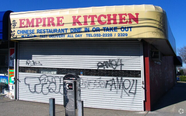
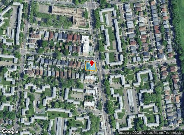
1702 Utopia Pky, Whitestone, NY 11357


NEARBY LISTINGS FOR SALE OR LEASE
Property Detail
1702 Utopia Pky
05741-0034
Beechurst View 3Rd Ward
Storebuilding
Queens
X
New York
3604970116F
34
2024
0.19 AC
2025
Northeast Queens
101700
Long Island (New York)
6,000 SF
New York-Jersey City-White Plains, NY-NJ
DEMOGRAPHICS near 1702 Utopia Pky
1 mile
3 mile
5 mile
2024 Total Population
45,098
332,060
1,019,658
2029 Population
42,285
311,286
951,110
Pop Growth 2024-2029
(6.24%)
(6.26%)
(6.72%)
Average Age
48
45
42
2024 Total Households
18,385
118,185
354,219
HH Growth 2024-2029
(6.53%)
(6.62%)
(6.95%)
Median Household Inc
$90,553
$67,718
$70,348
Avg Household Size
2.40
2.70
2.70
2024 Avg HH Vehicles
1.00
1.00
1.00
Median Home Value
$707,726
$745,883
$694,633
Median Year Built
1959
1957
1955
Nearby Places
Map Layers
Map Styles
 Street
 Aerial
Transit
 Traffic
 Biking
Places
Listings with unknown addresses are not visible on the map
- Restaurants
- Banks
- Shops
- Fitness
- Groceries
PUBLIC TRANSPORTATION
COMMUTER RAIL
Auburndale Station (Port Washington Branch - Long Island Rail Road)
Drive
Walk
Distance
Auburndale Station (Port Washington Branch - Long Island Rail Road)
5 min
1.8 mi
Broadway Station (Port Washington Branch - Long Island Rail Road)
Drive
Walk
Distance
Broadway Station (Port Washington Branch - Long Island Rail Road)
6 min
1.9 mi
AIRPORT
LaGuardia
Drive
Walk
Distance
LaGuardia
14 min
6.4 mi
John F Kennedy International
Drive
Walk
Distance
John F Kennedy International
23 min
13.9 mi
Westchester County
Drive
Walk
Distance
Westchester County
41 min
26.6 mi
Freight Ports
NY - Red Hook Container Terminal
Drive
Walk
Distance
NY - Red Hook Container Terminal
30 min
16.9 mi
SALE & LEASE HISTORY
LISTING DATE
SALE/LEASE

Nov 30, 2017
For Lease
Nearby Properties
Address
Land Use
TOTAL SIZE
Lot Size
Zoning
Address
Land Use
TOTAL SIZE
Lot Size
Zoning
2,697,663 SF
3.46 AC
C5-3
Address
Land Use
TOTAL SIZE
Lot Size
Zoning
1,666,696 SF
1.87 AC
C52.5
Address
Land Use
TOTAL SIZE
Lot Size
Zoning
878,386 SF
20.55 AC
R4
Address
Land Use
TOTAL SIZE
Lot Size
Zoning
703,265 SF
83.45 AC
R4
Address
Land Use
TOTAL SIZE
Lot Size
Zoning
421,996 SF
136.05 AC
R3-1
Address
Land Use
TOTAL SIZE
Lot Size
Zoning
4,050 SF
113.40 AC
PARK
Address
Land Use
TOTAL SIZE
Lot Size
Zoning
4,800 SF
80.10 AC
PARK
Address
Land Use
TOTAL SIZE
Lot Size
Zoning
480 SF
55.26 AC
R4A
Address
Land Use
TOTAL SIZE
Lot Size
Zoning
480 SF
55.26 AC
R4A
Address
Land Use
TOTAL SIZE
Lot Size
Zoning
480 SF
55.26 AC
R4A
Address
Land Use
TOTAL SIZE
Lot Size
Zoning
480 SF
55.26 AC
R4A
Address
Land Use
TOTAL SIZE
Lot Size
Zoning
480 SF
55.26 AC
R4A
Address
Land Use
TOTAL SIZE
Lot Size
Zoning
480 SF
55.26 AC
R4A
Address
Land Use
TOTAL SIZE
Lot Size
Zoning
480 SF
55.26 AC
R4A
Address
Land Use
TOTAL SIZE
Lot Size
Zoning
480 SF
55.26 AC
R4A
Address
Land Use
TOTAL SIZE
Lot Size
Zoning
480 SF
55.26 AC
R4A
Address
Land Use
TOTAL SIZE
Lot Size
Zoning
480 SF
55.26 AC
R4A
Address
Land Use
TOTAL SIZE
Lot Size
Zoning
480 SF
55.26 AC
R4A
Address
Land Use
TOTAL SIZE
Lot Size
Zoning
480 SF
55.26 AC
R4A
Address
Land Use
TOTAL SIZE
Lot Size
Zoning
480 SF
55.26 AC
R4A
Address
Land Use
TOTAL SIZE
Lot Size
Zoning
480 SF
55.26 AC
R4A
Address
Land Use
TOTAL SIZE
Lot Size
Zoning
480 SF
55.26 AC
R4A
Address
Land Use
TOTAL SIZE
Lot Size
Zoning
480 SF
55.26 AC
R4A
Address
Land Use
TOTAL SIZE
Lot Size
Zoning
480 SF
55.26 AC
R4A
Address
Land Use
TOTAL SIZE
Lot Size
Zoning
480 SF
55.26 AC
R4A
Address
Land Use
TOTAL SIZE
Lot Size
Zoning
480 SF
55.26 AC
R4A
Address
Land Use
TOTAL SIZE
Lot Size
Zoning
480 SF
55.26 AC
R4A
Address
Land Use
TOTAL SIZE
Lot Size
Zoning
480 SF
55.26 AC
R4A
Address
Land Use
TOTAL SIZE
Lot Size
Zoning
480 SF
55.26 AC
R4A
Address
Land Use
TOTAL SIZE
Lot Size
Zoning
480 SF
55.26 AC
R4A
The World's #1 Commercial Real Estate Marketplace
Connect with us
© 2026 CoStar Group
The information above has been obtained from sources believed reliable. While we do not doubt its accuracy we have not verified it and make no guarantee, warranty or representation about it. It is your responsibility to independently confirm its accuracy and completeness. Any projections, opinions, assumptions, or estimates used are for example only and do not represent the current or future performance of the property. The value of this transaction to you depends on tax and other factors which should be evaluated by your tax, financial, and legal advisors. You and your advisors should conduct a careful, independent investigation of the property to determine to your satisfaction the suitability of the property for your needs.