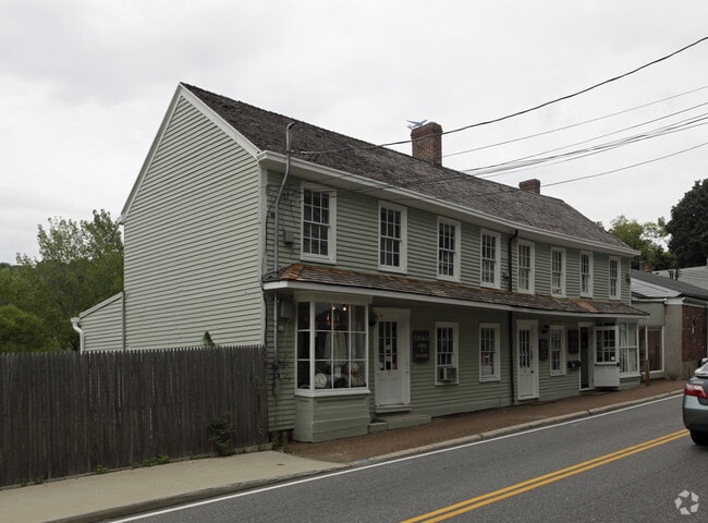
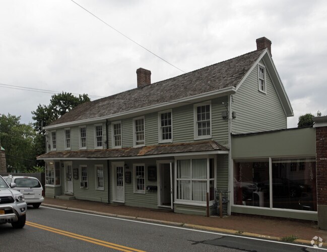
Property Record
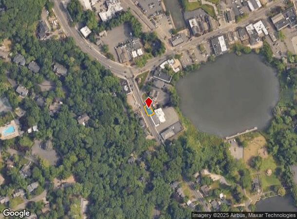
17 Main St, Roslyn, NY 11576

Current Lease Availabilities
NEARBY LISTINGS FOR SALE OR LEASE
Property Detail
17 Main St
2241-07-B-00-0560-0
TOWN #2 SCH DIST 003
Commercialnec
Nassau
X
New York
36059C0117G
560
2025
0.05 AC
2025
Western Nassau
302000
Long Island (New York)
6,779 SF
Nassau County-Suffolk County, NY
DEMOGRAPHICS near 17 Main St
1 Mile
3 Mile
5 Mile
2024 Total Population
11,652
81,840
295,602
2029 Population
11,549
80,841
290,840
Pop Growth 2024-2029
(0.88%)
(1.22%)
(1.61%)
Average Age
42
43
43
2024 Total Households
3,981
27,471
102,882
HH Growth 2024-2029
(0.95%)
(1.33%)
(1.70%)
Median Household Inc
$159,700
$171,885
$130,016
Avg Household Size
2.80
2.90
2.80
2024 Avg HH Vehicles
2.00
2.00
2.00
Median Home Value
$976,748
$957,898
$820,941
Median Year Built
1956
1955
1955
Nearby Places
- Restaurants
- Banks
- Shops
- Fitness
- Groceries
PUBLIC TRANSPORTATION
COMMUTER RAIL
Roslyn Station (Oyster Bay Branch - Long Island Rail Road)
DRIVE
WALK
Distance
Roslyn Station (Oyster Bay Branch - Long Island Rail Road)
3 min
14 min
0.8 mi
Greenvale Station (Oyster Bay Branch - Long Island Rail Road)
DRIVE
WALK
Distance
Greenvale Station (Oyster Bay Branch - Long Island Rail Road)
6 min
2.3 mi
AIRPORT
LaGuardia
DRIVE
WALK
Distance
LaGuardia
24 min
16.6 mi
John F Kennedy International
DRIVE
WALK
Distance
John F Kennedy International
26 min
18.7 mi
Westchester County
DRIVE
WALK
Distance
Westchester County
47 min
36.7 mi
Freight Ports
NY - Red Hook Container Terminal
DRIVE
WALK
Distance
NY - Red Hook Container Terminal
1 min
20.2 mi
Nearby Properties
Address
Land Use
TOTAL SIZE
Lot Size
Zoning
Address
Land Use
TOTAL SIZE
Lot Size
Zoning
375,331 SF
14.83 AC
Address
Land Use
TOTAL SIZE
Lot Size
Zoning
251,828 SF
31.03 AC
Address
Land Use
TOTAL SIZE
Lot Size
Zoning
152,926 SF
30 AC
Address
Land Use
TOTAL SIZE
Lot Size
Zoning
83,566 SF
38.12 AC
Address
Land Use
TOTAL SIZE
Lot Size
Zoning
26,200 SF
186 AC
Address
Land Use
TOTAL SIZE
Lot Size
Zoning
158,725 SF
24.46 AC
Address
Land Use
TOTAL SIZE
Lot Size
Zoning
148,942 SF
34.17 AC
Address
Land Use
TOTAL SIZE
Lot Size
Zoning
401,583 SF
17.93 AC
Address
Land Use
TOTAL SIZE
Lot Size
Zoning
50,252 SF
143.04 AC
Address
Land Use
TOTAL SIZE
Lot Size
Zoning
49,950 SF
51.02 AC
Address
Land Use
TOTAL SIZE
Lot Size
Zoning
171,770 SF
5.95 AC
Address
Land Use
TOTAL SIZE
Lot Size
Zoning
84,966 SF
18.74 AC
Address
Land Use
TOTAL SIZE
Lot Size
Zoning
179,365 SF
6.05 AC
Address
Land Use
TOTAL SIZE
Lot Size
Zoning
45,898 SF
85.13 AC
Address
Land Use
TOTAL SIZE
Lot Size
Zoning
98,439 SF
8.94 AC
Address
Land Use
TOTAL SIZE
Lot Size
Zoning
165,793 SF
18.61 AC
Address
Land Use
TOTAL SIZE
Lot Size
Zoning
56,663 SF
388.75 AC
Address
Land Use
TOTAL SIZE
Lot Size
Zoning
161,595 SF
29.91 AC
Address
Land Use
TOTAL SIZE
Lot Size
Zoning
109,503 SF
12.88 AC
Address
Land Use
TOTAL SIZE
Lot Size
Zoning
140,916 SF
3.14 AC
Address
Land Use
TOTAL SIZE
Lot Size
Zoning
80,013 SF
51.03 AC
Address
Land Use
TOTAL SIZE
Lot Size
Zoning
530,907 SF
21.69 AC
Address
Land Use
TOTAL SIZE
Lot Size
Zoning
130,665 SF
9.91 AC
Address
Land Use
TOTAL SIZE
Lot Size
Zoning
51,868 SF
44.24 AC
Address
Land Use
TOTAL SIZE
Lot Size
Zoning
246,555 SF
1.93 AC
Address
Land Use
TOTAL SIZE
Lot Size
Zoning
171,503 SF
6.87 AC
Address
Land Use
TOTAL SIZE
Lot Size
Zoning
62,607 SF
2.63 AC
Address
Land Use
TOTAL SIZE
Lot Size
Zoning
143,137 SF
14.99 AC
Address
Land Use
TOTAL SIZE
Lot Size
Zoning
179,607 SF
15.34 AC
Address
Land Use
TOTAL SIZE
Lot Size
Zoning
125,184 SF
9.58 AC
The World's #1 Commercial Real Estate Marketplace
Connect with us
© 2025 CoStar Group
The information above has been obtained from sources believed reliable. While we do not doubt its accuracy we have not verified it and make no guarantee, warranty or representation about it. It is your responsibility to independently confirm its accuracy and completeness. Any projections, opinions, assumptions, or estimates used are for example only and do not represent the current or future performance of the property. The value of this transaction to you depends on tax and other factors which should be evaluated by your tax, financial, and legal advisors. You and your advisors should conduct a careful, independent investigation of the property to determine to your satisfaction the suitability of the property for your needs.