Property Record
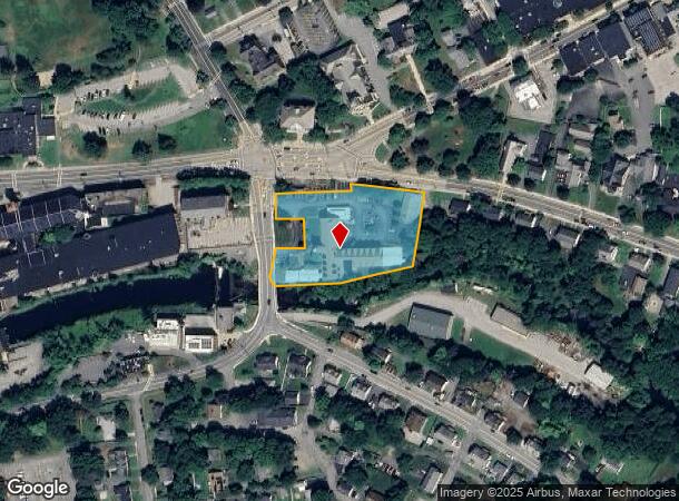
17 Douglas Rd, Whitinsville, MA 01588
NEARBY LISTINGS FOR SALE OR LEASE
-
-
View all Whitinsville listings for sale on LoopNet.com
Property Detail
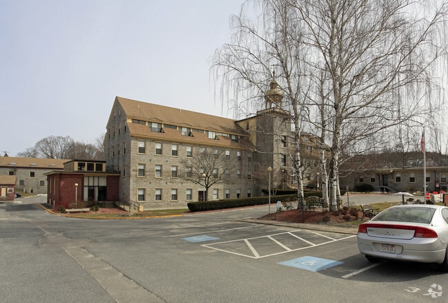
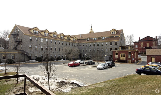
17 Douglas Rd
Apartment
Worcester
AE
Massachusetts
25027C1006E
2.19 AC
2025
Southeast Worcester County
2025
Boston
750100
Worcester, MA-CT
57,554 SF
NBRI-000005-000075
DEMOGRAPHICS near 17 Douglas Rd
1 Mile
3 Mile
5 Mile
2024 Total Population
5,244
21,515
46,917
2029 Population
5,251
21,459
46,753
Pop Growth 2024-2029
+ 0.13%
(0.26%)
(0.35%)
Average Age
41
42
42
2024 Total Households
2,080
8,525
17,924
HH Growth 2024-2029
+ 0.10%
(0.36%)
(0.42%)
Median Household Inc
$87,590
$105,549
$117,703
Avg Household Size
2.50
2.50
2.60
2024 Avg HH Vehicles
2.00
2.00
2.00
Median Home Value
$413,434
$394,670
$420,910
Median Year Built
1957
1970
1978
Nearby Places
Map Layers
Map Styles
 Street
 Aerial
- Restaurants
- Banks
- Shops
- Fitness
- Groceries
PUBLIC TRANSPORTATION
AIRPORT
Worcester Regional
DRIVE
WALK
Distance
Worcester Regional
31 min
19.0 mi
Rhode Island Tf Green International
DRIVE
WALK
Distance
Rhode Island Tf Green International
50 min
35.9 mi
Freight Ports
Port of Boston
DRIVE
WALK
Distance
Port of Boston
66 min
44.9 mi
Nearby Properties
Address
Land Use
TOTAL SIZE
Lot Size
Zoning
Address
Land Use
TOTAL SIZE
Lot Size
Zoning
607,486 SF
69.67 AC
AG
Address
Land Use
TOTAL SIZE
Lot Size
Zoning
161,541 SF
30.04 AC
Address
Land Use
TOTAL SIZE
Lot Size
Zoning
158,722 SF
77.55 AC
Address
Land Use
TOTAL SIZE
Lot Size
Zoning
173,667 SF
2.44 AC
Address
Land Use
TOTAL SIZE
Lot Size
Zoning
246,552 SF
24.55 AC
Address
Land Use
TOTAL SIZE
Lot Size
Zoning
192,817 SF
36.30 AC
RA
Address
Land Use
TOTAL SIZE
Lot Size
Zoning
607,486 SF
31.09 AC
OLI
Address
Land Use
TOTAL SIZE
Lot Size
Zoning
178,775 SF
36.78 AC
Address
Land Use
TOTAL SIZE
Lot Size
Zoning
312,077 SF
13.66 AC
C
Address
Land Use
TOTAL SIZE
Lot Size
Zoning
116,864 SF
16.87 AC
OLI
Address
Land Use
TOTAL SIZE
Lot Size
Zoning
50.49 AC
Address
Land Use
TOTAL SIZE
Lot Size
Zoning
37,781 SF
29.16 AC
Address
Land Use
TOTAL SIZE
Lot Size
Zoning
12.93 AC
Address
Land Use
TOTAL SIZE
Lot Size
Zoning
22,520 SF
7.03 AC
Address
Land Use
TOTAL SIZE
Lot Size
Zoning
75,977 SF
12.90 AC
RB
Address
Land Use
TOTAL SIZE
Lot Size
Zoning
55,671 SF
3.53 AC
Address
Land Use
TOTAL SIZE
Lot Size
Zoning
67,716 SF
42.39 AC
Address
Land Use
TOTAL SIZE
Lot Size
Zoning
90,000 SF
9.40 AC
OLI
Address
Land Use
TOTAL SIZE
Lot Size
Zoning
19,913 SF
0.78 AC
Address
Land Use
TOTAL SIZE
Lot Size
Zoning
17.12 AC
Address
Land Use
TOTAL SIZE
Lot Size
Zoning
607,486 SF
3.84 AC
IND
Address
Land Use
TOTAL SIZE
Lot Size
Zoning
100,882 SF
25.60 AC
Address
Land Use
TOTAL SIZE
Lot Size
Zoning
41,071 SF
0.61 AC
RA
Address
Land Use
TOTAL SIZE
Lot Size
Zoning
25,601 SF
9.26 AC
RB
Address
Land Use
TOTAL SIZE
Lot Size
Zoning
26.11 AC
Address
Land Use
TOTAL SIZE
Lot Size
Zoning
52,848 SF
7.02 AC
OLI
Address
Land Use
TOTAL SIZE
Lot Size
Zoning
27,918 SF
53.83 AC
OLI
Address
Land Use
TOTAL SIZE
Lot Size
Zoning
185,400 SF
16.35 AC
OLI
Address
Land Use
TOTAL SIZE
Lot Size
Zoning
6.17 AC
Address
Land Use
TOTAL SIZE
Lot Size
Zoning
2.72 AC
The World's #1 Commercial Real Estate Marketplace
Connect with us
© 2025 CoStar Group
The information above has been obtained from sources believed reliable. While we do not doubt its accuracy we have not verified it and make no guarantee, warranty or representation about it. It is your responsibility to independently confirm its accuracy and completeness. Any projections, opinions, assumptions, or estimates used are for example only and do not represent the current or future performance of the property. The value of this transaction to you depends on tax and other factors which should be evaluated by your tax, financial, and legal advisors. You and your advisors should conduct a careful, independent investigation of the property to determine to your satisfaction the suitability of the property for your needs.