Property Record
17 Lucienne Ave, Danielson, CT 06239
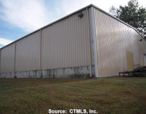

Property Detail
17 Lucienne Ave
Industrialgeneral
Northeastern Ct
LI
Connecticut
A Areas with a 1% annual chance of flooding and a 26% chance of flooding over the life of a 30-year mortgage.
3.97 AC
2025
Windham County
2025
Hartford
904500
Willimantic, CT
21,424 SF
KILL-000262-000000-000021
NEARBY LISTINGS FOR SALE OR LEASE
DEMOGRAPHICS near 17 Lucienne Ave
1 mile
3 mile
5 mile
2025 Total Population
1,099
13,607
29,354
2030 Population
1,121
13,938
30,148
Pop Growth 2025-2030
+ 2.00%
+ 2.43%
+ 2.70%
Average Age
42
42
43
2025 Total Households
418
5,298
11,715
HH Growth 2025-2030
+ 2.15%
+ 2.55%
+ 2.83%
Median Household Inc
$107,434
$84,932
$85,753
Avg Household Size
2.50
2.50
2.40
2025 Avg HH Vehicles
2.00
2.00
2.00
Median Home Value
$310,616
$292,487
$286,945
Median Year Built
1974
1966
1969
Nearby Places
Map Layers
Map Styles
 Street
 Aerial
Transit
 Traffic
 Biking
Places
Listings with unknown addresses are not visible on the map
- Restaurants
- Banks
- Shops
- Fitness
- Groceries
PUBLIC TRANSPORTATION
AIRPORT
Rhode Island Tf Green International
Drive
Walk
Distance
Rhode Island Tf Green International
48 min
33.9 mi
Worcester Regional
Drive
Walk
Distance
Worcester Regional
56 min
40.0 mi
Freight Ports
Port of Davisville, RI
Drive
Walk
Distance
Port of Davisville, RI
59 min
43.1 mi
Nearby Properties
Address
Land Use
TOTAL SIZE
Lot Size
Zoning
Address
Land Use
TOTAL SIZE
Lot Size
Zoning
186,583 SF
87.26 AC
RA60
Address
Land Use
TOTAL SIZE
Lot Size
Zoning
22 AC
I
Address
Land Use
TOTAL SIZE
Lot Size
Zoning
53,306 SF
1.60 AC
BI
Address
Land Use
TOTAL SIZE
Lot Size
Zoning
54.70 AC
RA
Address
Land Use
TOTAL SIZE
Lot Size
Zoning
147,139 SF
25.48 AC
PC
Address
Land Use
TOTAL SIZE
Lot Size
Zoning
5 AC
VC
Address
Land Use
TOTAL SIZE
Lot Size
Zoning
67,994 SF
8.30 AC
GC
Address
Land Use
TOTAL SIZE
Lot Size
Zoning
24.12 AC
VC
Address
Land Use
TOTAL SIZE
Lot Size
Zoning
23.55 AC
I
Address
Land Use
TOTAL SIZE
Lot Size
Zoning
9.77 AC
PC
Address
Land Use
TOTAL SIZE
Lot Size
Zoning
19.85 AC
R30
Address
Land Use
TOTAL SIZE
Lot Size
Zoning
139.70 AC
RA60
Address
Land Use
TOTAL SIZE
Lot Size
Zoning
96,848 SF
13.88 AC
IND-1
Address
Land Use
TOTAL SIZE
Lot Size
Zoning
9.12 AC
R10
Address
Land Use
TOTAL SIZE
Lot Size
Zoning
13,472 SF
1.40 AC
PC
Address
Land Use
TOTAL SIZE
Lot Size
Zoning
14,524 SF
0.92 AC
RHD
Address
Land Use
TOTAL SIZE
Lot Size
Zoning
11.50 AC
RA60
Address
Land Use
TOTAL SIZE
Lot Size
Zoning
4.60 AC
BRHD
Address
Land Use
TOTAL SIZE
Lot Size
Zoning
33,486 SF
4.10 AC
MMUDD
Address
Land Use
TOTAL SIZE
Lot Size
Zoning
28,678 SF
0.95 AC
BRHD
Address
Land Use
TOTAL SIZE
Lot Size
Zoning
4.80 AC
RHD
Address
Land Use
TOTAL SIZE
Lot Size
Zoning
Address
Land Use
TOTAL SIZE
Lot Size
Zoning
17,473 SF
3.49 AC
PC
Address
Land Use
TOTAL SIZE
Lot Size
Zoning
3,536 SF
27.50 AC
RA
Address
Land Use
TOTAL SIZE
Lot Size
Zoning
25,942 SF
3.52 AC
R10
Address
Land Use
TOTAL SIZE
Lot Size
Zoning
38.06 AC
Address
Land Use
TOTAL SIZE
Lot Size
Zoning
1,475 SF
148.80 AC
I
Address
Land Use
TOTAL SIZE
Lot Size
Zoning
4.75 AC
PBO
Address
Land Use
TOTAL SIZE
Lot Size
Zoning
1.40 AC
RA30
Address
Land Use
TOTAL SIZE
Lot Size
Zoning
23,584 SF
1.60 AC
BGC
The World's #1 Commercial Real Estate Marketplace
Connect with us
© 2026 CoStar Group
The information above has been obtained from sources believed reliable. While we do not doubt its accuracy we have not verified it and make no guarantee, warranty or representation about it. It is your responsibility to independently confirm its accuracy and completeness. Any projections, opinions, assumptions, or estimates used are for example only and do not represent the current or future performance of the property. The value of this transaction to you depends on tax and other factors which should be evaluated by your tax, financial, and legal advisors. You and your advisors should conduct a careful, independent investigation of the property to determine to your satisfaction the suitability of the property for your needs.