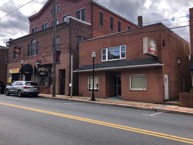
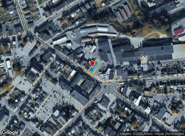
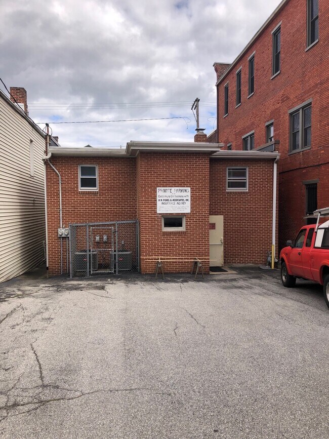
Property Record
17 N Main St, Red Lion, PA 17356
NEARBY LISTINGS FOR SALE OR LEASE
Property Detail
17 N Main St
Retailwithmorethanonenonretailuse
York
X
Pennsylvania
42133C0363F
0.21 AC
2025
York County
2025
Philadelphia
023100
York-Hanover, PA
13,790 SF
82-000-03-0154.00-00000
DEMOGRAPHICS near 17 N Main St
1 Mile
3 Mile
5 Mile
2024 Total Population
9,197
33,228
62,301
2029 Population
9,467
34,047
63,788
Pop Growth 2024-2029
+ 2.94%
+ 2.46%
+ 2.39%
Average Age
39
40
41
2024 Total Households
3,766
13,095
24,557
HH Growth 2024-2029
+ 3.05%
+ 2.54%
+ 2.44%
Median Household Inc
$66,579
$71,177
$76,649
Avg Household Size
2.40
2.50
2.50
2024 Avg HH Vehicles
2.00
2.00
2.00
Median Home Value
$181,197
$202,878
$221,777
Median Year Built
1961
1976
1981
Nearby Places
Map Layers
Map Styles
 Street
 Aerial
- Restaurants
- Banks
- Shops
- Fitness
- Groceries
PUBLIC TRANSPORTATION
AIRPORT
Harrisburg International
DRIVE
WALK
Distance
Harrisburg International
54 min
37.9 mi
Freight Ports
Port of Baltimore
DRIVE
WALK
Distance
Port of Baltimore
81 min
53.3 mi
SALE & LEASE HISTORY
LISTING DATE
SALE/LEASE

Nov 01, 2021
For Lease
Nearby Properties
Address
Land Use
TOTAL SIZE
Lot Size
Zoning
Address
Land Use
TOTAL SIZE
Lot Size
Zoning
15,644 SF
19 AC
ID
Address
Land Use
TOTAL SIZE
Lot Size
Zoning
7,200 SF
18.95 AC
CM
Address
Land Use
TOTAL SIZE
Lot Size
Zoning
1,148 SF
16.84 AC
R2
Address
Land Use
TOTAL SIZE
Lot Size
Zoning
15.26 AC
ID
Address
Land Use
TOTAL SIZE
Lot Size
Zoning
8.06 AC
Address
Land Use
TOTAL SIZE
Lot Size
Zoning
273,302 SF
25 AC
ID
Address
Land Use
TOTAL SIZE
Lot Size
Zoning
3.17 AC
CM
Address
Land Use
TOTAL SIZE
Lot Size
Zoning
123,040 SF
4.30 AC
ID
Address
Land Use
TOTAL SIZE
Lot Size
Zoning
45,380 SF
13.72 AC
RSCM
Address
Land Use
TOTAL SIZE
Lot Size
Zoning
18.21 AC
RS
Address
Land Use
TOTAL SIZE
Lot Size
Zoning
58.75 AC
I
Address
Land Use
TOTAL SIZE
Lot Size
Zoning
75,355 SF
9.59 AC
C1
Address
Land Use
TOTAL SIZE
Lot Size
Zoning
20,400 SF
26.60 AC
ID
Address
Land Use
TOTAL SIZE
Lot Size
Zoning
105,980 SF
2.40 AC
ID
Address
Land Use
TOTAL SIZE
Lot Size
Zoning
4,448 SF
8.71 AC
RS
Address
Land Use
TOTAL SIZE
Lot Size
Zoning
2,737 SF
26.41 AC
RS
Address
Land Use
TOTAL SIZE
Lot Size
Zoning
258,456 SF
9.77 AC
RS
Address
Land Use
TOTAL SIZE
Lot Size
Zoning
199,433 SF
7.17 AC
ID
Address
Land Use
TOTAL SIZE
Lot Size
Zoning
1,600 SF
10.90 AC
C1
Address
Land Use
TOTAL SIZE
Lot Size
Zoning
1,440 SF
76.99 AC
AG
Address
Land Use
TOTAL SIZE
Lot Size
Zoning
22,000 SF
2.82 AC
RS
Address
Land Use
TOTAL SIZE
Lot Size
Zoning
33,777 SF
15.96 AC
RS
Address
Land Use
TOTAL SIZE
Lot Size
Zoning
166,445 SF
14.14 AC
I
Address
Land Use
TOTAL SIZE
Lot Size
Zoning
40,320 SF
6.65 AC
RS
Address
Land Use
TOTAL SIZE
Lot Size
Zoning
17,664 SF
6.97 AC
RS
Address
Land Use
TOTAL SIZE
Lot Size
Zoning
1,433 SF
3.12 AC
CM
Address
Land Use
TOTAL SIZE
Lot Size
Zoning
3,000 SF
5.81 AC
C1
Address
Land Use
TOTAL SIZE
Lot Size
Zoning
33.21 AC
CV
Address
Land Use
TOTAL SIZE
Lot Size
Zoning
17,611 SF
3.72 AC
CM
Address
Land Use
TOTAL SIZE
Lot Size
Zoning
3.47 AC
CM
The World's #1 Commercial Real Estate Marketplace
Connect with us
© 2025 CoStar Group
The information above has been obtained from sources believed reliable. While we do not doubt its accuracy we have not verified it and make no guarantee, warranty or representation about it. It is your responsibility to independently confirm its accuracy and completeness. Any projections, opinions, assumptions, or estimates used are for example only and do not represent the current or future performance of the property. The value of this transaction to you depends on tax and other factors which should be evaluated by your tax, financial, and legal advisors. You and your advisors should conduct a careful, independent investigation of the property to determine to your satisfaction the suitability of the property for your needs.