Property Record
17 N Us Hwy, Bridgeton, NC 28519
NEARBY LISTINGS FOR SALE OR LEASE
-
-
View all Bridgeton listings for sale on LoopNet.com
Property Detail
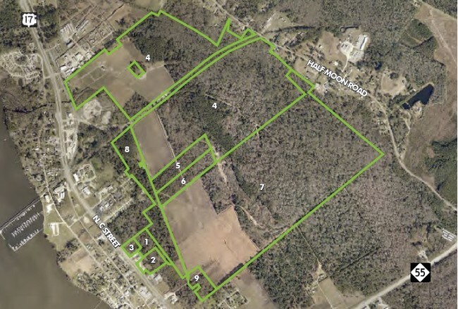
17 N Us Hwy
2-035-122
Blades Addition
Timberlandforesttreesagricultural
DAVIS, STILLEY, IPOCK
AE
Craven
3720559100K
North Carolina
2025
306.72 AC
2025
North Carolina Southeast Area
960101
Other Market Areas
790 SF
New Bern, NC
DEMOGRAPHICS near 17 N Us Hwy
1 Mile
3 Mile
5 Mile
2024 Total Population
609
8,552
28,155
2029 Population
589
8,782
28,628
Pop Growth 2024-2029
(3.28%)
+ 2.69%
+ 1.68%
Average Age
42
43
44
2024 Total Households
260
3,889
12,566
HH Growth 2024-2029
(3.46%)
+ 2.73%
+ 1.70%
Median Household Inc
$45,227
$45,146
$52,360
Avg Household Size
2.30
2.10
2.20
2024 Avg HH Vehicles
2.00
2.00
2.00
Median Home Value
$158,988
$177,982
$172,712
Median Year Built
1981
1975
1983
Nearby Places
Map Layers
Map Styles
 Street
 Aerial
- Restaurants
- Banks
- Shops
- Fitness
- Groceries
PUBLIC TRANSPORTATION
AIRPORT
Coastal Carolina Regional
DRIVE
WALK
Distance
Coastal Carolina Regional
17 min
7.4 mi
Freight Ports
Port of Morehead City
DRIVE
WALK
Distance
Port of Morehead City
76 min
45.4 mi
SALE & LEASE HISTORY
LISTING DATE
SALE/LEASE

Dec 05, 2018
For Sale
Nearby Properties
Address
Land Use
TOTAL SIZE
Lot Size
Zoning
Address
Land Use
TOTAL SIZE
Lot Size
Zoning
24.65 AC
Address
Land Use
TOTAL SIZE
Lot Size
Zoning
18,972 SF
2.70 AC
Address
Land Use
TOTAL SIZE
Lot Size
Zoning
53,952 SF
2.95 AC
NC2
Address
Land Use
TOTAL SIZE
Lot Size
Zoning
59,864 SF
2.64 AC
NC2
Address
Land Use
TOTAL SIZE
Lot Size
Zoning
68,356 SF
1.21 AC
NC5A
Address
Land Use
TOTAL SIZE
Lot Size
Zoning
18,016 SF
2.18 AC
Address
Land Use
TOTAL SIZE
Lot Size
Zoning
33,451 SF
0.64 AC
NC1
Address
Land Use
TOTAL SIZE
Lot Size
Zoning
8.06 AC
NC5A
Address
Land Use
TOTAL SIZE
Lot Size
Zoning
13,688 SF
1.24 AC
NC1
Address
Land Use
TOTAL SIZE
Lot Size
Zoning
37,937 SF
11.40 AC
NC3
Address
Land Use
TOTAL SIZE
Lot Size
Zoning
13,595 SF
1.85 AC
NC1
Address
Land Use
TOTAL SIZE
Lot Size
Zoning
6,513 SF
0.89 AC
NC1
Address
Land Use
TOTAL SIZE
Lot Size
Zoning
3.05 AC
NC2
Address
Land Use
TOTAL SIZE
Lot Size
Zoning
2.22 AC
NC2
Address
Land Use
TOTAL SIZE
Lot Size
Zoning
16,544 SF
0.46 AC
NC1
Address
Land Use
TOTAL SIZE
Lot Size
Zoning
70.28 AC
Address
Land Use
TOTAL SIZE
Lot Size
Zoning
5.42 AC
NC5A
Address
Land Use
TOTAL SIZE
Lot Size
Zoning
12,020 SF
0.77 AC
NC5
Address
Land Use
TOTAL SIZE
Lot Size
Zoning
21,344 SF
0.31 AC
NC1
Address
Land Use
TOTAL SIZE
Lot Size
Zoning
25,038 SF
2.86 AC
Address
Land Use
TOTAL SIZE
Lot Size
Zoning
7,800 SF
14.07 AC
NR6
Address
Land Use
TOTAL SIZE
Lot Size
Zoning
11,468 SF
1.28 AC
NC2
Address
Land Use
TOTAL SIZE
Lot Size
Zoning
24.58 AC
NI2
Address
Land Use
TOTAL SIZE
Lot Size
Zoning
4,000 SF
9.73 AC
Address
Land Use
TOTAL SIZE
Lot Size
Zoning
7,990 SF
1.34 AC
NC1
Address
Land Use
TOTAL SIZE
Lot Size
Zoning
4,050 SF
0.36 AC
NC2
Address
Land Use
TOTAL SIZE
Lot Size
Zoning
32,765 SF
0.16 AC
NC1
Address
Land Use
TOTAL SIZE
Lot Size
Zoning
5,320 SF
0.23 AC
Address
Land Use
TOTAL SIZE
Lot Size
Zoning
10,692 SF
0.51 AC
NC3
The World's #1 Commercial Real Estate Marketplace
Connect with us
© 2025 CoStar Group
The information above has been obtained from sources believed reliable. While we do not doubt its accuracy we have not verified it and make no guarantee, warranty or representation about it. It is your responsibility to independently confirm its accuracy and completeness. Any projections, opinions, assumptions, or estimates used are for example only and do not represent the current or future performance of the property. The value of this transaction to you depends on tax and other factors which should be evaluated by your tax, financial, and legal advisors. You and your advisors should conduct a careful, independent investigation of the property to determine to your satisfaction the suitability of the property for your needs.