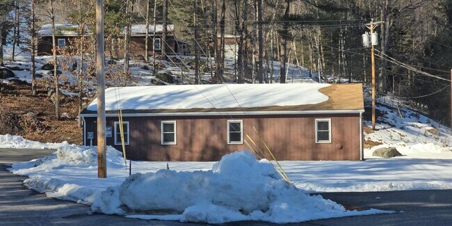
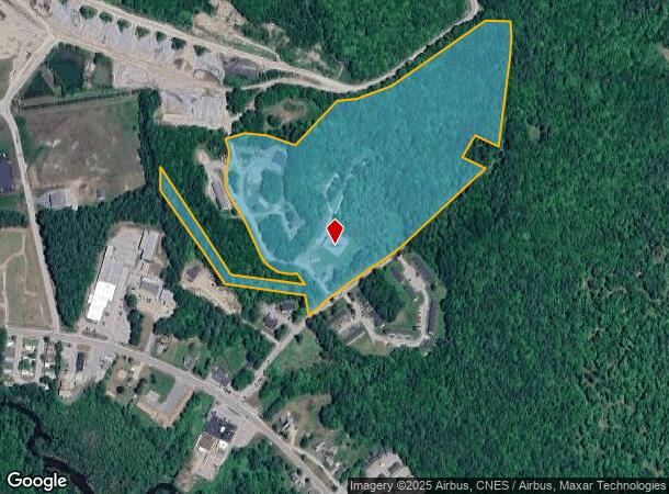
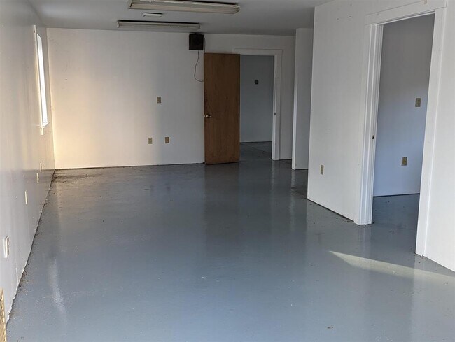
Property Record
17 Roymal Ln, Newport, NH 03773
NEARBY LISTINGS FOR SALE OR LEASE
-
-
View all Newport listings for lease on LoopNet.com
Property Detail
17 Roymal Ln
Commercialnec
Sullivan
X
New Hampshire
33019C0195E
26.94 AC
2024
Concord/New Hampshire North Area
2024
Other Market Areas
975401
Claremont-Lebanon, NH-VT
3,823 SF
NWPT-000216-003000
DEMOGRAPHICS near 17 Roymal Ln
1 Mile
3 Mile
5 Mile
2024 Total Population
518
6,667
11,380
2029 Population
533
6,961
11,910
Pop Growth 2024-2029
+ 2.90%
+ 4.41%
+ 4.66%
Average Age
42
43
45
2024 Total Households
237
2,857
4,856
HH Growth 2024-2029
+ 2.53%
+ 4.03%
+ 4.26%
Median Household Inc
$40,833
$70,644
$78,561
Avg Household Size
2.20
2.20
2.30
2024 Avg HH Vehicles
2.00
2.00
2.00
Median Home Value
$209,091
$231,729
$288,388
Median Year Built
1976
1970
1974
Nearby Places
- Restaurants
- Banks
- Shops
- Fitness
- Groceries
SALE & LEASE HISTORY
LISTING DATE
SALE/LEASE

Feb 19, 2024
For Lease
Nearby Properties
Address
Land Use
TOTAL SIZE
Lot Size
Zoning
Address
Land Use
TOTAL SIZE
Lot Size
Zoning
3.20 AC
RS - R
Address
Land Use
TOTAL SIZE
Lot Size
Zoning
0.82 AC
B2 H
Address
Land Use
TOTAL SIZE
Lot Size
Zoning
100,357 SF
20.30 AC
B2 H
Address
Land Use
TOTAL SIZE
Lot Size
Zoning
86,498 SF
53 AC
R110 S
Address
Land Use
TOTAL SIZE
Lot Size
Zoning
29,230 SF
4.69 AC
R110 S
Address
Land Use
TOTAL SIZE
Lot Size
Zoning
7,708 SF
43 AC
RR - R
Address
Land Use
TOTAL SIZE
Lot Size
Zoning
64,752 SF
3.70 AC
R210 G
Address
Land Use
TOTAL SIZE
Lot Size
Zoning
6,945 SF
15.81 AC
B2 H
Address
Land Use
TOTAL SIZE
Lot Size
Zoning
28,887 SF
1.99 AC
B2 H
Address
Land Use
TOTAL SIZE
Lot Size
Zoning
71,458 SF
34.10 AC
RS - R
Address
Land Use
TOTAL SIZE
Lot Size
Zoning
41,955 SF
3.87 AC
R110 S
Address
Land Use
TOTAL SIZE
Lot Size
Zoning
206,032 SF
54.60 AC
IND I
Address
Land Use
TOTAL SIZE
Lot Size
Zoning
21,509 SF
1.29 AC
B110 L
Address
Land Use
TOTAL SIZE
Lot Size
Zoning
23,976 SF
17.17 AC
R110 S
Address
Land Use
TOTAL SIZE
Lot Size
Zoning
36,661 SF
0.50 AC
B110 L
Address
Land Use
TOTAL SIZE
Lot Size
Zoning
4,012 SF
4 AC
R210 G
Address
Land Use
TOTAL SIZE
Lot Size
Zoning
11,617 SF
5.50 AC
R40 R
Address
Land Use
TOTAL SIZE
Lot Size
Zoning
27,907 SF
1.20 AC
PBD10P
Address
Land Use
TOTAL SIZE
Lot Size
Zoning
8,839 SF
46.03 AC
R20 R
Address
Land Use
TOTAL SIZE
Lot Size
Zoning
48,629 SF
9.30 AC
IND I
Address
Land Use
TOTAL SIZE
Lot Size
Zoning
17,868 SF
6.10 AC
VILLAG
Address
Land Use
TOTAL SIZE
Lot Size
Zoning
7,719 SF
2.38 AC
B110 L
Address
Land Use
TOTAL SIZE
Lot Size
Zoning
28,928 SF
2.70 AC
VILLAG
Address
Land Use
TOTAL SIZE
Lot Size
Zoning
14,988 SF
2.16 AC
IND I
Address
Land Use
TOTAL SIZE
Lot Size
Zoning
10,069 SF
1.60 AC
B110 L
Address
Land Use
TOTAL SIZE
Lot Size
Zoning
89,647 SF
8.74 AC
IND I
Address
Land Use
TOTAL SIZE
Lot Size
Zoning
1.67 AC
RS - R
Address
Land Use
TOTAL SIZE
Lot Size
Zoning
3,300 SF
35.50 AC
RRLL L
Address
Land Use
TOTAL SIZE
Lot Size
Zoning
10,661 SF
63 AC
IND I
Address
Land Use
TOTAL SIZE
Lot Size
Zoning
3,918 SF
1.40 AC
B110 L
The World's #1 Commercial Real Estate Marketplace
Connect with us
© 2025 CoStar Group
The information above has been obtained from sources believed reliable. While we do not doubt its accuracy we have not verified it and make no guarantee, warranty or representation about it. It is your responsibility to independently confirm its accuracy and completeness. Any projections, opinions, assumptions, or estimates used are for example only and do not represent the current or future performance of the property. The value of this transaction to you depends on tax and other factors which should be evaluated by your tax, financial, and legal advisors. You and your advisors should conduct a careful, independent investigation of the property to determine to your satisfaction the suitability of the property for your needs.