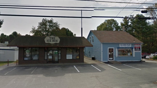
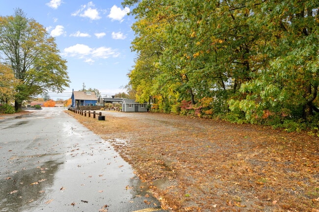
Property Record
17 S Main St, Brooklyn, CT 06234

This Property Is For Sale
Property Detail
17 S Main St
BROO-000041-000000-000104
Northeastern Ct
Commercialnec
Connecticut
PC
104
B and X Area of moderate flood hazard, usually the area between the limits of the 100-year and 500-year floods.
2.40 AC
2025
Windham County
2025
Hartford
905101
Willimantic, CT
NEARBY LISTINGS FOR SALE OR LEASE
DEMOGRAPHICS near 17 S Main St
1 mile
3 mile
5 mile
2025 Total Population
3,438
16,177
27,385
2030 Population
3,535
16,630
28,107
Pop Growth 2025-2030
+ 2.82%
+ 2.80%
+ 2.64%
Average Age
41
43
43
2025 Total Households
1,463
6,542
10,939
HH Growth 2025-2030
+ 2.87%
+ 2.90%
+ 2.76%
Median Household Inc
$66,453
$82,898
$88,448
Avg Household Size
2.30
2.30
2.40
2025 Avg HH Vehicles
2.00
2.00
2.00
Median Home Value
$273,451
$277,711
$295,248
Median Year Built
1954
1965
1970
Nearby Places
Map Layers
Map Styles
 Street
 Aerial
Transit
 Traffic
 Biking
Places
Listings with unknown addresses are not visible on the map
- Restaurants
- Banks
- Shops
- Fitness
- Groceries
PUBLIC TRANSPORTATION
AIRPORT
Rhode Island Tf Green International
Drive
Walk
Distance
Rhode Island Tf Green International
45 min
32.9 mi
Worcester Regional
Drive
Walk
Distance
Worcester Regional
54 min
37.7 mi
Freight Ports
Port of Davisville, RI
Drive
Walk
Distance
Port of Davisville, RI
57 min
42.1 mi
Nearby Properties
Address
Land Use
TOTAL SIZE
Lot Size
Zoning
Address
Land Use
TOTAL SIZE
Lot Size
Zoning
203,150 SF
21 AC
LD
Address
Land Use
TOTAL SIZE
Lot Size
Zoning
22 AC
I
Address
Land Use
TOTAL SIZE
Lot Size
Zoning
62 AC
LD
Address
Land Use
TOTAL SIZE
Lot Size
Zoning
53,306 SF
1.60 AC
BI
Address
Land Use
TOTAL SIZE
Lot Size
Zoning
54.70 AC
RA
Address
Land Use
TOTAL SIZE
Lot Size
Zoning
14.15 AC
VC
Address
Land Use
TOTAL SIZE
Lot Size
Zoning
227 AC
LD
Address
Land Use
TOTAL SIZE
Lot Size
Zoning
147,139 SF
25.48 AC
PC
Address
Land Use
TOTAL SIZE
Lot Size
Zoning
148,118 SF
17 AC
BRHD
Address
Land Use
TOTAL SIZE
Lot Size
Zoning
126,601 SF
13.40 AC
MUI
Address
Land Use
TOTAL SIZE
Lot Size
Zoning
5 AC
VC
Address
Land Use
TOTAL SIZE
Lot Size
Zoning
59,552 SF
4.28 AC
GC
Address
Land Use
TOTAL SIZE
Lot Size
Zoning
50,707 SF
10.50 AC
BRHD
Address
Land Use
TOTAL SIZE
Lot Size
Zoning
67,994 SF
8.30 AC
GC
Address
Land Use
TOTAL SIZE
Lot Size
Zoning
15 AC
I
Address
Land Use
TOTAL SIZE
Lot Size
Zoning
24.12 AC
VC
Address
Land Use
TOTAL SIZE
Lot Size
Zoning
9.77 AC
PC
Address
Land Use
TOTAL SIZE
Lot Size
Zoning
45,960 SF
1.40 AC
MD
Address
Land Use
TOTAL SIZE
Lot Size
Zoning
19.85 AC
R30
Address
Land Use
TOTAL SIZE
Lot Size
Zoning
7,808 SF
6.90 AC
I
Address
Land Use
TOTAL SIZE
Lot Size
Zoning
9.80 AC
GC
Address
Land Use
TOTAL SIZE
Lot Size
Zoning
12.20 AC
MD
Address
Land Use
TOTAL SIZE
Lot Size
Zoning
18,958 SF
1.52 AC
BGC
Address
Land Use
TOTAL SIZE
Lot Size
Zoning
9.12 AC
R10
Address
Land Use
TOTAL SIZE
Lot Size
Zoning
13,472 SF
1.40 AC
PC
Address
Land Use
TOTAL SIZE
Lot Size
Zoning
14,524 SF
0.92 AC
RHD
Address
Land Use
TOTAL SIZE
Lot Size
Zoning
4.60 AC
BRHD
Address
Land Use
TOTAL SIZE
Lot Size
Zoning
33,486 SF
4.10 AC
MMUDD
Address
Land Use
TOTAL SIZE
Lot Size
Zoning
28,678 SF
0.95 AC
BRHD
Address
Land Use
TOTAL SIZE
Lot Size
Zoning
74 AC
I
The World's #1 Commercial Real Estate Marketplace
Connect with us
© 2026 CoStar Group
The information above has been obtained from sources believed reliable. While we do not doubt its accuracy we have not verified it and make no guarantee, warranty or representation about it. It is your responsibility to independently confirm its accuracy and completeness. Any projections, opinions, assumptions, or estimates used are for example only and do not represent the current or future performance of the property. The value of this transaction to you depends on tax and other factors which should be evaluated by your tax, financial, and legal advisors. You and your advisors should conduct a careful, independent investigation of the property to determine to your satisfaction the suitability of the property for your needs.