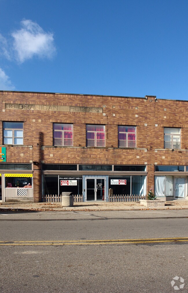
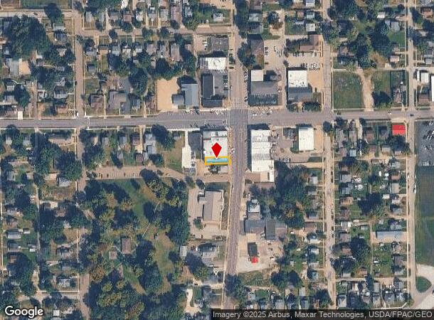
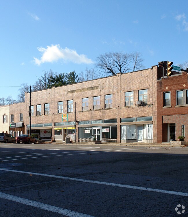
Property Record
17 S Main St, Rittman, OH 44270
NEARBY LISTINGS FOR SALE OR LEASE
Property Detail
17 S Main St
Wooster, OH
Rittman
63-02370-000
LOT 570 25' MP 9 CD 2408
Storebuilding
Wayne
X
Ohio
39169C0106E
570
2024
0.06 AC
2024
Ohio North Area
003400
Other Market Areas
29,700 SF
DEMOGRAPHICS near 17 S Main St
1 Mile
3 Mile
5 Mile
2024 Total Population
5,385
9,947
32,099
2029 Population
5,474
10,076
32,482
Pop Growth 2024-2029
+ 1.65%
+ 1.30%
+ 1.19%
Average Age
41
42
41
2024 Total Households
2,268
4,023
12,699
HH Growth 2024-2029
+ 1.50%
+ 1.17%
+ 1.11%
Median Household Inc
$49,474
$58,519
$67,975
Avg Household Size
2.30
2.40
2.50
2024 Avg HH Vehicles
2.00
2.00
2.00
Median Home Value
$140,823
$169,930
$187,606
Median Year Built
1964
1969
1971
Nearby Places
Map Layers
Map Styles
 Street
 Aerial
- Restaurants
- Banks
- Shops
- Fitness
- Groceries
PUBLIC TRANSPORTATION
AIRPORT
Akron-Canton Regional
DRIVE
WALK
Distance
Akron-Canton Regional
38 min
29.0 mi
Freight Ports
Port of Toledo
DRIVE
WALK
Distance
Port of Toledo
167 min
133.3 mi
Nearby Properties
Address
Land Use
TOTAL SIZE
Lot Size
Zoning
Address
Land Use
TOTAL SIZE
Lot Size
Zoning
3,450 SF
43.53 AC
PSM
Address
Land Use
TOTAL SIZE
Lot Size
Zoning
2,584 SF
12.89 AC
Address
Land Use
TOTAL SIZE
Lot Size
Zoning
6,573 SF
22.01 AC
Address
Land Use
TOTAL SIZE
Lot Size
Zoning
90,267 SF
10.91 AC
Address
Land Use
TOTAL SIZE
Lot Size
Zoning
47,784 SF
28.30 AC
Address
Land Use
TOTAL SIZE
Lot Size
Zoning
184,237 SF
22.64 AC
Address
Land Use
TOTAL SIZE
Lot Size
Zoning
37,843 SF
5.82 AC
Address
Land Use
TOTAL SIZE
Lot Size
Zoning
31,075 SF
3.17 AC
PSM
Address
Land Use
TOTAL SIZE
Lot Size
Zoning
14.21 AC
Address
Land Use
TOTAL SIZE
Lot Size
Zoning
35,124 SF
6.18 AC
Address
Land Use
TOTAL SIZE
Lot Size
Zoning
16,722 SF
18.17 AC
Address
Land Use
TOTAL SIZE
Lot Size
Zoning
20,767 SF
9.35 AC
Address
Land Use
TOTAL SIZE
Lot Size
Zoning
50,868 SF
7.71 AC
Address
Land Use
TOTAL SIZE
Lot Size
Zoning
54,931 SF
19.01 AC
Address
Land Use
TOTAL SIZE
Lot Size
Zoning
13,980 SF
2.91 AC
PSM
Address
Land Use
TOTAL SIZE
Lot Size
Zoning
1,134 SF
270.94 AC
Address
Land Use
TOTAL SIZE
Lot Size
Zoning
20,000 SF
3.60 AC
M3
Address
Land Use
TOTAL SIZE
Lot Size
Zoning
31,800 SF
6.42 AC
M3
Address
Land Use
TOTAL SIZE
Lot Size
Zoning
27.84 AC
M2
Address
Land Use
TOTAL SIZE
Lot Size
Zoning
35,340 SF
14.32 AC
Address
Land Use
TOTAL SIZE
Lot Size
Zoning
31,202 SF
11.08 AC
Address
Land Use
TOTAL SIZE
Lot Size
Zoning
34,848 SF
3.76 AC
Address
Land Use
TOTAL SIZE
Lot Size
Zoning
45,216 SF
0.77 AC
R3
Address
Land Use
TOTAL SIZE
Lot Size
Zoning
37,766 SF
6.33 AC
C2
Address
Land Use
TOTAL SIZE
Lot Size
Zoning
19,092 SF
3.68 AC
C1
Address
Land Use
TOTAL SIZE
Lot Size
Zoning
16,492 SF
3.53 AC
Address
Land Use
TOTAL SIZE
Lot Size
Zoning
17,403 SF
9.73 AC
Address
Land Use
TOTAL SIZE
Lot Size
Zoning
12,000 SF
5.37 AC
Address
Land Use
TOTAL SIZE
Lot Size
Zoning
51,700 SF
15 AC
Address
Land Use
TOTAL SIZE
Lot Size
Zoning
2,760 SF
130.19 AC
The World's #1 Commercial Real Estate Marketplace
Connect with us
© 2025 CoStar Group
The information above has been obtained from sources believed reliable. While we do not doubt its accuracy we have not verified it and make no guarantee, warranty or representation about it. It is your responsibility to independently confirm its accuracy and completeness. Any projections, opinions, assumptions, or estimates used are for example only and do not represent the current or future performance of the property. The value of this transaction to you depends on tax and other factors which should be evaluated by your tax, financial, and legal advisors. You and your advisors should conduct a careful, independent investigation of the property to determine to your satisfaction the suitability of the property for your needs.