Property Record
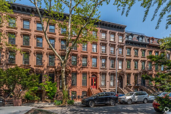
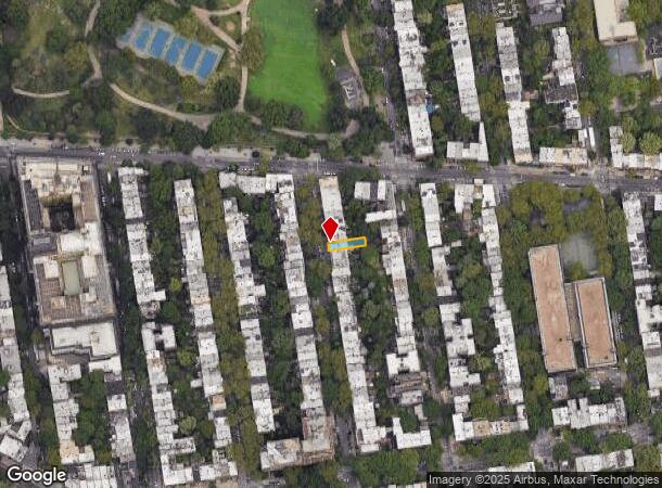
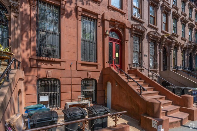
17 S Oxford St, Brooklyn, NY 11217

NEARBY LISTINGS FOR SALE OR LEASE
Property Detail
17 S Oxford St
02101-0027
DOCID-2019071701006001
Transientlodging
Kings
X
New York
3604970203F
27
2024
0.05 AC
2025
Fort Greene
018100
Long Island (New York)
4,400 SF
New York-Jersey City-White Plains, NY-NJ
DEMOGRAPHICS near 17 S Oxford St
1 Mile
3 Mile
5 Mile
2024 Total Population
169,253
1,237,871
2,734,749
2029 Population
162,614
1,172,963
2,570,075
Pop Growth 2024-2029
(3.92%)
(5.24%)
(6.02%)
Average Age
37
38
38
2024 Total Households
74,493
520,375
1,118,715
HH Growth 2024-2029
(4.30%)
(5.72%)
(6.27%)
Median Household Inc
$110,132
$86,515
$84,766
Avg Household Size
2.10
2.30
2.30
2024 Avg HH Vehicles
.00
.00
.00
Median Home Value
$1,009,110
$1,018,978
$896,031
Median Year Built
1954
1948
1949
Nearby Places
- Restaurants
- Banks
- Shops
- Fitness
- Groceries
PUBLIC TRANSPORTATION
TRANSIT/SUBWAY
Fulton Street (G Line) (G - New York MTA Subway (The Subway))
DRIVE
WALK
Distance
Fulton Street (G Line) (G - New York MTA Subway (The Subway))
2 min
4 min
0.2 mi
Lafayette Avenue (A - New York MTA Subway (The Subway), C - New York MTA Subway (The Subway))
DRIVE
WALK
Distance
Lafayette Avenue (A - New York MTA Subway (The Subway), C - New York MTA Subway (The Subway))
2 min
5 min
0.2 mi
Nevins Street (2 - New York MTA Subway (The Subway), 3 - New York MTA Subway (The Subway), 4 - New York MTA Subway (The Subway), 5 - New York MTA Subway (The Subway))
DRIVE
WALK
Distance
Nevins Street (2 - New York MTA Subway (The Subway), 3 - New York MTA Subway (The Subway), 4 - New York MTA Subway (The Subway), 5 - New York MTA Subway (The Subway))
2 min
10 min
0.5 mi
Atlantic Avenue (2 - New York MTA Subway (The Subway), 3 - New York MTA Subway (The Subway), 4 - New York MTA Subway (The Subway), 5 - New York MTA Subway (The Subway), B - New York MTA Subway (The Subway), Q - New York MTA Subway (The Subway))
DRIVE
WALK
Distance
Atlantic Avenue (2 - New York MTA Subway (The Subway), 3 - New York MTA Subway (The Subway), 4 - New York MTA Subway (The Subway), 5 - New York MTA Subway (The Subway), B - New York MTA Subway (The Subway), Q - New York MTA Subway (The Subway))
3 min
10 min
0.5 mi
Pacific Street (D - New York MTA Subway (The Subway), M - New York MTA Subway (The Subway), N - New York MTA Subway (The Subway), R - New York MTA Subway (The Subway))
DRIVE
WALK
Distance
Pacific Street (D - New York MTA Subway (The Subway), M - New York MTA Subway (The Subway), N - New York MTA Subway (The Subway), R - New York MTA Subway (The Subway))
3 min
11 min
0.6 mi
COMMUTER RAIL
DRIVE
WALK
Distance
3 min
10 min
0.5 mi
Nostrand Avenue Station (Far Rockaway Branch - Long Island Rail Road, Hempstead Branch - Long Island Rail Road, Long Beach Branch - Long Island Rail Road, West Hempstead Branch - Long Island Rail Road)
DRIVE
WALK
Distance
Nostrand Avenue Station (Far Rockaway Branch - Long Island Rail Road, Hempstead Branch - Long Island Rail Road, Long Beach Branch - Long Island Rail Road, West Hempstead Branch - Long Island Rail Road)
6 min
1.9 mi
AIRPORT
LaGuardia
DRIVE
WALK
Distance
LaGuardia
20 min
10.2 mi
John F Kennedy International
DRIVE
WALK
Distance
John F Kennedy International
28 min
12.7 mi
Newark Liberty International
DRIVE
WALK
Distance
Newark Liberty International
26 min
14.9 mi
Freight Ports
NY - Red Hook Container Terminal
DRIVE
WALK
Distance
NY - Red Hook Container Terminal
7 min
2.2 mi
Nearby Properties
Address
Land Use
TOTAL SIZE
Lot Size
Zoning
Address
Land Use
TOTAL SIZE
Lot Size
Zoning
8,462,176 SF
61.41 AC
R7-2
Address
Land Use
TOTAL SIZE
Lot Size
Zoning
2,354,289 SF
3.96 AC
C6-4
Address
Land Use
TOTAL SIZE
Lot Size
Zoning
2,812,739 SF
2.10 AC
C5-3
Address
Land Use
TOTAL SIZE
Lot Size
Zoning
2,157,862 SF
2.23 AC
BPC
Address
Land Use
TOTAL SIZE
Lot Size
Zoning
2,255,659 SF
4.58 AC
BPC
Address
Land Use
TOTAL SIZE
Lot Size
Zoning
2,233,692 SF
1.90 AC
BPC
Address
Land Use
TOTAL SIZE
Lot Size
Zoning
1,104,505 SF
2.32 AC
C4-7
Address
Land Use
TOTAL SIZE
Lot Size
Zoning
1,636,000 SF
1.09 AC
C6-4
Address
Land Use
TOTAL SIZE
Lot Size
Zoning
1,909,502 SF
2.37 AC
BPC
Address
Land Use
TOTAL SIZE
Lot Size
Zoning
1,780,030 SF
5.07 AC
BPC
Address
Land Use
TOTAL SIZE
Lot Size
Zoning
7,058,736 SF
147.61 AC
M3-1
Address
Land Use
TOTAL SIZE
Lot Size
Zoning
869,038 SF
1.53 AC
M1-1
Address
Land Use
TOTAL SIZE
Lot Size
Zoning
1,260,362 SF
4.32 AC
C1-7
Address
Land Use
TOTAL SIZE
Lot Size
Zoning
92,440 SF
466.23 AC
R5
Address
Land Use
TOTAL SIZE
Lot Size
Zoning
802,000 SF
1.20 AC
C62A
Address
Land Use
TOTAL SIZE
Lot Size
Zoning
2,210,200 SF
2.58 AC
C5-5
Address
Land Use
TOTAL SIZE
Lot Size
Zoning
1,362,190 SF
C5-5
Address
Land Use
TOTAL SIZE
Lot Size
Zoning
1,653,794 SF
3.15 AC
C6-4
Address
Land Use
TOTAL SIZE
Lot Size
Zoning
932,587 SF
1.23 AC
C5-3
Address
Land Use
TOTAL SIZE
Lot Size
Zoning
1,499,568 SF
1.66 AC
C5-5
Address
Land Use
TOTAL SIZE
Lot Size
Zoning
1,440,960 SF
2.17 AC
BPC
Address
Land Use
TOTAL SIZE
Lot Size
Zoning
1,740,736 SF
4.29 AC
C6-4
Address
Land Use
TOTAL SIZE
Lot Size
Zoning
1,617,206 SF
1.23 AC
C5-5
Address
Land Use
TOTAL SIZE
Lot Size
Zoning
2,542,066 SF
174.49 AC
R3-2
Address
Land Use
TOTAL SIZE
Lot Size
Zoning
1,092,665 SF
1.06 AC
C62A
Address
Land Use
TOTAL SIZE
Lot Size
Zoning
1,503,150 SF
20.47 AC
R5
Address
Land Use
TOTAL SIZE
Lot Size
Zoning
1,075,808 SF
1.12 AC
C5-5
Address
Land Use
TOTAL SIZE
Lot Size
Zoning
1,141,276 SF
1.21 AC
C5-5
Address
Land Use
TOTAL SIZE
Lot Size
Zoning
1,000,746 SF
1.44 AC
M1-6
Address
Land Use
TOTAL SIZE
Lot Size
Zoning
393.54 AC
PARK
The World's #1 Commercial Real Estate Marketplace
Connect with us
© 2025 CoStar Group
The information above has been obtained from sources believed reliable. While we do not doubt its accuracy we have not verified it and make no guarantee, warranty or representation about it. It is your responsibility to independently confirm its accuracy and completeness. Any projections, opinions, assumptions, or estimates used are for example only and do not represent the current or future performance of the property. The value of this transaction to you depends on tax and other factors which should be evaluated by your tax, financial, and legal advisors. You and your advisors should conduct a careful, independent investigation of the property to determine to your satisfaction the suitability of the property for your needs.