Property Record
170 Highland Park Dr, Bloomfield, CT 06002
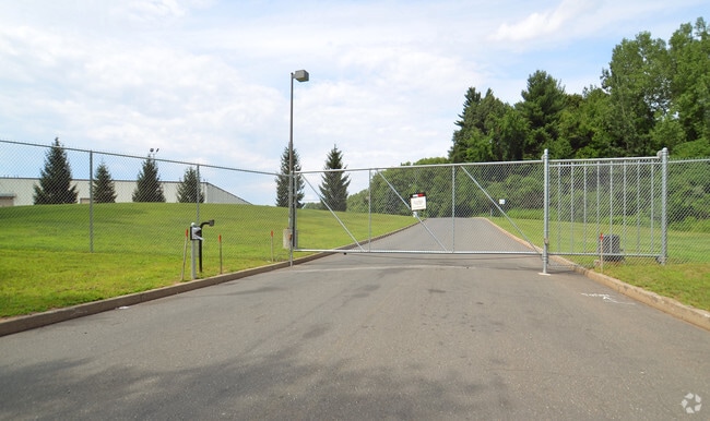

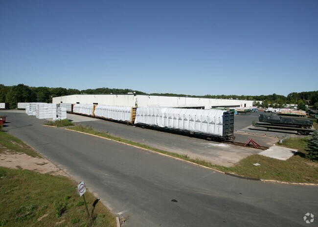

Property Detail
170 Highland Park Dr
BLOO-000372-000000-006008
Capitol
Industrialgeneral
Connecticut
I-2
94
B and X Area of moderate flood hazard, usually the area between the limits of the 100-year and 500-year floods.
37.82 AC
2024
Bloomfield
2025
Hartford
471500
Hartford-West Hartford-East Hartford, CT
451,806 SF
NEARBY LISTINGS FOR SALE OR LEASE
DEMOGRAPHICS near 170 Highland Park Dr
1 mile
3 mile
5 mile
2025 Total Population
1,544
17,505
74,498
2030 Population
1,579
18,158
76,324
Pop Growth 2025-2030
+ 2.27%
+ 3.73%
+ 2.45%
Average Age
47
47
44
2025 Total Households
674
7,574
29,346
HH Growth 2025-2030
+ 2.37%
+ 3.75%
+ 2.52%
Median Household Inc
$99,670
$108,520
$110,784
Avg Household Size
2.20
2.20
2.40
2025 Avg HH Vehicles
2.00
2.00
2.00
Median Home Value
$318,881
$338,250
$328,775
Median Year Built
1980
1979
1969
Nearby Places
Map Layers
Map Styles
 Street
 Aerial
Layers
 Traffic
 Biking
Places
Listings with unknown addresses are not visible on the map
- Restaurants
- Banks
- Shops
- Fitness
- Groceries
PUBLIC TRANSPORTATION
COMMUTER RAIL
Windsor (Hartford Line - CONN DOT)
Drive
Walk
Distance
Windsor (Hartford Line - CONN DOT)
16 min
6.8 mi
Windsor Locks (Hartford Line - CT Rail (CTRail))
Drive
Walk
Distance
Windsor Locks (Hartford Line - CT Rail (CTRail))
16 min
8.5 mi
AIRPORT
Bradley International
Drive
Walk
Distance
Bradley International
27 min
10.1 mi
Freight Ports
Port of New Haven
Drive
Walk
Distance
Port of New Haven
71 min
50.4 mi
Nearby Properties
Address
Land Use
TOTAL SIZE
Lot Size
Zoning
Address
Land Use
TOTAL SIZE
Lot Size
Zoning
105,796 SF
89.51 AC
Address
Land Use
TOTAL SIZE
Lot Size
Zoning
221,054 SF
28.85 AC
R-40
Address
Land Use
TOTAL SIZE
Lot Size
Zoning
66.60 AC
I-2
Address
Land Use
TOTAL SIZE
Lot Size
Zoning
802,150 SF
96.24 AC
I-2
Address
Land Use
TOTAL SIZE
Lot Size
Zoning
68.36 AC
Address
Land Use
TOTAL SIZE
Lot Size
Zoning
227,898 SF
5.33 AC
BCD
Address
Land Use
TOTAL SIZE
Lot Size
Zoning
433,356 SF
45.53 AC
I-2
Address
Land Use
TOTAL SIZE
Lot Size
Zoning
93.79 AC
Address
Land Use
TOTAL SIZE
Lot Size
Zoning
65,042 SF
36.76 AC
I-2
Address
Land Use
TOTAL SIZE
Lot Size
Zoning
8.89 AC
Address
Land Use
TOTAL SIZE
Lot Size
Zoning
161,576 SF
4 AC
BCD
Address
Land Use
TOTAL SIZE
Lot Size
Zoning
39,281 SF
678.81 AC
R-80
Address
Land Use
TOTAL SIZE
Lot Size
Zoning
102,949 SF
59.10 AC
PEC
Address
Land Use
TOTAL SIZE
Lot Size
Zoning
77,497 SF
14.17 AC
R-20
Address
Land Use
TOTAL SIZE
Lot Size
Zoning
135,344 SF
17.85 AC
PO
Address
Land Use
TOTAL SIZE
Lot Size
Zoning
180,964 SF
32.10 AC
R-15
Address
Land Use
TOTAL SIZE
Lot Size
Zoning
14.02 AC
PLR
Address
Land Use
TOTAL SIZE
Lot Size
Zoning
39.47 AC
R-15
Address
Land Use
TOTAL SIZE
Lot Size
Zoning
53.78 AC
R-30
Address
Land Use
TOTAL SIZE
Lot Size
Zoning
215,269 SF
41 AC
I-2
Address
Land Use
TOTAL SIZE
Lot Size
Zoning
152,382 SF
10.46 AC
Address
Land Use
TOTAL SIZE
Lot Size
Zoning
457,396 SF
72.99 AC
Address
Land Use
TOTAL SIZE
Lot Size
Zoning
14.90 AC
R-15
Address
Land Use
TOTAL SIZE
Lot Size
Zoning
15.33 AC
R-15
Address
Land Use
TOTAL SIZE
Lot Size
Zoning
25,622 SF
19.80 AC
PLR
Address
Land Use
TOTAL SIZE
Lot Size
Zoning
11,172 SF
16.04 AC
MFER
Address
Land Use
TOTAL SIZE
Lot Size
Zoning
156,950 SF
27.53 AC
I-2
Address
Land Use
TOTAL SIZE
Lot Size
Zoning
239,516 SF
31.50 AC
I-2
Address
Land Use
TOTAL SIZE
Lot Size
Zoning
236,977 SF
16.99 AC
The World's #1 Commercial Real Estate Marketplace
Connect with us
© 2026 CoStar Group
The information above has been obtained from sources believed reliable. While we do not doubt its accuracy we have not verified it and make no guarantee, warranty or representation about it. It is your responsibility to independently confirm its accuracy and completeness. Any projections, opinions, assumptions, or estimates used are for example only and do not represent the current or future performance of the property. The value of this transaction to you depends on tax and other factors which should be evaluated by your tax, financial, and legal advisors. You and your advisors should conduct a careful, independent investigation of the property to determine to your satisfaction the suitability of the property for your needs.