Property Record
170 Longs Pond Rd, Lexington, SC 29072
NEARBY LISTINGS FOR SALE OR LEASE
-
-
View all Lexington listings for sale on LoopNet.com
Property Detail
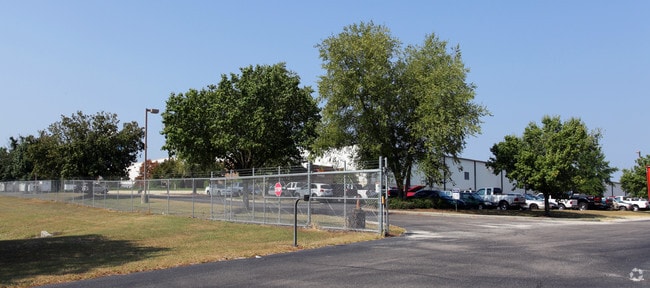
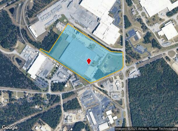
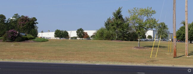
170 Longs Pond Rd
006400-06-007
PARCEL C & PO B
Warehouse
Lexington
X
South Carolina
45063C0241J
28.48 AC
2025
Lexington
2024
Columbia
021041
Columbia, SC
7,752 SF
DEMOGRAPHICS near 170 Longs Pond Rd
1 Mile
3 Mile
5 Mile
2024 Total Population
2,592
20,823
58,159
2029 Population
2,819
22,676
63,753
Pop Growth 2024-2029
+ 8.76%
+ 8.90%
+ 9.62%
Average Age
36
37
37
2024 Total Households
877
7,181
21,256
HH Growth 2024-2029
+ 9.01%
+ 9.07%
+ 9.84%
Median Household Inc
$72,841
$87,898
$73,079
Avg Household Size
2.90
2.90
2.70
2024 Avg HH Vehicles
2.00
2.00
2.00
Median Home Value
$221,519
$227,025
$209,228
Median Year Built
2002
2002
2002
Nearby Places
Map Layers
Map Styles
 Street
 Aerial
- Restaurants
- Banks
- Shops
- Fitness
- Groceries
PUBLIC TRANSPORTATION
AIRPORT
Columbia Metro
DRIVE
WALK
Distance
Columbia Metro
32 min
17.0 mi
Freight Ports
North Charleston Terminal
DRIVE
WALK
Distance
North Charleston Terminal
134 min
114.9 mi
Nearby Properties
Address
Land Use
TOTAL SIZE
Lot Size
Zoning
Address
Land Use
TOTAL SIZE
Lot Size
Zoning
336,700 SF
80.12 AC
ID
Address
Land Use
TOTAL SIZE
Lot Size
Zoning
567,464 SF
44.62 AC
ID
Address
Land Use
TOTAL SIZE
Lot Size
Zoning
97,606 SF
15.92 AC
ID
Address
Land Use
TOTAL SIZE
Lot Size
Zoning
44,100 SF
67.47 AC
RD
Address
Land Use
TOTAL SIZE
Lot Size
Zoning
1,232 SF
0.42 AC
ID
Address
Land Use
TOTAL SIZE
Lot Size
Zoning
15,319 SF
12.72 AC
ID
Address
Land Use
TOTAL SIZE
Lot Size
Zoning
117,188 SF
15.54 AC
ID
Address
Land Use
TOTAL SIZE
Lot Size
Zoning
121.12 AC
RD
Address
Land Use
TOTAL SIZE
Lot Size
Zoning
16,465 SF
182.78 AC
ID
Address
Land Use
TOTAL SIZE
Lot Size
Zoning
56,023 SF
4.52 AC
ID
Address
Land Use
TOTAL SIZE
Lot Size
Zoning
10,776 SF
2.10 AC
ID
Address
Land Use
TOTAL SIZE
Lot Size
Zoning
1,042 SF
6.25 AC
ID
Address
Land Use
TOTAL SIZE
Lot Size
Zoning
11,288 SF
3.08 AC
ID
Address
Land Use
TOTAL SIZE
Lot Size
Zoning
3,072 SF
1.53 AC
RD
Address
Land Use
TOTAL SIZE
Lot Size
Zoning
118.58 AC
RD
Address
Land Use
TOTAL SIZE
Lot Size
Zoning
181.17 AC
ID
Address
Land Use
TOTAL SIZE
Lot Size
Zoning
720 SF
31.37 AC
RD
Address
Land Use
TOTAL SIZE
Lot Size
Zoning
14,000 SF
10.32 AC
ID
Address
Land Use
TOTAL SIZE
Lot Size
Zoning
12,204 SF
1.63 AC
ID
Address
Land Use
TOTAL SIZE
Lot Size
Zoning
8,220 SF
5.35 AC
ID
Address
Land Use
TOTAL SIZE
Lot Size
Zoning
55.76 AC
ID
Address
Land Use
TOTAL SIZE
Lot Size
Zoning
11,203 SF
57.22 AC
ID
Address
Land Use
TOTAL SIZE
Lot Size
Zoning
15,000 SF
2.13 AC
Address
Land Use
TOTAL SIZE
Lot Size
Zoning
19,200 SF
2.93 AC
ID
Address
Land Use
TOTAL SIZE
Lot Size
Zoning
22.69 AC
ID
Address
Land Use
TOTAL SIZE
Lot Size
Zoning
5,108 SF
1.21 AC
RD
Address
Land Use
TOTAL SIZE
Lot Size
Zoning
9,932 SF
3 AC
ID
Address
Land Use
TOTAL SIZE
Lot Size
Zoning
6,000 SF
12.91 AC
ID
Address
Land Use
TOTAL SIZE
Lot Size
Zoning
3,220 SF
5.76 AC
RD
The World's #1 Commercial Real Estate Marketplace
Connect with us
© 2025 CoStar Group
The information above has been obtained from sources believed reliable. While we do not doubt its accuracy we have not verified it and make no guarantee, warranty or representation about it. It is your responsibility to independently confirm its accuracy and completeness. Any projections, opinions, assumptions, or estimates used are for example only and do not represent the current or future performance of the property. The value of this transaction to you depends on tax and other factors which should be evaluated by your tax, financial, and legal advisors. You and your advisors should conduct a careful, independent investigation of the property to determine to your satisfaction the suitability of the property for your needs.