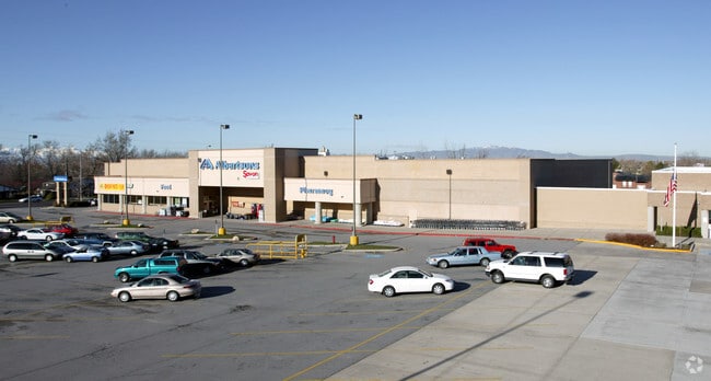
Property Record
170 W 200 N, Kaysville, UT 84037


NEARBY LISTINGS FOR SALE OR LEASE
-
-
No Photo
-
-
-
860-880 North Fairfield Road, Layton, UT 84041
Layton, UT 84041
$14.00 SF/YR
1,475 - 13,692 SF
Retail
-
-
-
View all Kaysville listings for sale on LoopNet.com
Property Detail
170 W 200 N
11-100-0138
Kaysville Ts
Gymhealthspa
BEG AT THE SW COR OF BLK 2, PLAT B, KAYSVILLE TS SURVEY, SD POB BEING N 0^59'55" E ALG THE CENTERLINE OF 200 WEST STR 49.50 FT & S 89^08'08" E 33.00 FT FR THE MONU IN THE INTERSECTION OF 200 NORTH STR
X
Davis
49011C0237F
Utah
2025
4.23 AC
2025
Davis/Weber Counties
126101
Salt Lake City
51,105 SF
Ogden, UT
DEMOGRAPHICS near 170 W 200 N
1 Mile
3 Mile
5 Mile
2024 Total Population
11,480
76,831
144,771
2029 Population
12,109
81,365
153,436
Pop Growth 2024-2029
+ 5.48%
+ 5.90%
+ 5.99%
Average Age
36
35
35
2024 Total Households
3,649
22,632
44,202
HH Growth 2024-2029
+ 5.51%
+ 5.93%
+ 6.00%
Median Household Inc
$81,755
$106,127
$98,548
Avg Household Size
3.10
3.40
3.20
2024 Avg HH Vehicles
2.00
2.00
2.00
Median Home Value
$424,458
$487,146
$459,442
Median Year Built
1982
1991
1994
Nearby Places
Map Layers
Map Styles
 Street
 Aerial
- Restaurants
- Banks
- Shops
- Fitness
- Groceries
PUBLIC TRANSPORTATION
COMMUTER RAIL
Layton (FrontRunner North - Utah Transit Authority (UTA))
DRIVE
WALK
Distance
Layton (FrontRunner North - Utah Transit Authority (UTA))
4 min
2.3 mi
Farmington (FrontRunner North - Utah Transit Authority (UTA))
DRIVE
WALK
Distance
Farmington (FrontRunner North - Utah Transit Authority (UTA))
7 min
4.8 mi
AIRPORT
Salt Lake City International
DRIVE
WALK
Distance
Salt Lake City International
31 min
24.3 mi
Freight Ports
Port of Stockton
DRIVE
WALK
Distance
Port of Stockton
731 min
714.7 mi
Nearby Properties
Address
Land Use
TOTAL SIZE
Lot Size
Zoning
Address
Land Use
TOTAL SIZE
Lot Size
Zoning
346,223 SF
36.29 AC
BRP
Address
Land Use
TOTAL SIZE
Lot Size
Zoning
102,978 SF
6.42 AC
Address
Land Use
TOTAL SIZE
Lot Size
Zoning
100,348 SF
21.75 AC
R18
Address
Land Use
TOTAL SIZE
Lot Size
Zoning
67,233 SF
32.52 AC
A1
Address
Land Use
TOTAL SIZE
Lot Size
Zoning
16,184 SF
23.31 AC
PU
Address
Land Use
TOTAL SIZE
Lot Size
Zoning
94,532 SF
7.07 AC
Address
Land Use
TOTAL SIZE
Lot Size
Zoning
147,675 SF
11.25 AC
C-H
Address
Land Use
TOTAL SIZE
Lot Size
Zoning
111,724 SF
10.72 AC
RA
Address
Land Use
TOTAL SIZE
Lot Size
Zoning
67,536 SF
13.16 AC
LI
Address
Land Use
TOTAL SIZE
Lot Size
Zoning
104,342 SF
18.54 AC
M2
Address
Land Use
TOTAL SIZE
Lot Size
Zoning
61,926 SF
40.43 AC
PU
Address
Land Use
TOTAL SIZE
Lot Size
Zoning
73,229 SF
9.94 AC
R120
Address
Land Use
TOTAL SIZE
Lot Size
Zoning
140,364 SF
6.47 AC
RH
Address
Land Use
TOTAL SIZE
Lot Size
Zoning
218,896 SF
2.76 AC
MUTOD
Address
Land Use
TOTAL SIZE
Lot Size
Zoning
119,988 SF
10.63 AC
LI
Address
Land Use
TOTAL SIZE
Lot Size
Zoning
72,750 SF
13.09 AC
A1
Address
Land Use
TOTAL SIZE
Lot Size
Zoning
312,601 SF
13.30 AC
R18
Address
Land Use
TOTAL SIZE
Lot Size
Zoning
220,887 SF
12.17 AC
CH
Address
Land Use
TOTAL SIZE
Lot Size
Zoning
61,864 SF
11.66 AC
Address
Land Use
TOTAL SIZE
Lot Size
Zoning
126,304 SF
4.70 AC
BRP
Address
Land Use
TOTAL SIZE
Lot Size
Zoning
7,098 SF
183.50 AC
A
Address
Land Use
TOTAL SIZE
Lot Size
Zoning
77,091 SF
11.09 AC
A
Address
Land Use
TOTAL SIZE
Lot Size
Zoning
43,620 SF
67.58 AC
PU
Address
Land Use
TOTAL SIZE
Lot Size
Zoning
300,026 SF
4.39 AC
Address
Land Use
TOTAL SIZE
Lot Size
Zoning
52,223 SF
7.01 AC
Address
Land Use
TOTAL SIZE
Lot Size
Zoning
399,469 SF
7.88 AC
M2
Address
Land Use
TOTAL SIZE
Lot Size
Zoning
122,792 SF
21.72 AC
R18
Address
Land Use
TOTAL SIZE
Lot Size
Zoning
83,616 SF
7.48 AC
Address
Land Use
TOTAL SIZE
Lot Size
Zoning
3,640 SF
6.45 AC
R18
Address
Land Use
TOTAL SIZE
Lot Size
Zoning
1,120 SF
45.92 AC
PU
The World's #1 Commercial Real Estate Marketplace
Connect with us
© 2026 CoStar Group
The information above has been obtained from sources believed reliable. While we do not doubt its accuracy we have not verified it and make no guarantee, warranty or representation about it. It is your responsibility to independently confirm its accuracy and completeness. Any projections, opinions, assumptions, or estimates used are for example only and do not represent the current or future performance of the property. The value of this transaction to you depends on tax and other factors which should be evaluated by your tax, financial, and legal advisors. You and your advisors should conduct a careful, independent investigation of the property to determine to your satisfaction the suitability of the property for your needs.