Property Record
1700 55Th St Ne, Canton, OH 44721

Property Detail
1700 55Th St Ne
00304667
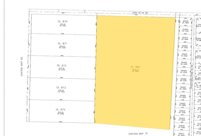
OL 880 55.51A
Commercialnec
Stark
B and X Area of moderate flood hazard, usually the area between the limits of the 100-year and 500-year floods.
Ohio
0
55.51 AC
2025
Stark County
712202
Cleveland
116,904 SF
Canton-Massillon, OH
NEARBY LISTINGS FOR SALE OR LEASE
DEMOGRAPHICS near 1700 55Th St Ne
1 mile
3 mile
5 mile
2025 Total Population
5,423
58,082
129,586
2030 Population
5,349
57,783
129,509
Pop Growth 2025-2030
(1.36%)
(0.51%)
(0.06%)
Average Age
45
42
42
2025 Total Households
2,232
24,135
55,294
HH Growth 2025-2030
(1.43%)
(0.56%)
(0.10%)
Median Household Inc
$86,628
$64,960
$58,423
Avg Household Size
2.40
2.30
2.20
2025 Avg HH Vehicles
2.00
2.00
2.00
Median Home Value
$239,511
$195,039
$182,333
Median Year Built
1978
1964
1963
Nearby Places
Map Layers
Map Styles
 Street
 Aerial
Layers
 Traffic
 Biking
Places
Listings with unknown addresses are not visible on the map
- Restaurants
- Banks
- Shops
- Fitness
- Groceries
PUBLIC TRANSPORTATION
AIRPORT
Akron-Canton Regional
Drive
Walk
Distance
Akron-Canton Regional
16 min
8.8 mi
Freight Ports
Port of Toledo
Drive
Walk
Distance
Port of Toledo
188 min
156.1 mi
Nearby Properties
Address
Land Use
TOTAL SIZE
Lot Size
Zoning
Address
Land Use
TOTAL SIZE
Lot Size
Zoning
730,347 SF
55.42 AC
Address
Land Use
TOTAL SIZE
Lot Size
Zoning
365,452 SF
113.92 AC
Address
Land Use
TOTAL SIZE
Lot Size
Zoning
91.83 AC
Address
Land Use
TOTAL SIZE
Lot Size
Zoning
356,083 SF
32.10 AC
Address
Land Use
TOTAL SIZE
Lot Size
Zoning
272,327 SF
23.62 AC
Address
Land Use
TOTAL SIZE
Lot Size
Zoning
272,888 SF
27.61 AC
Address
Land Use
TOTAL SIZE
Lot Size
Zoning
327,119 SF
50.74 AC
Address
Land Use
TOTAL SIZE
Lot Size
Zoning
140,060 SF
27.57 AC
Address
Land Use
TOTAL SIZE
Lot Size
Zoning
118,889 SF
19.77 AC
Address
Land Use
TOTAL SIZE
Lot Size
Zoning
195,551 SF
37.77 AC
Address
Land Use
TOTAL SIZE
Lot Size
Zoning
93,932 SF
11.31 AC
Address
Land Use
TOTAL SIZE
Lot Size
Zoning
53,687 SF
14.94 AC
Address
Land Use
TOTAL SIZE
Lot Size
Zoning
465,350 SF
7.95 AC
Address
Land Use
TOTAL SIZE
Lot Size
Zoning
180,088 SF
71.80 AC
Address
Land Use
TOTAL SIZE
Lot Size
Zoning
235,290 SF
25.58 AC
Address
Land Use
TOTAL SIZE
Lot Size
Zoning
145,719 SF
43.60 AC
Address
Land Use
TOTAL SIZE
Lot Size
Zoning
217,695 SF
19.46 AC
Address
Land Use
TOTAL SIZE
Lot Size
Zoning
135,840 SF
21 AC
Address
Land Use
TOTAL SIZE
Lot Size
Zoning
52,876 SF
4.96 AC
Address
Land Use
TOTAL SIZE
Lot Size
Zoning
121,790 SF
5.94 AC
Address
Land Use
TOTAL SIZE
Lot Size
Zoning
118,052 SF
12.52 AC
Address
Land Use
TOTAL SIZE
Lot Size
Zoning
138,720 SF
Address
Land Use
TOTAL SIZE
Lot Size
Zoning
126,987 SF
9.77 AC
Address
Land Use
TOTAL SIZE
Lot Size
Zoning
217,634 SF
11.85 AC
Address
Land Use
TOTAL SIZE
Lot Size
Zoning
72,405 SF
1.43 AC
Address
Land Use
TOTAL SIZE
Lot Size
Zoning
102,048 SF
7.45 AC
Address
Land Use
TOTAL SIZE
Lot Size
Zoning
54,150 SF
4.14 AC
Address
Land Use
TOTAL SIZE
Lot Size
Zoning
174,954 SF
16.30 AC
Address
Land Use
TOTAL SIZE
Lot Size
Zoning
70,901 SF
0.27 AC
The World's #1 Commercial Real Estate Marketplace
Connect with us
© 2026 CoStar Group
The information above has been obtained from sources believed reliable. While we do not doubt its accuracy we have not verified it and make no guarantee, warranty or representation about it. It is your responsibility to independently confirm its accuracy and completeness. Any projections, opinions, assumptions, or estimates used are for example only and do not represent the current or future performance of the property. The value of this transaction to you depends on tax and other factors which should be evaluated by your tax, financial, and legal advisors. You and your advisors should conduct a careful, independent investigation of the property to determine to your satisfaction the suitability of the property for your needs.