Property Record
1700 Altus St, Conway, AR 72032


Save to a Folder
{{folder.Name}}
{{folder.ListingIds.length}} Properties
{{folder.ListingIds.length}} Property
Create a New Folder
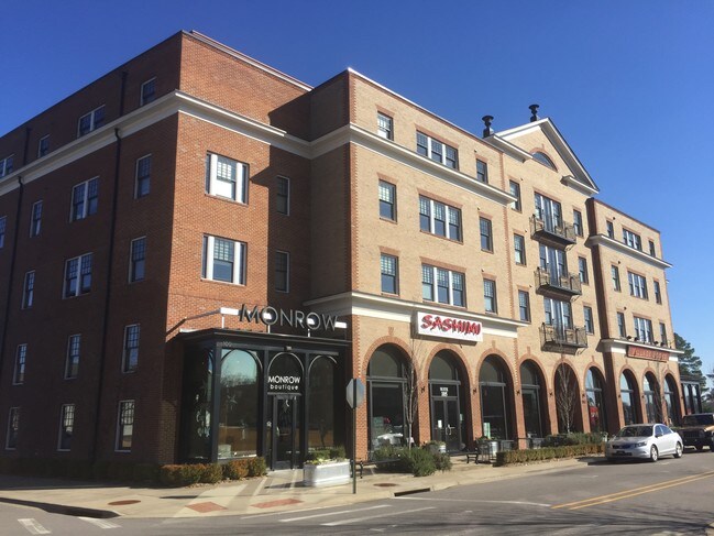
Property Detail
1700 Altus St
Little Rock-North Little Rock-Conway, AR
THE VILLAGE AT HENDRIX IMP DIST NO. 1
710-08199-191
Faulkner
Commercialnec
Arkansas
B and X Area of moderate flood hazard, usually the area between the limits of the 100-year and 500-year floods.
91
2025
0.36 AC
2025
Faulkner County
030502
Little Rock/N Little Rock
3,321 SF
NEARBY LISTINGS FOR SALE OR LEASE
DEMOGRAPHICS near 1700 Altus St
1 mile
3 mile
5 mile
2025 Total Population
6,992
47,529
75,276
2030 Population
7,360
50,059
79,218
Pop Growth 2025-2030
+ 5.26%
+ 5.32%
+ 5.24%
Average Age
34
36
36
2025 Total Households
2,791
18,627
29,721
HH Growth 2025-2030
+ 5.59%
+ 5.76%
+ 5.60%
Median Household Inc
$60,262
$60,521
$65,511
Avg Household Size
2.10
2.30
2.30
2025 Avg HH Vehicles
2.00
2.00
2.00
Median Home Value
$176,434
$234,812
$258,177
Median Year Built
1984
1993
1997
Nearby Places
Map Layers
Map Styles
 Street
 Aerial
Layers
 Traffic
 Biking
Places
Listings with unknown addresses are not visible on the map
- Restaurants
- Banks
- Shops
- Fitness
- Groceries
PUBLIC TRANSPORTATION
AIRPORT
Bill and Hillary Clinton Ntl/Adams Field
Drive
Walk
Distance
Bill and Hillary Clinton Ntl/Adams Field
41 min
35.8 mi
Freight Ports
Tulsa Port of Inola
Drive
Walk
Distance
Tulsa Port of Inola
252 min
230.3 mi
SALE & LEASE HISTORY
LISTING DATE
SALE/LEASE

Dec 27, 2018
For Lease
Dec 16, 2019
For Lease
Nearby Properties
Address
Land Use
TOTAL SIZE
Lot Size
Zoning
Address
Land Use
TOTAL SIZE
Lot Size
Zoning
158,289 SF
28.42 AC
Address
Land Use
TOTAL SIZE
Lot Size
Zoning
214,622 SF
38.85 AC
Address
Land Use
TOTAL SIZE
Lot Size
Zoning
123,032 SF
9.59 AC
Address
Land Use
TOTAL SIZE
Lot Size
Zoning
89,037 SF
11.30 AC
Address
Land Use
TOTAL SIZE
Lot Size
Zoning
164,655 SF
10.36 AC
Address
Land Use
TOTAL SIZE
Lot Size
Zoning
26,928 SF
2.37 AC
Address
Land Use
TOTAL SIZE
Lot Size
Zoning
107,636 SF
Address
Land Use
TOTAL SIZE
Lot Size
Zoning
38,442 SF
30.57 AC
Address
Land Use
TOTAL SIZE
Lot Size
Zoning
21,664 SF
13.85 AC
Address
Land Use
TOTAL SIZE
Lot Size
Zoning
77,129 SF
12.84 AC
Address
Land Use
TOTAL SIZE
Lot Size
Zoning
21,532 SF
13.21 AC
Address
Land Use
TOTAL SIZE
Lot Size
Zoning
29,223 SF
8.88 AC
Address
Land Use
TOTAL SIZE
Lot Size
Zoning
30,312 SF
7.24 AC
Address
Land Use
TOTAL SIZE
Lot Size
Zoning
43,340 SF
28.77 AC
Address
Land Use
TOTAL SIZE
Lot Size
Zoning
171,059 SF
13.34 AC
Address
Land Use
TOTAL SIZE
Lot Size
Zoning
42,457 SF
16.89 AC
Address
Land Use
TOTAL SIZE
Lot Size
Zoning
34,086 SF
9.77 AC
Address
Land Use
TOTAL SIZE
Lot Size
Zoning
31,520 SF
12.22 AC
Address
Land Use
TOTAL SIZE
Lot Size
Zoning
98,915 SF
2.77 AC
Address
Land Use
TOTAL SIZE
Lot Size
Zoning
138,840 SF
15.46 AC
Address
Land Use
TOTAL SIZE
Lot Size
Zoning
1,811 SF
23.47 AC
Address
Land Use
TOTAL SIZE
Lot Size
Zoning
31,584 SF
8.60 AC
Address
Land Use
TOTAL SIZE
Lot Size
Zoning
12,419 SF
1.56 AC
Address
Land Use
TOTAL SIZE
Lot Size
Zoning
21,511 SF
20 AC
Address
Land Use
TOTAL SIZE
Lot Size
Zoning
28,167 SF
6.85 AC
Address
Land Use
TOTAL SIZE
Lot Size
Zoning
103,278 SF
10.03 AC
Address
Land Use
TOTAL SIZE
Lot Size
Zoning
61,971 SF
4.77 AC
Address
Land Use
TOTAL SIZE
Lot Size
Zoning
12,948 SF
7.18 AC
Address
Land Use
TOTAL SIZE
Lot Size
Zoning
126,911 SF
10.19 AC
Address
Land Use
TOTAL SIZE
Lot Size
Zoning
15,000 SF
7.50 AC
The World's #1 Commercial Real Estate Marketplace
Connect with us
© 2026 CoStar Group
The information above has been obtained from sources believed reliable. While we do not doubt its accuracy we have not verified it and make no guarantee, warranty or representation about it. It is your responsibility to independently confirm its accuracy and completeness. Any projections, opinions, assumptions, or estimates used are for example only and do not represent the current or future performance of the property. The value of this transaction to you depends on tax and other factors which should be evaluated by your tax, financial, and legal advisors. You and your advisors should conduct a careful, independent investigation of the property to determine to your satisfaction the suitability of the property for your needs.