Property Record
1700 E 4Th St, Austin, TX 78702
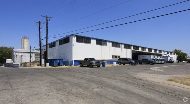

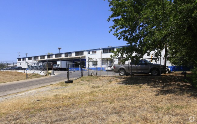

Property Detail
1700 E 4Th St
Austin-Round Rock-San Marcos, TX
Division O
191954
2.5768 AC OF OLT 6 DIVISION 0 & VAC ST & 1.7577 AC OF LOT 1 & LOT 2 BLK 1 HENKE SUBD
Multifamilydwelling
Travis
X
Texas
48453C0465K
1,2
2025
4.34 AC
2025
East
000902
Austin
255,790 SF
NEARBY LISTINGS FOR SALE OR LEASE
DEMOGRAPHICS near 1700 E 4Th St
1 mile
3 mile
5 mile
2024 Total Population
22,868
202,073
368,169
2029 Population
25,277
221,477
402,898
Pop Growth 2024-2029
+ 10.53%
+ 9.60%
+ 9.43%
Average Age
38
34
36
2024 Total Households
11,714
94,679
167,041
HH Growth 2024-2029
+ 11.76%
+ 10.71%
+ 10.37%
Median Household Inc
$98,152
$71,755
$75,285
Avg Household Size
1.80
1.90
2.00
2024 Avg HH Vehicles
1.00
1.00
2.00
Median Home Value
$689,836
$672,691
$628,035
Median Year Built
2009
2000
1992
Nearby Places
Map Layers
Map Styles
 Street
 Aerial
Transit
 Traffic
 Biking
Places
Listings with unknown addresses are not visible on the map
- Restaurants
- Banks
- Shops
- Fitness
- Groceries
PUBLIC TRANSPORTATION
TRANSIT/SUBWAY
Plaza Saltillo Station (550-Metro Rail Red Line - Capital Metro)
Drive
Walk
Distance
Plaza Saltillo Station (550-Metro Rail Red Line - Capital Metro)
0 min
6 min
0.2 mi
Downtown Station (550-Metro Rail Red Line - Capital Metro)
Drive
Walk
Distance
Downtown Station (550-Metro Rail Red Line - Capital Metro)
3 min
18 min
1.0 mi
COMMUTER RAIL
Austin (Texas Eagle - Amtrak)
Drive
Walk
Distance
Austin (Texas Eagle - Amtrak)
6 min
2.4 mi
AIRPORT
Austin-Bergstrom International
Drive
Walk
Distance
Austin-Bergstrom International
20 min
10.3 mi
Freight Ports
Calhoun Port
Drive
Walk
Distance
Calhoun Port
185 min
153.7 mi
Nearby Properties
Address
Land Use
TOTAL SIZE
Lot Size
Zoning
Address
Land Use
TOTAL SIZE
Lot Size
Zoning
9,768 SF
386.80 AC
Address
Land Use
TOTAL SIZE
Lot Size
Zoning
1,008,789 SF
17.50 AC
Address
Land Use
TOTAL SIZE
Lot Size
Zoning
20,550 SF
14.15 AC
Address
Land Use
TOTAL SIZE
Lot Size
Zoning
262 SF
65.06 AC
Address
Land Use
TOTAL SIZE
Lot Size
Zoning
28.39 AC
Address
Land Use
TOTAL SIZE
Lot Size
Zoning
Address
Land Use
TOTAL SIZE
Lot Size
Zoning
28.62 AC
Address
Land Use
TOTAL SIZE
Lot Size
Zoning
1,156,135 SF
1.74 AC
Address
Land Use
TOTAL SIZE
Lot Size
Zoning
1,003,475 SF
1.84 AC
Address
Land Use
TOTAL SIZE
Lot Size
Zoning
27.17 AC
Address
Land Use
TOTAL SIZE
Lot Size
Zoning
136,900 SF
19.32 AC
Address
Land Use
TOTAL SIZE
Lot Size
Zoning
786,600 SF
1.27 AC
Address
Land Use
TOTAL SIZE
Lot Size
Zoning
24.50 AC
Address
Land Use
TOTAL SIZE
Lot Size
Zoning
9,034 SF
28.69 AC
Address
Land Use
TOTAL SIZE
Lot Size
Zoning
30.96 AC
Address
Land Use
TOTAL SIZE
Lot Size
Zoning
709,300 SF
0.94 AC
Address
Land Use
TOTAL SIZE
Lot Size
Zoning
498,684 SF
61.86 AC
Address
Land Use
TOTAL SIZE
Lot Size
Zoning
18.52 AC
Address
Land Use
TOTAL SIZE
Lot Size
Zoning
47.20 AC
Address
Land Use
TOTAL SIZE
Lot Size
Zoning
1,400,000 SF
3.07 AC
Address
Land Use
TOTAL SIZE
Lot Size
Zoning
789,220 SF
14.34 AC
Address
Land Use
TOTAL SIZE
Lot Size
Zoning
35,041 SF
28.65 AC
Address
Land Use
TOTAL SIZE
Lot Size
Zoning
21 AC
Address
Land Use
TOTAL SIZE
Lot Size
Zoning
999,200 SF
25 AC
Address
Land Use
TOTAL SIZE
Lot Size
Zoning
513,567 SF
1.78 AC
Address
Land Use
TOTAL SIZE
Lot Size
Zoning
500,511 SF
0.82 AC
Address
Land Use
TOTAL SIZE
Lot Size
Zoning
609,613 SF
1.31 AC
Address
Land Use
TOTAL SIZE
Lot Size
Zoning
24.06 AC
Address
Land Use
TOTAL SIZE
Lot Size
Zoning
826,478 SF
1.75 AC
The World's #1 Commercial Real Estate Marketplace
Connect with us
© 2026 CoStar Group
The information above has been obtained from sources believed reliable. While we do not doubt its accuracy we have not verified it and make no guarantee, warranty or representation about it. It is your responsibility to independently confirm its accuracy and completeness. Any projections, opinions, assumptions, or estimates used are for example only and do not represent the current or future performance of the property. The value of this transaction to you depends on tax and other factors which should be evaluated by your tax, financial, and legal advisors. You and your advisors should conduct a careful, independent investigation of the property to determine to your satisfaction the suitability of the property for your needs.