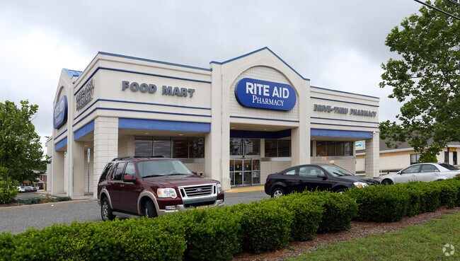
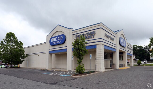
Property Record
1700 E Main St, Millville, NJ 08332

Property Detail
1700 E Main St
10-00492-0000-00004
ADDITIONAL LOTS: RITE AID
Storebuilding
Cumberland
B-1
New Jersey
B and X Area of moderate flood hazard, usually the area between the limits of the 100-year and 500-year floods.
4
2024
1.14 AC
2025
Vineland/Bridgeton
030401
Philadelphia
11,057 SF
Vineland, NJ
NEARBY LISTINGS FOR SALE OR LEASE
-
-
View all Millville listings for sale on LoopNet.com
DEMOGRAPHICS near 1700 E Main St
1 mile
3 mile
5 mile
2025 Total Population
7,817
28,800
46,123
2030 Population
8,152
29,803
47,694
Pop Growth 2025-2030
+ 4.29%
+ 3.48%
+ 3.41%
Average Age
38
39
40
2025 Total Households
2,987
11,195
17,776
HH Growth 2025-2030
+ 4.35%
+ 3.47%
+ 3.41%
Median Household Inc
$63,694
$62,483
$70,136
Avg Household Size
2.50
2.50
2.50
2025 Avg HH Vehicles
2.00
2.00
2.00
Median Home Value
$185,899
$206,941
$226,182
Median Year Built
1958
1965
1971
Nearby Places
Map Layers
Map Styles
 Street
 Aerial
Layers
 Traffic
 Biking
Places
Listings with unknown addresses are not visible on the map
- Restaurants
- Banks
- Shops
- Fitness
- Groceries
PUBLIC TRANSPORTATION
AIRPORT
Atlantic City International
Drive
Walk
Distance
Atlantic City International
62 min
29.2 mi
Freight Ports
Port of Wilmington, RI
Drive
Walk
Distance
Port of Wilmington, RI
59 min
44.2 mi
Nearby Properties
Address
Land Use
TOTAL SIZE
Lot Size
Zoning
Address
Land Use
TOTAL SIZE
Lot Size
Zoning
43.69 AC
X/T
Address
Land Use
TOTAL SIZE
Lot Size
Zoning
57.43 AC
B4
Address
Land Use
TOTAL SIZE
Lot Size
Zoning
96.90 AC
Address
Land Use
TOTAL SIZE
Lot Size
Zoning
392,928 SF
127.70 AC
I-1
Address
Land Use
TOTAL SIZE
Lot Size
Zoning
Address
Land Use
TOTAL SIZE
Lot Size
Zoning
5.90 AC
Address
Land Use
TOTAL SIZE
Lot Size
Zoning
5.90 AC
Address
Land Use
TOTAL SIZE
Lot Size
Zoning
73.09 AC
I-1
Address
Land Use
TOTAL SIZE
Lot Size
Zoning
31.69 AC
B-4
Address
Land Use
TOTAL SIZE
Lot Size
Zoning
47.01 AC
Address
Land Use
TOTAL SIZE
Lot Size
Zoning
11.81 AC
X
Address
Land Use
TOTAL SIZE
Lot Size
Zoning
Address
Land Use
TOTAL SIZE
Lot Size
Zoning
16.94 AC
Address
Land Use
TOTAL SIZE
Lot Size
Zoning
16.70 AC
X
Address
Land Use
TOTAL SIZE
Lot Size
Zoning
45.91 AC
Address
Land Use
TOTAL SIZE
Lot Size
Zoning
4.65 AC
Address
Land Use
TOTAL SIZE
Lot Size
Zoning
8.72 AC
Address
Land Use
TOTAL SIZE
Lot Size
Zoning
2.67 AC
Address
Land Use
TOTAL SIZE
Lot Size
Zoning
63,012 SF
8.72 AC
Address
Land Use
TOTAL SIZE
Lot Size
Zoning
22.26 AC
Address
Land Use
TOTAL SIZE
Lot Size
Zoning
63,104 SF
11.11 AC
B-4
Address
Land Use
TOTAL SIZE
Lot Size
Zoning
13.65 AC
Address
Land Use
TOTAL SIZE
Lot Size
Zoning
10.67 AC
I3
Address
Land Use
TOTAL SIZE
Lot Size
Zoning
26,494 SF
3.43 AC
Address
Land Use
TOTAL SIZE
Lot Size
Zoning
1.28 AC
Address
Land Use
TOTAL SIZE
Lot Size
Zoning
3,702 SF
22.76 AC
B4I1
Address
Land Use
TOTAL SIZE
Lot Size
Zoning
91,584 SF
10.92 AC
Address
Land Use
TOTAL SIZE
Lot Size
Zoning
7.81 AC
Address
Land Use
TOTAL SIZE
Lot Size
Zoning
5,000 SF
2.54 AC
X
Address
Land Use
TOTAL SIZE
Lot Size
Zoning
94,630 SF
32.14 AC
The World's #1 Commercial Real Estate Marketplace
Connect with us
© 2026 CoStar Group
The information above has been obtained from sources believed reliable. While we do not doubt its accuracy we have not verified it and make no guarantee, warranty or representation about it. It is your responsibility to independently confirm its accuracy and completeness. Any projections, opinions, assumptions, or estimates used are for example only and do not represent the current or future performance of the property. The value of this transaction to you depends on tax and other factors which should be evaluated by your tax, financial, and legal advisors. You and your advisors should conduct a careful, independent investigation of the property to determine to your satisfaction the suitability of the property for your needs.