Property Record
1700 Enterprise Way Se, Marietta, GA 30067
NEARBY LISTINGS FOR SALE OR LEASE
Property Detail
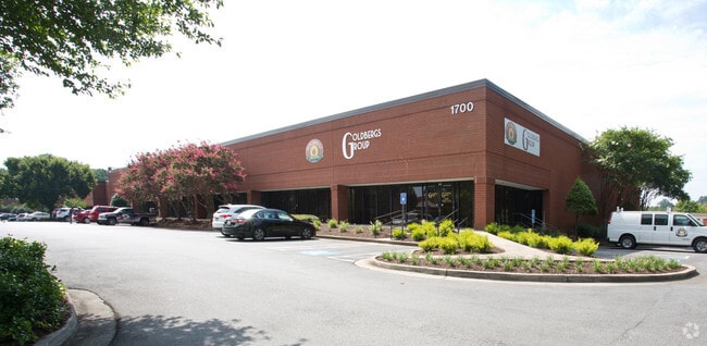
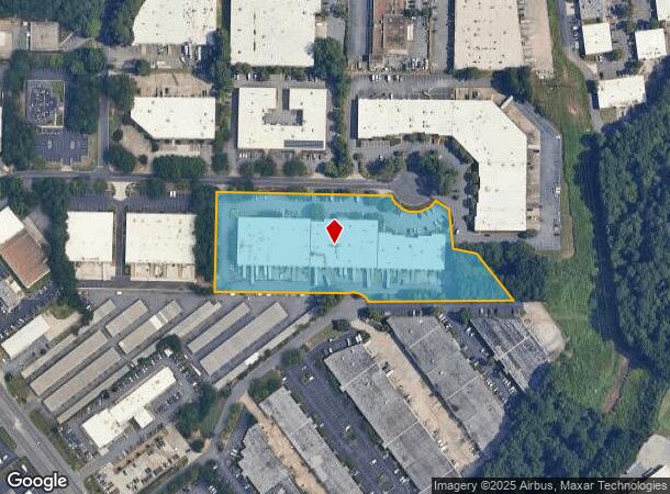
1700 Enterprise Way Se
Officebuilding
Cobb
X
Georgia
13067C0136G
5.20 AC
2025
SE Cobb Cnty/Marietta
2025
Atlanta
030414
Atlanta-Sandy Springs-Roswell, GA
74,938 SF
17-0712-0-020-0
DEMOGRAPHICS near 1700 Enterprise Way Se
1 Mile
3 Mile
5 Mile
2024 Total Population
8,082
99,443
242,609
2029 Population
8,072
101,789
247,662
Pop Growth 2024-2029
(0.12%)
+ 2.36%
+ 2.08%
Average Age
31
35
37
2024 Total Households
3,639
45,861
104,230
HH Growth 2024-2029
+ 0.05%
+ 2.21%
+ 2.05%
Median Household Inc
$40,617
$71,868
$78,297
Avg Household Size
2.20
2.10
2.20
2024 Avg HH Vehicles
1.00
2.00
2.00
Median Home Value
$243,333
$339,971
$391,876
Median Year Built
1980
1985
1985
Nearby Places
Map Layers
Map Styles
 Street
 Aerial
- Restaurants
- Banks
- Shops
- Fitness
- Groceries
PUBLIC TRANSPORTATION
AIRPORT
Hartsfield - Jackson Atlanta International
DRIVE
WALK
Distance
Hartsfield - Jackson Atlanta International
36 min
23.8 mi
SALE & LEASE HISTORY
LISTING DATE
SALE/LEASE

Sep 24, 2016
For Lease
Nov 07, 2017
For Lease
Jul 20, 2020
For Lease
Jan 09, 2020
For Lease
Nearby Properties
Address
Land Use
TOTAL SIZE
Lot Size
Zoning
Address
Land Use
TOTAL SIZE
Lot Size
Zoning
41,500 SF
15.61 AC
RRC
Address
Land Use
TOTAL SIZE
Lot Size
Zoning
649,754 SF
20.73 AC
PSC/CRC
Address
Land Use
TOTAL SIZE
Lot Size
Zoning
1,221,836 SF
12.32 AC
GC
Address
Land Use
TOTAL SIZE
Lot Size
Zoning
417,453 SF
21.94 AC
RMR
Address
Land Use
TOTAL SIZE
Lot Size
Zoning
610,147 SF
45.74 AC
RRC
Address
Land Use
TOTAL SIZE
Lot Size
Zoning
789,925 SF
3.77 AC
GC
Address
Land Use
TOTAL SIZE
Lot Size
Zoning
553,125 SF
42.07 AC
PRD MF
Address
Land Use
TOTAL SIZE
Lot Size
Zoning
968,384 SF
4.93 AC
GC
Address
Land Use
TOTAL SIZE
Lot Size
Zoning
237,743 SF
10.32 AC
RRC
Address
Land Use
TOTAL SIZE
Lot Size
Zoning
468,079 SF
31.79 AC
RMR
Address
Land Use
TOTAL SIZE
Lot Size
Zoning
1,779,364 SF
8.66 AC
OHR
Address
Land Use
TOTAL SIZE
Lot Size
Zoning
583,570 SF
4.56 AC
PVC/OI
Address
Land Use
TOTAL SIZE
Lot Size
Zoning
883,054 SF
3 AC
GC
Address
Land Use
TOTAL SIZE
Lot Size
Zoning
480,544 SF
2.36 AC
RRC
Address
Land Use
TOTAL SIZE
Lot Size
Zoning
483,147 SF
29.70 AC
RM-16
Address
Land Use
TOTAL SIZE
Lot Size
Zoning
3.51 AC
RRC
Address
Land Use
TOTAL SIZE
Lot Size
Zoning
2.81 AC
RRC
Address
Land Use
TOTAL SIZE
Lot Size
Zoning
612,660 SF
46.67 AC
RM-16
Address
Land Use
TOTAL SIZE
Lot Size
Zoning
389,428 SF
22.50 AC
RM12
Address
Land Use
TOTAL SIZE
Lot Size
Zoning
550,144 SF
4.70 AC
RRC
Address
Land Use
TOTAL SIZE
Lot Size
Zoning
560,836 SF
60.28 AC
RM-8
Address
Land Use
TOTAL SIZE
Lot Size
Zoning
379,000 SF
29.86 AC
RM-12
Address
Land Use
TOTAL SIZE
Lot Size
Zoning
643,086 SF
40.63 AC
RM-12
Address
Land Use
TOTAL SIZE
Lot Size
Zoning
787,804 SF
5.64 AC
GC
Address
Land Use
TOTAL SIZE
Lot Size
Zoning
486,095 SF
5.57 AC
UC
Address
Land Use
TOTAL SIZE
Lot Size
Zoning
437,793 SF
41.12 AC
RM-16
Address
Land Use
TOTAL SIZE
Lot Size
Zoning
606,936 SF
7.92 AC
GC
Address
Land Use
TOTAL SIZE
Lot Size
Zoning
5.50 AC
RRC
Address
Land Use
TOTAL SIZE
Lot Size
Zoning
473,199 SF
24.09 AC
RM-16
Address
Land Use
TOTAL SIZE
Lot Size
Zoning
605,670 SF
4.10 AC
GC
The World's #1 Commercial Real Estate Marketplace
Connect with us
© 2025 CoStar Group
The information above has been obtained from sources believed reliable. While we do not doubt its accuracy we have not verified it and make no guarantee, warranty or representation about it. It is your responsibility to independently confirm its accuracy and completeness. Any projections, opinions, assumptions, or estimates used are for example only and do not represent the current or future performance of the property. The value of this transaction to you depends on tax and other factors which should be evaluated by your tax, financial, and legal advisors. You and your advisors should conduct a careful, independent investigation of the property to determine to your satisfaction the suitability of the property for your needs.