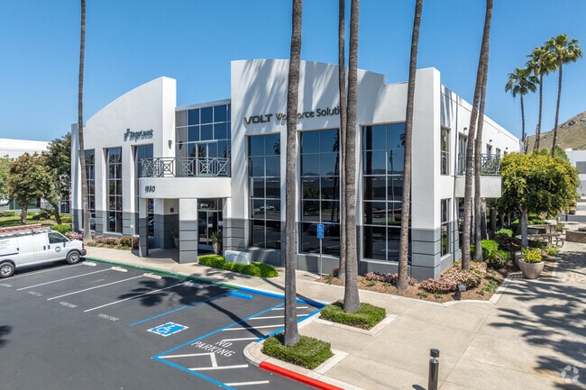
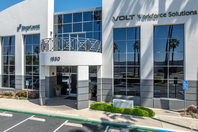
Property Record
1650 Iowa Ave, Riverside, CA 92507

Save to a Folder
{{folder.Name}}
{{folder.ListingIds.length}} Properties
{{folder.ListingIds.length}} Property
Create a New Folder
Current Lease Availabilities
Property Detail
1650 Iowa Ave
Riverside-San Bernardino-Ontario, CA
2.75 ACRES IN PAR 2 PM 163/084 PM 25073
249-130-041
Riverside
Officebuilding
California
B and X Area of moderate flood hazard, usually the area between the limits of the 100-year and 500-year floods.
2
2024
2.75 AC
2025
Riverside
042210
Inland Empire (California)
36,420 SF
NEARBY LISTINGS FOR SALE OR LEASE
DEMOGRAPHICS near 1650 Iowa Ave
1 mile
3 mile
5 mile
2025 Total Population
11,068
92,292
204,906
2030 Population
11,293
94,755
209,545
Pop Growth 2025-2030
+ 2.03%
+ 2.67%
+ 2.26%
Average Age
32
34
36
2025 Total Households
3,855
27,685
63,507
HH Growth 2025-2030
+ 1.66%
+ 2.29%
+ 1.96%
Median Household Inc
$64,265
$78,892
$86,755
Avg Household Size
2.70
2.90
3.00
2025 Avg HH Vehicles
2.00
2.00
2.00
Median Home Value
$418,162
$572,444
$609,500
Median Year Built
1981
1976
1977
Nearby Places
Map Layers
Map Styles
 Street
 Aerial
Layers
 Traffic
 Biking
Places
Listings with unknown addresses are not visible on the map
- Restaurants
- Banks
- Shops
- Fitness
- Groceries
PUBLIC TRANSPORTATION
COMMUTER RAIL
Riverside-Hunter Park/Ucr (Metrolink 91-Perris Valley Line - Metrolink Trains)
Drive
Walk
Distance
Riverside-Hunter Park/Ucr (Metrolink 91-Perris Valley Line - Metrolink Trains)
1 min
5 min
0.3 mi
Riverside-Downtown (91 Line - Southern California Regional Rail Authority (Metrolink), Inland Empire-Orange County Line - Southern California Regional Rail Authority (Metrolink), Riverside Line - Southern California Regional Rail Authority (Metrolink))
Drive
Walk
Distance
Riverside-Downtown (91 Line - Southern California Regional Rail Authority (Metrolink), Inland Empire-Orange County Line - Southern California Regional Rail Authority (Metrolink), Riverside Line - Southern California Regional Rail Authority (Metrolink))
8 min
3.1 mi
AIRPORT
Ontario International
Drive
Walk
Distance
Ontario International
26 min
19.2 mi
Freight Ports
Port of Long Beach
Drive
Walk
Distance
Port of Long Beach
76 min
58.9 mi
The World's #1 Commercial Real Estate Marketplace
Connect with us
© 2026 CoStar Group
The information above has been obtained from sources believed reliable. While we do not doubt its accuracy we have not verified it and make no guarantee, warranty or representation about it. It is your responsibility to independently confirm its accuracy and completeness. Any projections, opinions, assumptions, or estimates used are for example only and do not represent the current or future performance of the property. The value of this transaction to you depends on tax and other factors which should be evaluated by your tax, financial, and legal advisors. You and your advisors should conduct a careful, independent investigation of the property to determine to your satisfaction the suitability of the property for your needs.