Property Record
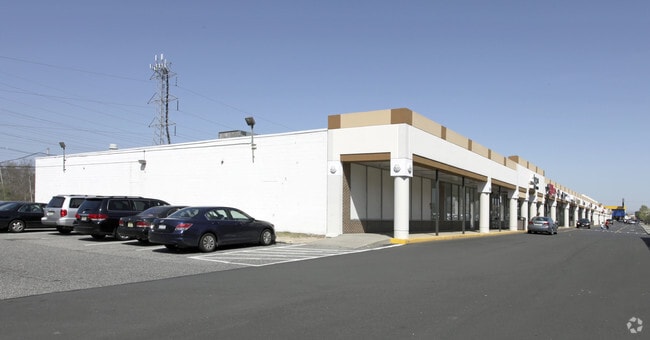
1700 Madison Ave, Lakewood, NJ 08701


NEARBY LISTINGS FOR SALE OR LEASE
Property Detail
1700 Madison Ave
New York-Jersey City-White Plains, NY-NJ
Pine Lake Park Estates
15-00027-0000-00063
22.26AC FIRE SUPPRESSION
Commercialnec
Ocean
AE
New Jersey
34025C0430F
63
2024
22.26 AC
2025
Ocean County
715401
Northern New Jersey
21,876 SF
DEMOGRAPHICS near 1700 Madison Ave
1 Mile
3 Mile
5 Mile
2024 Total Population
18,496
107,664
197,134
2029 Population
18,999
110,328
203,050
Pop Growth 2024-2029
+ 2.72%
+ 2.47%
+ 3.00%
Average Age
25
25
31
2024 Total Households
4,005
22,747
52,696
HH Growth 2024-2029
+ 1.67%
+ 1.10%
+ 2.19%
Median Household Inc
$44,847
$66,729
$75,096
Avg Household Size
4.00
4.10
3.40
2024 Avg HH Vehicles
1.00
2.00
2.00
Median Home Value
$491,345
$422,902
$376,154
Median Year Built
1976
1985
1986
Nearby Places
Map Layers
Map Styles
 Street
 Aerial
- Restaurants
- Banks
- Shops
- Fitness
- Groceries
SALE & LEASE HISTORY
LISTING DATE
SALE/LEASE

Sep 25, 2016
For Lease
Aug 10, 2017
For Lease
Apr 20, 2017
For Lease
Nearby Properties
Address
Land Use
TOTAL SIZE
Lot Size
Zoning
Address
Land Use
TOTAL SIZE
Lot Size
Zoning
113.02 AC
R12
Address
Land Use
TOTAL SIZE
Lot Size
Zoning
12.43 AC
HD7
Address
Land Use
TOTAL SIZE
Lot Size
Zoning
155.11 AC
PFE/
Address
Land Use
TOTAL SIZE
Lot Size
Zoning
24.15 AC
MF
Address
Land Use
TOTAL SIZE
Lot Size
Zoning
338.52 AC
OSP
Address
Land Use
TOTAL SIZE
Lot Size
Zoning
105.04 AC
SED
Address
Land Use
TOTAL SIZE
Lot Size
Zoning
2,382 SF
341 AC
OSP
Address
Land Use
TOTAL SIZE
Lot Size
Zoning
161,340 SF
35.35 AC
HD-1
Address
Land Use
TOTAL SIZE
Lot Size
Zoning
56.58 AC
DA-1
Address
Land Use
TOTAL SIZE
Lot Size
Zoning
237,479 SF
21 AC
LC
Address
Land Use
TOTAL SIZE
Lot Size
Zoning
36.25 AC
R12
Address
Land Use
TOTAL SIZE
Lot Size
Zoning
50,125 SF
19.18 AC
M1
Address
Land Use
TOTAL SIZE
Lot Size
Zoning
17,676 SF
7.25 AC
R15
Address
Land Use
TOTAL SIZE
Lot Size
Zoning
15.17 AC
M1
Address
Land Use
TOTAL SIZE
Lot Size
Zoning
28.99 AC
HD-1
Address
Land Use
TOTAL SIZE
Lot Size
Zoning
94,380 SF
8.71 AC
B4
Address
Land Use
TOTAL SIZE
Lot Size
Zoning
14.73 AC
R-5
Address
Land Use
TOTAL SIZE
Lot Size
Zoning
37,202 SF
14.79 AC
B3
Address
Land Use
TOTAL SIZE
Lot Size
Zoning
85,995 SF
7.60 AC
M1
Address
Land Use
TOTAL SIZE
Lot Size
Zoning
8.08 AC
HC
Address
Land Use
TOTAL SIZE
Lot Size
Zoning
39.28 AC
R12
Address
Land Use
TOTAL SIZE
Lot Size
Zoning
93,712 SF
15.17 AC
M1
Address
Land Use
TOTAL SIZE
Lot Size
Zoning
8,784 SF
16.16 AC
R-LM
Address
Land Use
TOTAL SIZE
Lot Size
Zoning
1,825 SF
49.38 AC
OSP
Address
Land Use
TOTAL SIZE
Lot Size
Zoning
19.11 AC
M1
Address
Land Use
TOTAL SIZE
Lot Size
Zoning
8.43 AC
MF
Address
Land Use
TOTAL SIZE
Lot Size
Zoning
17.08 AC
R15
Address
Land Use
TOTAL SIZE
Lot Size
Zoning
1,270 SF
3.65 AC
R12
Address
Land Use
TOTAL SIZE
Lot Size
Zoning
360,400 SF
35.98 AC
SED
The World's #1 Commercial Real Estate Marketplace
Connect with us
© 2026 CoStar Group
The information above has been obtained from sources believed reliable. While we do not doubt its accuracy we have not verified it and make no guarantee, warranty or representation about it. It is your responsibility to independently confirm its accuracy and completeness. Any projections, opinions, assumptions, or estimates used are for example only and do not represent the current or future performance of the property. The value of this transaction to you depends on tax and other factors which should be evaluated by your tax, financial, and legal advisors. You and your advisors should conduct a careful, independent investigation of the property to determine to your satisfaction the suitability of the property for your needs.