Property Record
1700 Michigan Blvd, Dunedin, FL 34698


This Property Is For Sale
NEARBY LISTINGS FOR SALE OR LEASE
Property Detail
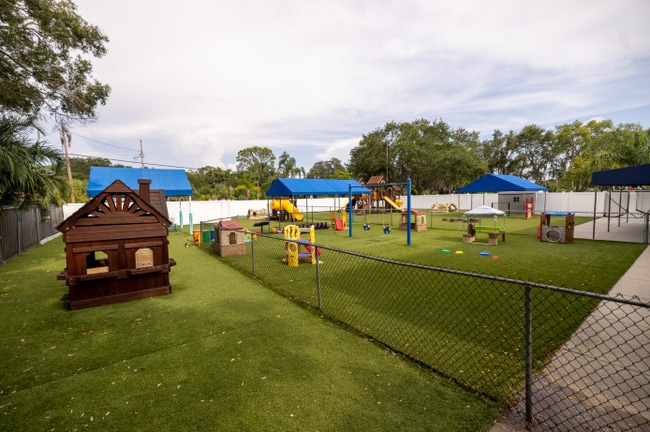
1700 Michigan Blvd
24-28-15-00000-220-1500
Part Of Se 1/4 Of Nw 1/4
Privateschool
PART OF SE 1/4 OF NW 1/4 OF NW 1/4 OF SEC 24-28-15 DESC AS FROM NE COR OF NW 1/4 OF NW 1/4 OF SEC TH S00D22E 1113.48FT TH N89D 3202W 25FT FOR POB TH S00D22E 189.66FT TH S89D 5030W 283FT(S) TH CUR RT RAD 30FT ARC 26FT(S) CB N13DW 2FT(S) TH N09D54 59E
X
Pinellas
12103C0067H
Florida
2024
1.21 AC
2025
North Pinellas
026908
Tampa/St Petersburg
10,560 SF
Tampa-St. Petersburg-Clearwater, FL
DEMOGRAPHICS near 1700 Michigan Blvd
1 Mile
3 Mile
5 Mile
2024 Total Population
8,980
90,649
195,578
2029 Population
8,946
90,786
195,119
Pop Growth 2024-2029
(0.38%)
+ 0.15%
(0.23%)
Average Age
52
50
48
2024 Total Households
4,209
43,237
88,839
HH Growth 2024-2029
(0.67%)
+ 0.07%
(0.35%)
Median Household Inc
$68,689
$60,848
$62,241
Avg Household Size
2.10
2.00
2.10
2024 Avg HH Vehicles
2.00
2.00
2.00
Median Home Value
$368,055
$289,294
$295,889
Median Year Built
1976
1980
1980
Nearby Places
Map Layers
Map Styles
 Street
 Aerial
- Restaurants
- Banks
- Shops
- Fitness
- Groceries
PUBLIC TRANSPORTATION
AIRPORT
St Pete-Clearwater International
DRIVE
WALK
Distance
St Pete-Clearwater International
32 min
16.7 mi
Tampa International
DRIVE
WALK
Distance
Tampa International
34 min
18.6 mi
Nearby Properties
Address
Land Use
TOTAL SIZE
Lot Size
Zoning
Address
Land Use
TOTAL SIZE
Lot Size
Zoning
675,202 SF
43.24 AC
Address
Land Use
TOTAL SIZE
Lot Size
Zoning
724,220 SF
22.95 AC
Address
Land Use
TOTAL SIZE
Lot Size
Zoning
460,041 SF
44.28 AC
Address
Land Use
TOTAL SIZE
Lot Size
Zoning
167,201 SF
63.11 AC
AE
Address
Land Use
TOTAL SIZE
Lot Size
Zoning
406,729 SF
29.79 AC
CP1
Address
Land Use
TOTAL SIZE
Lot Size
Zoning
412,099 SF
49.21 AC
Address
Land Use
TOTAL SIZE
Lot Size
Zoning
278,505 SF
38.67 AC
Address
Land Use
TOTAL SIZE
Lot Size
Zoning
242,708 SF
26.17 AC
RPD10
Address
Land Use
TOTAL SIZE
Lot Size
Zoning
362,238 SF
13.80 AC
Address
Land Use
TOTAL SIZE
Lot Size
Zoning
239,480 SF
18.89 AC
RPD5
Address
Land Use
TOTAL SIZE
Lot Size
Zoning
215,081 SF
16.60 AC
Address
Land Use
TOTAL SIZE
Lot Size
Zoning
117,024 SF
56.52 AC
Address
Land Use
TOTAL SIZE
Lot Size
Zoning
161,404 SF
18.48 AC
CP2
Address
Land Use
TOTAL SIZE
Lot Size
Zoning
191,375 SF
13.58 AC
AE
Address
Land Use
TOTAL SIZE
Lot Size
Zoning
186,967 SF
16.86 AC
Address
Land Use
TOTAL SIZE
Lot Size
Zoning
199,825 SF
22.75 AC
R2
Address
Land Use
TOTAL SIZE
Lot Size
Zoning
151,398 SF
15.55 AC
CP1
Address
Land Use
TOTAL SIZE
Lot Size
Zoning
311,414 SF
15.59 AC
RPD75
Address
Land Use
TOTAL SIZE
Lot Size
Zoning
250,113 SF
39.50 AC
Address
Land Use
TOTAL SIZE
Lot Size
Zoning
196,808 SF
12.70 AC
Address
Land Use
TOTAL SIZE
Lot Size
Zoning
201,208 SF
2.16 AC
Address
Land Use
TOTAL SIZE
Lot Size
Zoning
173,160 SF
5.39 AC
Address
Land Use
TOTAL SIZE
Lot Size
Zoning
107,766 SF
25.15 AC
Address
Land Use
TOTAL SIZE
Lot Size
Zoning
158,400 SF
9.80 AC
Address
Land Use
TOTAL SIZE
Lot Size
Zoning
396,841 SF
9.73 AC
Address
Land Use
TOTAL SIZE
Lot Size
Zoning
130,628 SF
10.26 AC
Address
Land Use
TOTAL SIZE
Lot Size
Zoning
94,029 SF
19.67 AC
RPD75
Address
Land Use
TOTAL SIZE
Lot Size
Zoning
415,593 SF
29.66 AC
Address
Land Use
TOTAL SIZE
Lot Size
Zoning
236,952 SF
14.48 AC
Address
Land Use
TOTAL SIZE
Lot Size
Zoning
99,361 SF
12.64 AC
CP1
The World's #1 Commercial Real Estate Marketplace
Connect with us
© 2026 CoStar Group
The information above has been obtained from sources believed reliable. While we do not doubt its accuracy we have not verified it and make no guarantee, warranty or representation about it. It is your responsibility to independently confirm its accuracy and completeness. Any projections, opinions, assumptions, or estimates used are for example only and do not represent the current or future performance of the property. The value of this transaction to you depends on tax and other factors which should be evaluated by your tax, financial, and legal advisors. You and your advisors should conduct a careful, independent investigation of the property to determine to your satisfaction the suitability of the property for your needs.