Property Record
1700 Providence Rd, Charlotte, NC 28207

NEARBY LISTINGS FOR SALE OR LEASE
Property Detail
1700 Providence Rd
Charlotte-Concord-Gastonia, NC-SC
R B Pharr Surv
153-105-28
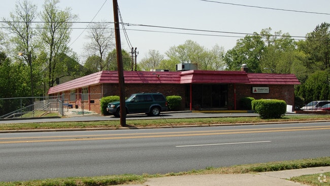
1700 PROVIDENCE RD
Daycare
Mecklenburg
AE
North Carolina
3710455200K
28
2024
1.56 AC
2025
Inner Southeast
002800
Charlotte
8,060 SF
DEMOGRAPHICS near 1700 Providence Rd
1 Mile
3 Mile
5 Mile
2024 Total Population
10,553
118,375
306,458
2029 Population
11,107
125,408
325,489
Pop Growth 2024-2029
+ 5.25%
+ 5.94%
+ 6.21%
Average Age
39
37
37
2024 Total Households
3,882
58,130
141,172
HH Growth 2024-2029
+ 5.31%
+ 6.02%
+ 6.42%
Median Household Inc
$193,712
$95,146
$77,656
Avg Household Size
2.50
2.00
2.10
2024 Avg HH Vehicles
2.00
2.00
2.00
Median Home Value
$1,057,070
$659,731
$456,343
Median Year Built
1974
1988
1985
Nearby Places
Map Layers
Map Styles
 Street
 Aerial
- Restaurants
- Banks
- Shops
- Fitness
- Groceries
PUBLIC TRANSPORTATION
COMMUTER RAIL
DRIVE
WALK
Distance
9 min
5.0 mi
AIRPORT
Charlotte/Douglas International
DRIVE
WALK
Distance
Charlotte/Douglas International
22 min
10.8 mi
Concord-Padgett Regional
DRIVE
WALK
Distance
Concord-Padgett Regional
31 min
18.8 mi
Nearby Properties
Address
Land Use
TOTAL SIZE
Lot Size
Zoning
Address
Land Use
TOTAL SIZE
Lot Size
Zoning
3,286,640 SF
55.70 AC
O6CD
Address
Land Use
TOTAL SIZE
Lot Size
Zoning
1,652,470 SF
10.96 AC
UMUD
Address
Land Use
TOTAL SIZE
Lot Size
Zoning
1,250,218 SF
17.75 AC
O2
Address
Land Use
TOTAL SIZE
Lot Size
Zoning
852,355 SF
16.72 AC
MUDDO
Address
Land Use
TOTAL SIZE
Lot Size
Zoning
875,672 SF
41.66 AC
CC
Address
Land Use
TOTAL SIZE
Lot Size
Zoning
582,357 SF
1.13 AC
MUDD-O
Address
Land Use
TOTAL SIZE
Lot Size
Zoning
1,017,564 SF
13.91 AC
O2
Address
Land Use
TOTAL SIZE
Lot Size
Zoning
965,867 SF
5.81 AC
O1
Address
Land Use
TOTAL SIZE
Lot Size
Zoning
894,108 SF
4.52 AC
UMUDO
Address
Land Use
TOTAL SIZE
Lot Size
Zoning
944,863 SF
3.58 AC
UMUD
Address
Land Use
TOTAL SIZE
Lot Size
Zoning
864,694 SF
11.07 AC
MUDDO
Address
Land Use
TOTAL SIZE
Lot Size
Zoning
645,212 SF
3.76 AC
UMUD
Address
Land Use
TOTAL SIZE
Lot Size
Zoning
768,780 SF
6.84 AC
UMUDO
Address
Land Use
TOTAL SIZE
Lot Size
Zoning
709,410 SF
22.24 AC
INSTCD
Address
Land Use
TOTAL SIZE
Lot Size
Zoning
766,215 SF
1.17 AC
UMUD
Address
Land Use
TOTAL SIZE
Lot Size
Zoning
743,550 SF
4.69 AC
I2
Address
Land Use
TOTAL SIZE
Lot Size
Zoning
689,165 SF
1.30 AC
Address
Land Use
TOTAL SIZE
Lot Size
Zoning
692,098 SF
7.83 AC
MUDDO
Address
Land Use
TOTAL SIZE
Lot Size
Zoning
729,709 SF
10.67 AC
B2
Address
Land Use
TOTAL SIZE
Lot Size
Zoning
711,907 SF
4.84 AC
Address
Land Use
TOTAL SIZE
Lot Size
Zoning
693,089 SF
1.81 AC
MUDDO
Address
Land Use
TOTAL SIZE
Lot Size
Zoning
838,508 SF
4.25 AC
UMUD
Address
Land Use
TOTAL SIZE
Lot Size
Zoning
581,470 SF
2.55 AC
I2
Address
Land Use
TOTAL SIZE
Lot Size
Zoning
573,667 SF
5.81 AC
MUDDO
Address
Land Use
TOTAL SIZE
Lot Size
Zoning
603,986 SF
1.47 AC
B1
Address
Land Use
TOTAL SIZE
Lot Size
Zoning
831,732 SF
24.50 AC
R3
Address
Land Use
TOTAL SIZE
Lot Size
Zoning
357,769 SF
4.93 AC
Address
Land Use
TOTAL SIZE
Lot Size
Zoning
606,594 SF
3.45 AC
MUDDO
Address
Land Use
TOTAL SIZE
Lot Size
Zoning
565,754 SF
4.96 AC
MUDD
Address
Land Use
TOTAL SIZE
Lot Size
Zoning
410,964 SF
0.58 AC
UMUDO
The World's #1 Commercial Real Estate Marketplace
Connect with us
© 2026 CoStar Group
The information above has been obtained from sources believed reliable. While we do not doubt its accuracy we have not verified it and make no guarantee, warranty or representation about it. It is your responsibility to independently confirm its accuracy and completeness. Any projections, opinions, assumptions, or estimates used are for example only and do not represent the current or future performance of the property. The value of this transaction to you depends on tax and other factors which should be evaluated by your tax, financial, and legal advisors. You and your advisors should conduct a careful, independent investigation of the property to determine to your satisfaction the suitability of the property for your needs.