Property Record
1700 Royston Ln, Round Rock, TX 78664
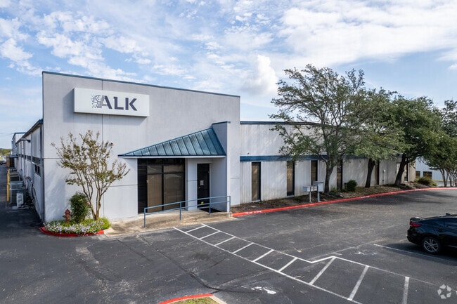


Property Detail
1700 Royston Ln
Austin-Round Rock-San Marcos, TX
LOT 2 ROBERTS GEORGE F SUBD 2
279545
Travis
Industrialgeneral
Texas
B and X Area of moderate flood hazard, usually the area between the limits of the 100-year and 500-year floods.
2
2025
3.18 AC
2025
Far Northeast
046500
Austin
37,288 SF
NEARBY LISTINGS FOR SALE OR LEASE
DEMOGRAPHICS near 1700 Royston Ln
1 mile
3 mile
5 mile
2025 Total Population
9,667
116,829
260,745
2030 Population
9,978
124,427
280,040
Pop Growth 2025-2030
+ 3.22%
+ 6.50%
+ 7.40%
Average Age
38
37
37
2025 Total Households
3,885
47,430
101,522
HH Growth 2025-2030
+ 3.78%
+ 7.24%
+ 7.87%
Median Household Inc
$84,979
$87,494
$93,193
Avg Household Size
2.50
2.40
2.50
2025 Avg HH Vehicles
2.00
2.00
2.00
Median Home Value
$358,010
$373,210
$408,318
Median Year Built
1998
2001
2002
Nearby Places
Map Layers
Map Styles
 Street
 Aerial
Layers
 Traffic
 Biking
Places
Listings with unknown addresses are not visible on the map
- Restaurants
- Banks
- Shops
- Fitness
- Groceries
PUBLIC TRANSPORTATION
AIRPORT
Austin-Bergstrom International
Drive
Walk
Distance
Austin-Bergstrom International
38 min
25.5 mi
SALE & LEASE HISTORY
LISTING DATE
SALE/LEASE

Sep 12, 2024
For Sale
Oct 02, 2024
For Lease
May 07, 2019
For Lease
Jun 17, 2020
For Sale
Jul 08, 2024
For Sale
Jan 11, 2023
For Lease
Feb 17, 2025
For Lease
Feb 09, 2024
For Lease
Aug 24, 2020
For Sale
Nearby Properties
Address
Land Use
TOTAL SIZE
Lot Size
Zoning
Address
Land Use
TOTAL SIZE
Lot Size
Zoning
2,089,779 SF
167.49 AC
Address
Land Use
TOTAL SIZE
Lot Size
Zoning
956,707 SF
71.90 AC
C1
Address
Land Use
TOTAL SIZE
Lot Size
Zoning
422,682 SF
95.18 AC
Address
Land Use
TOTAL SIZE
Lot Size
Zoning
485,021 SF
50.17 AC
C1
Address
Land Use
TOTAL SIZE
Lot Size
Zoning
491,412 SF
25.66 AC
Address
Land Use
TOTAL SIZE
Lot Size
Zoning
428,011 SF
25 AC
Address
Land Use
TOTAL SIZE
Lot Size
Zoning
565,886 SF
29.30 AC
Address
Land Use
TOTAL SIZE
Lot Size
Zoning
466,256 SF
38.33 AC
Address
Land Use
TOTAL SIZE
Lot Size
Zoning
284,625 SF
11.25 AC
Address
Land Use
TOTAL SIZE
Lot Size
Zoning
426,415 SF
50 AC
Address
Land Use
TOTAL SIZE
Lot Size
Zoning
543,958 SF
60.19 AC
Address
Land Use
TOTAL SIZE
Lot Size
Zoning
273,462 SF
47.12 AC
Address
Land Use
TOTAL SIZE
Lot Size
Zoning
541,124 SF
60.17 AC
Address
Land Use
TOTAL SIZE
Lot Size
Zoning
349,128 SF
17.89 AC
Address
Land Use
TOTAL SIZE
Lot Size
Zoning
470,992 SF
25.92 AC
Address
Land Use
TOTAL SIZE
Lot Size
Zoning
323,284 SF
14.21 AC
Address
Land Use
TOTAL SIZE
Lot Size
Zoning
295,750 SF
21.46 AC
Address
Land Use
TOTAL SIZE
Lot Size
Zoning
361,440 SF
19.35 AC
Address
Land Use
TOTAL SIZE
Lot Size
Zoning
290,400 SF
42.71 AC
Address
Land Use
TOTAL SIZE
Lot Size
Zoning
362,216 SF
19.72 AC
Address
Land Use
TOTAL SIZE
Lot Size
Zoning
618,605 SF
14.11 AC
PUD
Address
Land Use
TOTAL SIZE
Lot Size
Zoning
326,015 SF
11.11 AC
Address
Land Use
TOTAL SIZE
Lot Size
Zoning
477,454 SF
22.28 AC
Address
Land Use
TOTAL SIZE
Lot Size
Zoning
332,752 SF
10.30 AC
Address
Land Use
TOTAL SIZE
Lot Size
Zoning
306,387 SF
14.63 AC
Address
Land Use
TOTAL SIZE
Lot Size
Zoning
216,198 SF
9.47 AC
Address
Land Use
TOTAL SIZE
Lot Size
Zoning
341,480 SF
16.35 AC
Address
Land Use
TOTAL SIZE
Lot Size
Zoning
673,809 SF
9.03 AC
PUD
Address
Land Use
TOTAL SIZE
Lot Size
Zoning
379,953 SF
11.74 AC
PUD
Address
Land Use
TOTAL SIZE
Lot Size
Zoning
285,835 SF
25.69 AC
C1
The World's #1 Commercial Real Estate Marketplace
Connect with us
© 2026 CoStar Group
The information above has been obtained from sources believed reliable. While we do not doubt its accuracy we have not verified it and make no guarantee, warranty or representation about it. It is your responsibility to independently confirm its accuracy and completeness. Any projections, opinions, assumptions, or estimates used are for example only and do not represent the current or future performance of the property. The value of this transaction to you depends on tax and other factors which should be evaluated by your tax, financial, and legal advisors. You and your advisors should conduct a careful, independent investigation of the property to determine to your satisfaction the suitability of the property for your needs.