Property Record
1700 S Main St, Lexington, NC 27292


NEARBY LISTINGS FOR SALE OR LEASE
Property Detail
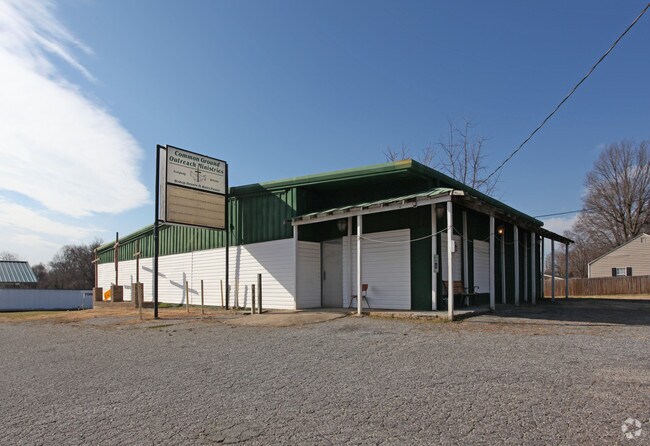
1700 S Main St
11-175-0-000-0002-0-0-0
Warner Stamey Property
Commercialnec
P=6-43 L2-7&11-18 BK2670-1152 WARNER S
X
Davidson
3710672500J
North Carolina
2025
0.86 AC
2025
South Davidson County
061600
Greensboro/Winston-Salem
3,266 SF
Winston-Salem, NC
DEMOGRAPHICS near 1700 S Main St
1 Mile
3 Mile
5 Mile
2024 Total Population
4,597
27,210
41,751
2029 Population
4,927
28,980
44,302
Pop Growth 2024-2029
+ 7.18%
+ 6.50%
+ 6.11%
Average Age
39
40
41
2024 Total Households
1,814
10,922
16,745
HH Growth 2024-2029
+ 7.11%
+ 6.45%
+ 6.03%
Median Household Inc
$34,843
$36,094
$39,637
Avg Household Size
2.40
2.40
2.40
2024 Avg HH Vehicles
2.00
2.00
2.00
Median Home Value
$81,397
$138,136
$152,611
Median Year Built
1982
1975
1979
Nearby Places
Map Layers
Map Styles
 Street
 Aerial
- Restaurants
- Banks
- Shops
- Fitness
- Groceries
PUBLIC TRANSPORTATION
AIRPORT
Piedmont Triad International
DRIVE
WALK
Distance
Piedmont Triad International
54 min
33.8 mi
Concord-Padgett Regional
DRIVE
WALK
Distance
Concord-Padgett Regional
53 min
43.0 mi
Nearby Properties
Address
Land Use
TOTAL SIZE
Lot Size
Zoning
Address
Land Use
TOTAL SIZE
Lot Size
Zoning
187,540 SF
26.94 AC
PD
Address
Land Use
TOTAL SIZE
Lot Size
Zoning
1,444 SF
19.95 AC
RA1
Address
Land Use
TOTAL SIZE
Lot Size
Zoning
22,560 SF
204.19 AC
I
Address
Land Use
TOTAL SIZE
Lot Size
Zoning
2,736 SF
4.77 AC
U
Address
Land Use
TOTAL SIZE
Lot Size
Zoning
3,156 SF
332.28 AC
HI
Address
Land Use
TOTAL SIZE
Lot Size
Zoning
207,185 SF
29.84 AC
B
Address
Land Use
TOTAL SIZE
Lot Size
Zoning
32,834 SF
30 AC
RA3
Address
Land Use
TOTAL SIZE
Lot Size
Zoning
28,176 SF
16.01 AC
B
Address
Land Use
TOTAL SIZE
Lot Size
Zoning
2,821 SF
32.06 AC
TN
Address
Land Use
TOTAL SIZE
Lot Size
Zoning
9,728 SF
40.03 AC
RA1
Address
Land Use
TOTAL SIZE
Lot Size
Zoning
20,651 SF
12.03 AC
B
Address
Land Use
TOTAL SIZE
Lot Size
Zoning
33,282 SF
4.41 AC
B
Address
Land Use
TOTAL SIZE
Lot Size
Zoning
43,008 SF
25.21 AC
B
Address
Land Use
TOTAL SIZE
Lot Size
Zoning
142,700 SF
18.21 AC
B
Address
Land Use
TOTAL SIZE
Lot Size
Zoning
15,192 SF
117.89 AC
SN
Address
Land Use
TOTAL SIZE
Lot Size
Zoning
68,288 SF
23.30 AC
LI
Address
Land Use
TOTAL SIZE
Lot Size
Zoning
40,047 SF
8.75 AC
B
Address
Land Use
TOTAL SIZE
Lot Size
Zoning
8,008 SF
9.26 AC
TN
Address
Land Use
TOTAL SIZE
Lot Size
Zoning
63,794 SF
2.84 AC
B
Address
Land Use
TOTAL SIZE
Lot Size
Zoning
46,562 SF
1.73 AC
B
Address
Land Use
TOTAL SIZE
Lot Size
Zoning
1,160 SF
28.40 AC
TN
Address
Land Use
TOTAL SIZE
Lot Size
Zoning
131,100 SF
17.78 AC
I
Address
Land Use
TOTAL SIZE
Lot Size
Zoning
85,425 SF
1.16 AC
U
Address
Land Use
TOTAL SIZE
Lot Size
Zoning
115,748 SF
8.14 AC
B
Address
Land Use
TOTAL SIZE
Lot Size
Zoning
49,578 SF
7.74 AC
I
Address
Land Use
TOTAL SIZE
Lot Size
Zoning
14,148 SF
3.34 AC
B
Address
Land Use
TOTAL SIZE
Lot Size
Zoning
128 SF
107.80 AC
PD
Address
Land Use
TOTAL SIZE
Lot Size
Zoning
23,572 SF
36.39 AC
I
Address
Land Use
TOTAL SIZE
Lot Size
Zoning
115,600 SF
13.15 AC
I
Address
Land Use
TOTAL SIZE
Lot Size
Zoning
59,281 SF
4.34 AC
B
The World's #1 Commercial Real Estate Marketplace
Connect with us
© 2026 CoStar Group
The information above has been obtained from sources believed reliable. While we do not doubt its accuracy we have not verified it and make no guarantee, warranty or representation about it. It is your responsibility to independently confirm its accuracy and completeness. Any projections, opinions, assumptions, or estimates used are for example only and do not represent the current or future performance of the property. The value of this transaction to you depends on tax and other factors which should be evaluated by your tax, financial, and legal advisors. You and your advisors should conduct a careful, independent investigation of the property to determine to your satisfaction the suitability of the property for your needs.