Property Record
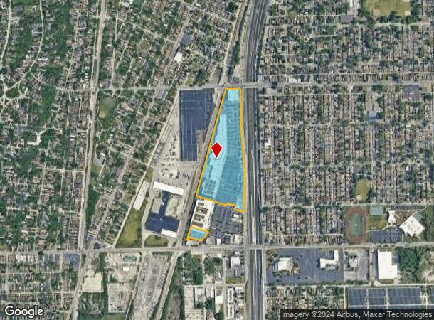
1700 W 115Th St, Chicago, IL 60643


NEARBY LISTINGS FOR SALE OR LEASE
Property Detail
1700 W 115Th St
25-19-417-017-0000
Marshfields Plaza
Supermarket
Cook
X
Illinois
17031C0645J
24.17 AC
2023
South Chicago
2024
Chicago
720700
Chicago-Naperville-Elgin, IL-IN-WI
307,335 SF
DEMOGRAPHICS near 1700 W 115Th St
1 Mile
3 Mile
5 Mile
2024 Total Population
18,795
163,709
397,775
2029 Population
18,268
159,048
387,583
Pop Growth 2024-2029
(2.80%)
(2.85%)
(2.56%)
Average Age
42
41
41
2024 Total Households
7,116
61,750
150,623
HH Growth 2024-2029
(3.13%)
(3.21%)
(2.92%)
Median Household Inc
$56,516
$60,556
$56,535
Avg Household Size
2.50
2.60
2.50
2024 Avg HH Vehicles
1.00
1.00
1.00
Median Home Value
$163,805
$186,806
$181,200
Median Year Built
1957
1952
1955
Nearby Places
Map Layers
Map Styles
 Street
 Aerial
- Restaurants
- Banks
- Shops
- Fitness
- Groceries
PUBLIC TRANSPORTATION
TRANSIT/SUBWAY
119th Street Station (Rock Island District Line - Northeast Illinois Regional Commuter Railroad (Metra))
DRIVE
WALK
Distance
119th Street Station (Rock Island District Line - Northeast Illinois Regional Commuter Railroad (Metra))
3 min
13 min
0.7 mi
Morgan Park - 115th Street Station (Rock Island District Line - Northeast Illinois Regional Commuter Railroad (Metra))
DRIVE
WALK
Distance
Morgan Park - 115th Street Station (Rock Island District Line - Northeast Illinois Regional Commuter Railroad (Metra))
3 min
13 min
0.7 mi
111th Street Station (Rock Island District Line - Northeast Illinois Regional Commuter Railroad (Metra))
DRIVE
WALK
Distance
111th Street Station (Rock Island District Line - Northeast Illinois Regional Commuter Railroad (Metra))
4 min
20 min
1.1 mi
COMMUTER RAIL
Morgan Park - 115th Street Station (Rock Island District Line - Northeast Illinois Regional Commuter Railroad (Metra))
DRIVE
WALK
Distance
Morgan Park - 115th Street Station (Rock Island District Line - Northeast Illinois Regional Commuter Railroad (Metra))
3 min
14 min
0.7 mi
119th Street Station (Rock Island District Line - Northeast Illinois Regional Commuter Railroad (Metra))
DRIVE
WALK
Distance
119th Street Station (Rock Island District Line - Northeast Illinois Regional Commuter Railroad (Metra))
3 min
15 min
0.8 mi
AIRPORT
Chicago Midway International
DRIVE
WALK
Distance
Chicago Midway International
23 min
12.5 mi
Chicago O'Hare International
DRIVE
WALK
Distance
Chicago O'Hare International
50 min
32.7 mi
SALE & LEASE HISTORY
LISTING DATE
SALE/LEASE

Sep 25, 2016
For Lease
Nearby Properties
Address
Land Use
TOTAL SIZE
Lot Size
Zoning
Address
Land Use
TOTAL SIZE
Lot Size
Zoning
8 AC
PD 1168
Address
Land Use
TOTAL SIZE
Lot Size
Zoning
0.51 AC
PD 1168
Address
Land Use
TOTAL SIZE
Lot Size
Zoning
1.08 AC
PD 1168
Address
Land Use
TOTAL SIZE
Lot Size
Zoning
11 AC
PD 1168
Address
Land Use
TOTAL SIZE
Lot Size
Zoning
48,792 SF
8.71 AC
RT-4
Address
Land Use
TOTAL SIZE
Lot Size
Zoning
63,930 SF
3.49 AC
PD 181
Address
Land Use
TOTAL SIZE
Lot Size
Zoning
Address
Land Use
TOTAL SIZE
Lot Size
Zoning
83,005 SF
3.11 AC
Address
Land Use
TOTAL SIZE
Lot Size
Zoning
380,924 SF
19.13 AC
Address
Land Use
TOTAL SIZE
Lot Size
Zoning
129,837 SF
10.44 AC
PD 770
Address
Land Use
TOTAL SIZE
Lot Size
Zoning
224,089 SF
Address
Land Use
TOTAL SIZE
Lot Size
Zoning
82,000 SF
Address
Land Use
TOTAL SIZE
Lot Size
Zoning
Address
Land Use
TOTAL SIZE
Lot Size
Zoning
98,506 SF
7.66 AC
Address
Land Use
TOTAL SIZE
Lot Size
Zoning
1 AC
RS-3
Address
Land Use
TOTAL SIZE
Lot Size
Zoning
105,150 SF
4 AC
Address
Land Use
TOTAL SIZE
Lot Size
Zoning
162,379 SF
10.59 AC
Address
Land Use
TOTAL SIZE
Lot Size
Zoning
8,800 SF
8.83 AC
Address
Land Use
TOTAL SIZE
Lot Size
Zoning
451,400 SF
26.59 AC
M3-3
Address
Land Use
TOTAL SIZE
Lot Size
Zoning
1.71 AC
PD 1168
Address
Land Use
TOTAL SIZE
Lot Size
Zoning
109,213 SF
7.59 AC
Address
Land Use
TOTAL SIZE
Lot Size
Zoning
63,700 SF
0.74 AC
C1-1
Address
Land Use
TOTAL SIZE
Lot Size
Zoning
66,152 SF
5.47 AC
PD 430
Address
Land Use
TOTAL SIZE
Lot Size
Zoning
Address
Land Use
TOTAL SIZE
Lot Size
Zoning
67,348 SF
6.33 AC
PD 131
Address
Land Use
TOTAL SIZE
Lot Size
Zoning
69,864 SF
0.56 AC
C1-3
Address
Land Use
TOTAL SIZE
Lot Size
Zoning
440,257 SF
18.83 AC
M3-3
Address
Land Use
TOTAL SIZE
Lot Size
Zoning
1.38 AC
PD 1168
Address
Land Use
TOTAL SIZE
Lot Size
Zoning
15,600 SF
7.77 AC
PMD 10
The World's #1 Commercial Real Estate Marketplace
Connect with us
© 2025 CoStar Group
The information above has been obtained from sources believed reliable. While we do not doubt its accuracy we have not verified it and make no guarantee, warranty or representation about it. It is your responsibility to independently confirm its accuracy and completeness. Any projections, opinions, assumptions, or estimates used are for example only and do not represent the current or future performance of the property. The value of this transaction to you depends on tax and other factors which should be evaluated by your tax, financial, and legal advisors. You and your advisors should conduct a careful, independent investigation of the property to determine to your satisfaction the suitability of the property for your needs.