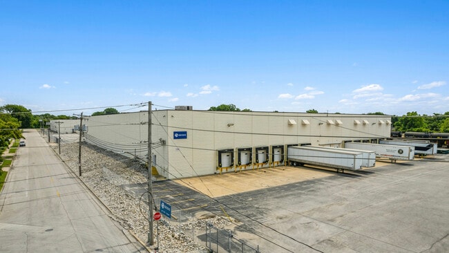
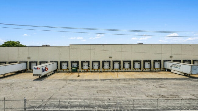
Property Record
1700 Wayne Lanter Ave, Madison, IL 62060

Property Detail
1700 Wayne Lanter Ave
St. Louis, MO-IL
SE4 SE4 T03N R10W
21-1-19-25-00-000-011
MADISON
Publicstorage
Illinois
2024
10.80 AC
2025
Illinois
400600
St. Louis
208,260 SF
NEARBY LISTINGS FOR SALE OR LEASE
DEMOGRAPHICS near 1700 Wayne Lanter Ave
1 mile
3 mile
5 mile
2025 Total Population
4,494
22,590
101,965
2030 Population
4,609
23,030
102,054
Pop Growth 2025-2030
+ 2.56%
+ 1.95%
+ 0.09%
Average Age
41
39
41
2025 Total Households
1,860
9,363
45,119
HH Growth 2025-2030
+ 2.47%
+ 1.88%
(0.34%)
Median Household Inc
$46,745
$45,994
$44,199
Avg Household Size
2.30
2.30
2.10
2025 Avg HH Vehicles
2.00
2.00
1.00
Median Home Value
$81,904
$69,207
$83,818
Median Year Built
1962
1951
1953
Nearby Places
Map Layers
Map Styles
 Street
 Aerial
Layers
 Traffic
 Biking
Places
Listings with unknown addresses are not visible on the map
- Restaurants
- Banks
- Shops
- Fitness
- Groceries
SALE & LEASE HISTORY
LISTING DATE
SALE/LEASE

Aug 13, 2025
For Lease
Nearby Properties
Address
Land Use
TOTAL SIZE
Lot Size
Zoning
Address
Land Use
TOTAL SIZE
Lot Size
Zoning
33.55 AC
Address
Land Use
TOTAL SIZE
Lot Size
Zoning
Address
Land Use
TOTAL SIZE
Lot Size
Zoning
1,925 SF
79.42 AC
Address
Land Use
TOTAL SIZE
Lot Size
Zoning
3.46 AC
Address
Land Use
TOTAL SIZE
Lot Size
Zoning
3.26 AC
Address
Land Use
TOTAL SIZE
Lot Size
Zoning
71,730 SF
3.23 AC
Address
Land Use
TOTAL SIZE
Lot Size
Zoning
165.04 AC
Address
Land Use
TOTAL SIZE
Lot Size
Zoning
54.74 AC
K
Address
Land Use
TOTAL SIZE
Lot Size
Zoning
Address
Land Use
TOTAL SIZE
Lot Size
Zoning
353,312 SF
17.84 AC
K
Address
Land Use
TOTAL SIZE
Lot Size
Zoning
429,181 SF
23.56 AC
K
Address
Land Use
TOTAL SIZE
Lot Size
Zoning
6,240 SF
4.50 AC
Address
Land Use
TOTAL SIZE
Lot Size
Zoning
42.52 AC
Address
Land Use
TOTAL SIZE
Lot Size
Zoning
8,510 SF
27.51 AC
Address
Land Use
TOTAL SIZE
Lot Size
Zoning
102,355 SF
9.31 AC
Address
Land Use
TOTAL SIZE
Lot Size
Zoning
5,610 SF
50.66 AC
Address
Land Use
TOTAL SIZE
Lot Size
Zoning
107,814 SF
5.89 AC
K
Address
Land Use
TOTAL SIZE
Lot Size
Zoning
47,556 SF
1.62 AC
Address
Land Use
TOTAL SIZE
Lot Size
Zoning
9,031 SF
11.89 AC
Address
Land Use
TOTAL SIZE
Lot Size
Zoning
20.80 AC
Address
Land Use
TOTAL SIZE
Lot Size
Zoning
118,410 SF
2.25 AC
D
Address
Land Use
TOTAL SIZE
Lot Size
Zoning
30,906 SF
1.68 AC
Address
Land Use
TOTAL SIZE
Lot Size
Zoning
87,419 SF
3.72 AC
D
Address
Land Use
TOTAL SIZE
Lot Size
Zoning
Address
Land Use
TOTAL SIZE
Lot Size
Zoning
45,888 SF
14.62 AC
Address
Land Use
TOTAL SIZE
Lot Size
Zoning
22,500 SF
22.21 AC
Address
Land Use
TOTAL SIZE
Lot Size
Zoning
389.39 AC
Address
Land Use
TOTAL SIZE
Lot Size
Zoning
154,822 SF
Address
Land Use
TOTAL SIZE
Lot Size
Zoning
188,496 SF
4.47 AC
K
Address
Land Use
TOTAL SIZE
Lot Size
Zoning
21,700 SF
6.56 AC
The World's #1 Commercial Real Estate Marketplace
Connect with us
© 2026 CoStar Group
The information above has been obtained from sources believed reliable. While we do not doubt its accuracy we have not verified it and make no guarantee, warranty or representation about it. It is your responsibility to independently confirm its accuracy and completeness. Any projections, opinions, assumptions, or estimates used are for example only and do not represent the current or future performance of the property. The value of this transaction to you depends on tax and other factors which should be evaluated by your tax, financial, and legal advisors. You and your advisors should conduct a careful, independent investigation of the property to determine to your satisfaction the suitability of the property for your needs.