Property Record
17000 Tamiami Trl, North Port, FL 34287

NEARBY LISTINGS FOR SALE OR LEASE
Property Detail
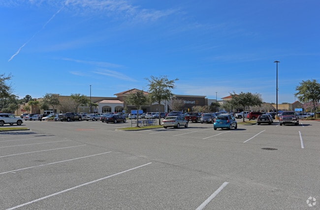
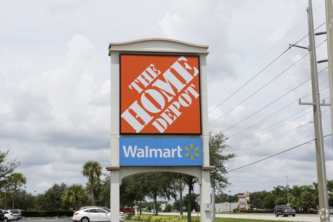
17000 Tamiami Trl
North Port-Sarasota-Bradenton, FL
Fullenkamp Sumter
1002-16-0010
LOT 1, FULLENKAMP SUMTER SUB, LESS BEG AT NE COR OF SUMTER SOUTHEAST SUB TH S 69-19-39 E ALONG SLY R/W LINE OF US HWY 41 A DISTANCE OF 92.13 FT TH CONT ALONG SAID R/W LINE S 86-01-40 E 89.52 FT TH
Departmentstore
Sarasota
AE
Florida
12115C0387G
1
2024
21.37 AC
2025
Sarasota Outlying
002710
Tampa/St Petersburg
215,230 SF
DEMOGRAPHICS near 17000 Tamiami Trl
1 Mile
3 Mile
5 Mile
2024 Total Population
4,763
35,369
75,168
2029 Population
5,521
40,725
86,852
Pop Growth 2024-2029
+ 15.91%
+ 15.14%
+ 15.54%
Average Age
51
47
47
2024 Total Households
2,161
14,960
31,094
HH Growth 2024-2029
+ 15.96%
+ 15.19%
+ 15.69%
Median Household Inc
$57,568
$59,552
$60,596
Avg Household Size
2.10
2.30
2.40
2024 Avg HH Vehicles
2.00
2.00
2.00
Median Home Value
$188,818
$236,979
$236,297
Median Year Built
1987
1996
2000
Nearby Places
Map Layers
Map Styles
 Street
 Aerial
- Restaurants
- Banks
- Shops
- Fitness
- Groceries
PUBLIC TRANSPORTATION
AIRPORT
Punta Gorda
DRIVE
WALK
Distance
Punta Gorda
32 min
17.4 mi
Freight Ports
Port Manatee
DRIVE
WALK
Distance
Port Manatee
72 min
54.4 mi
Nearby Properties
Address
Land Use
TOTAL SIZE
Lot Size
Zoning
Address
Land Use
TOTAL SIZE
Lot Size
Zoning
548,781 SF
196.98 AC
GU
Address
Land Use
TOTAL SIZE
Lot Size
Zoning
103,886 SF
21.48 AC
PD
Address
Land Use
TOTAL SIZE
Lot Size
Zoning
218,356 SF
17.14 AC
AC2
Address
Land Use
TOTAL SIZE
Lot Size
Zoning
267,412 SF
23.26 AC
AC1
Address
Land Use
TOTAL SIZE
Lot Size
Zoning
146,932 SF
39.48 AC
AC2
Address
Land Use
TOTAL SIZE
Lot Size
Zoning
302,632 SF
15.71 AC
AC2
Address
Land Use
TOTAL SIZE
Lot Size
Zoning
131,053 SF
14.40 AC
PD
Address
Land Use
TOTAL SIZE
Lot Size
Zoning
9,511 SF
40.53 AC
PD
Address
Land Use
TOTAL SIZE
Lot Size
Zoning
114,985 SF
29.77 AC
GU
Address
Land Use
TOTAL SIZE
Lot Size
Zoning
101,676 SF
8.83 AC
AC1
Address
Land Use
TOTAL SIZE
Lot Size
Zoning
79,944 SF
15.64 AC
AC1
Address
Land Use
TOTAL SIZE
Lot Size
Zoning
155,080 SF
8.96 AC
CG
Address
Land Use
TOTAL SIZE
Lot Size
Zoning
196,163 SF
15.60 AC
AC1
Address
Land Use
TOTAL SIZE
Lot Size
Zoning
142,364 SF
13.87 AC
AC1
Address
Land Use
TOTAL SIZE
Lot Size
Zoning
37,567 SF
36.76 AC
PKR
Address
Land Use
TOTAL SIZE
Lot Size
Zoning
40,161 SF
40 AC
GU
Address
Land Use
TOTAL SIZE
Lot Size
Zoning
65,103 SF
10.16 AC
AC2
Address
Land Use
TOTAL SIZE
Lot Size
Zoning
85,529 SF
11.41 AC
AC1
Address
Land Use
TOTAL SIZE
Lot Size
Zoning
105,046 SF
12.69 AC
AC1
Address
Land Use
TOTAL SIZE
Lot Size
Zoning
115,678 SF
8.58 AC
R3
Address
Land Use
TOTAL SIZE
Lot Size
Zoning
42,923 SF
403.06 AC
R1
Address
Land Use
TOTAL SIZE
Lot Size
Zoning
63,016 SF
2.56 AC
AC1
Address
Land Use
TOTAL SIZE
Lot Size
Zoning
43,387 SF
5.09 AC
AC2
Address
Land Use
TOTAL SIZE
Lot Size
Zoning
22.07 AC
PD
Address
Land Use
TOTAL SIZE
Lot Size
Zoning
12,670 SF
17.20 AC
CG
Address
Land Use
TOTAL SIZE
Lot Size
Zoning
289,861 SF
27.47 AC
AC2
Address
Land Use
TOTAL SIZE
Lot Size
Zoning
19,816 SF
2.70 AC
AC2
Address
Land Use
TOTAL SIZE
Lot Size
Zoning
17.48 AC
AC1
Address
Land Use
TOTAL SIZE
Lot Size
Zoning
10,721 SF
3 AC
PD
The World's #1 Commercial Real Estate Marketplace
Connect with us
© 2026 CoStar Group
The information above has been obtained from sources believed reliable. While we do not doubt its accuracy we have not verified it and make no guarantee, warranty or representation about it. It is your responsibility to independently confirm its accuracy and completeness. Any projections, opinions, assumptions, or estimates used are for example only and do not represent the current or future performance of the property. The value of this transaction to you depends on tax and other factors which should be evaluated by your tax, financial, and legal advisors. You and your advisors should conduct a careful, independent investigation of the property to determine to your satisfaction the suitability of the property for your needs.