Property Record
17001 Pines Blvd, Pembroke Pines, FL 33027


NEARBY LISTINGS FOR SALE OR LEASE
Property Detail
17001 Pines Blvd
51-40-17-03-0010
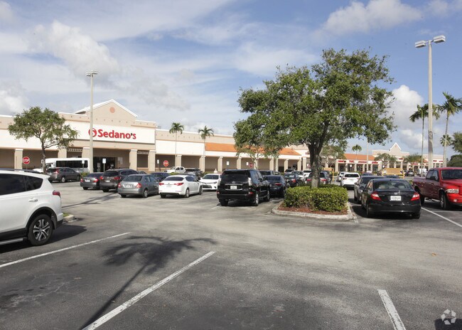
Pembroke Isles Plaza 158-49 B
Regionalshoppingcenterormallwithanchorstore
PEMBROKE ISLES PLAZA 158-49 B PARCEL 1 OF 158-49 B TOG WITH PARCEL K-1 LESS P/P/A 158-49B, OF 157-46B
AE
Broward
12011C0540J
Florida
2024
15.42 AC
2025
Southwest Broward
110356
South Florida
133,357 SF
Fort Lauderdale-Pompano Beach-Deerfield Beach, FL
DEMOGRAPHICS near 17001 Pines Blvd
1 Mile
3 Mile
5 Mile
2024 Total Population
10,585
87,312
194,865
2029 Population
10,342
85,723
191,607
Pop Growth 2024-2029
(2.30%)
(1.82%)
(1.67%)
Average Age
39
40
41
2024 Total Households
3,141
27,082
64,438
HH Growth 2024-2029
(2.96%)
(2.36%)
(2.04%)
Median Household Inc
$125,599
$121,456
$98,136
Avg Household Size
3.20
3.10
2.90
2024 Avg HH Vehicles
2.00
2.00
2.00
Median Home Value
$440,067
$462,566
$437,683
Median Year Built
1994
1995
1995
Nearby Places
Map Layers
Map Styles
 Street
 Aerial
- Restaurants
- Banks
- Shops
- Fitness
- Groceries
PUBLIC TRANSPORTATION
AIRPORT
Fort Lauderdale/Hollywood International
DRIVE
WALK
Distance
Fort Lauderdale/Hollywood International
34 min
17.5 mi
Miami International
DRIVE
WALK
Distance
Miami International
32 min
21.0 mi
Freight Ports
Port Everglades
DRIVE
WALK
Distance
Port Everglades
35 min
25.1 mi
Nearby Properties
Address
Land Use
TOTAL SIZE
Lot Size
Zoning
Address
Land Use
TOTAL SIZE
Lot Size
Zoning
598,209 SF
20 AC
PID
Address
Land Use
TOTAL SIZE
Lot Size
Zoning
402,526 SF
39.92 AC
(PCD)
Address
Land Use
TOTAL SIZE
Lot Size
Zoning
573,771 SF
59.36 AC
CF
Address
Land Use
TOTAL SIZE
Lot Size
Zoning
539,883 SF
28.07 AC
(PUD)
Address
Land Use
TOTAL SIZE
Lot Size
Zoning
345,423 SF
32.97 AC
(R-MF)
Address
Land Use
TOTAL SIZE
Lot Size
Zoning
428,179 SF
21.50 AC
RM2
Address
Land Use
TOTAL SIZE
Lot Size
Zoning
454,092 SF
6.13 AC
(PD-SL)
Address
Land Use
TOTAL SIZE
Lot Size
Zoning
312,631 SF
40.99 AC
(B-3)
Address
Land Use
TOTAL SIZE
Lot Size
Zoning
353,215 SF
23.37 AC
(PUD)
Address
Land Use
TOTAL SIZE
Lot Size
Zoning
8.95 AC
ML
Address
Land Use
TOTAL SIZE
Lot Size
Zoning
302,864 SF
20.08 AC
PID
Address
Land Use
TOTAL SIZE
Lot Size
Zoning
309,343 SF
69.91 AC
(A)
Address
Land Use
TOTAL SIZE
Lot Size
Zoning
242,189 SF
18.03 AC
PID
Address
Land Use
TOTAL SIZE
Lot Size
Zoning
124,351 SF
13.19 AC
(MXD)
Address
Land Use
TOTAL SIZE
Lot Size
Zoning
268,977 SF
45.01 AC
CF
Address
Land Use
TOTAL SIZE
Lot Size
Zoning
137,254 SF
18.31 AC
(B-3)
Address
Land Use
TOTAL SIZE
Lot Size
Zoning
442,450 SF
13.14 AC
(PUD)
Address
Land Use
TOTAL SIZE
Lot Size
Zoning
144,851 SF
8.85 AC
(PCD)
Address
Land Use
TOTAL SIZE
Lot Size
Zoning
323,776 SF
19.31 AC
(B-3)
Address
Land Use
TOTAL SIZE
Lot Size
Zoning
250,900 SF
19.17 AC
PUD
Address
Land Use
TOTAL SIZE
Lot Size
Zoning
177,346 SF
6.58 AC
(PCD)
Address
Land Use
TOTAL SIZE
Lot Size
Zoning
147,281 SF
15.27 AC
B2
Address
Land Use
TOTAL SIZE
Lot Size
Zoning
263,057 SF
12.68 AC
PID
Address
Land Use
TOTAL SIZE
Lot Size
Zoning
243,995 SF
20.01 AC
CF
Address
Land Use
TOTAL SIZE
Lot Size
Zoning
97,644 SF
11.13 AC
(B-3)
Address
Land Use
TOTAL SIZE
Lot Size
Zoning
155,671 SF
10.62 AC
B2
Address
Land Use
TOTAL SIZE
Lot Size
Zoning
301,962 SF
134.48 AC
(R-R)
Address
Land Use
TOTAL SIZE
Lot Size
Zoning
134,786 SF
10.41 AC
PID
Address
Land Use
TOTAL SIZE
Lot Size
Zoning
198,499 SF
22.45 AC
(A)
The World's #1 Commercial Real Estate Marketplace
Connect with us
© 2025 CoStar Group
The information above has been obtained from sources believed reliable. While we do not doubt its accuracy we have not verified it and make no guarantee, warranty or representation about it. It is your responsibility to independently confirm its accuracy and completeness. Any projections, opinions, assumptions, or estimates used are for example only and do not represent the current or future performance of the property. The value of this transaction to you depends on tax and other factors which should be evaluated by your tax, financial, and legal advisors. You and your advisors should conduct a careful, independent investigation of the property to determine to your satisfaction the suitability of the property for your needs.